Mt Whitney is the highest point in the lower 48 states and is located in the Sierra Nevada mountain range in California. Now the odd thing about the Sierra is that if you come at them from the west (Yosemite Valley and surrounding areas) you have to traverse dozens, even hundreds of miles of mountains in order to reach Mt Whitney, but the Sierra end suddenly and abruptly at the edge of the Owens Valley Desert along Hwy 395 in California. In fact they end so abruptly that it is just 25 miles from the town of Lone Pine California to the top of Mt Whitney and 13 of those are road getting to the Whitney Portal campsite. So it is just a mere 12 miles from the trail head to the top of the highest point in the continental United States. You might surmise then that it is an easy feat to reach Mt Whitney from the eastern side, but you would be wrong as the elevation change is 6000 feet in those 12 miles and the trail averages a 10% grade containing among other things a section of 99 switchbacks which make up 1700 feet of the elevation gain. In addition, the maximum time you are allotted to do the entire feat is 2 days!
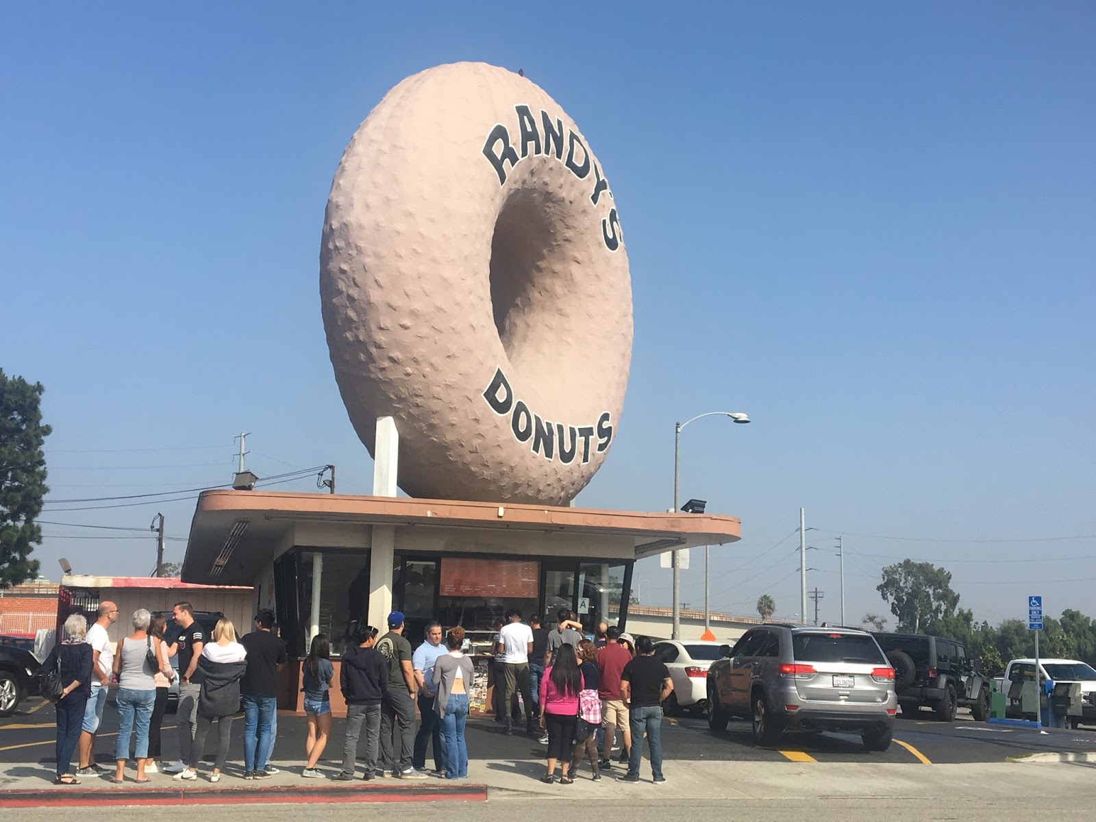
Hardy and I started out adventure by flying from St.Louis to Salt Lake City and then taking a connecting flight to Los Angeles LAX airport. Just outside of LAX is the famous Randy's Donuts made more famous by being featured in Iron Man.
It is 3.5 hours from LAX to the small town of Lone Pine California where we would base our adventure. You can see the Sierra ending along highway 395

The first stop was the ranger station in Lone Pine to pick up our permits and get their orientation lecture. You can see Mt Whitney from their parking area. Part of the orientation for hiking in the "Whitney Zone" is the need to use a Bear Canister, which was going to about 5 pounds to my baseweight and the use of WAG Bags (waste alleviation gelling- bag). this is a fancy way of saying a bag with some kitty litter in it, so you can carry out your own poop! I will leave the link for you to figure this out for yourself, but I will have more comments on this later
In the process the Ranger let us know that they expected snow on Tuesday and would we like to move our itenerary up a day. YES please

After getting our permit sorted and instructions given we drove up to Whitney Portal campground to have a look at the trail head while it was daylight as now we would be up here in the early morning to not camp for the night but to start from the trail head at first light.

Back to downtown Lone Pine a busy metropolis!

I am sure in the height of the hiker season the town is very busy but on this week before Halloween, not much is happening, which honestly is just the way I like it.

We were booked into the Whitney Portal Hostel- a never nice and convenient place to stay. they have accommodations from bunks to regular hotel rooms. They were also the center of attention for Halloween, which it seems the whole town celebrates together. the Hostel was to be the Haunted House and was being converted as we were checking in.


Our second floor view

We got the local recommendation for breakfast the next morning. Alabama Hills Cafe and Bakery.


Driving up the road to Whitney Portal campground gave us another view of our destination for tomorrow.

Getting up to the parking lot for Mount Whitney Trail and having to pose for the ubiquitous trail sign photo. Actually I am quite excited and nervous to start. I would have liked to train a bit more for this hike than I was able to do with a busy new work schedule proceeding this trip.

At the Whitney trail "portal" they have a scale to weigh your pack before you start.

coming in at 24 pounds this is heavier than I am used to, but 4 pounds of that is bear canister and I have 3 liters of water at 6 pounds, and with about 3.5 pounds of food, my base weight is around 10 pounds as usual.

The Whitney Trail "Portal"

The day was incredible great, sunny sky, warm temperatures, no bugs, the perfect day to walk

Another milestone for me... entering the John Muir Wilderness


Log walking over some wet bit at the 3 miles mark of the trail


The Pine trees in the area have a great bark patter with lots of twisted roots when they come out of the ground


Panorama before Outpost Camp

Above outpost camp hiking in lovely alpine area.

Mirror Lake above output camp as the trail becomes steeper now.


Reaching Trail Camp, 6 mile mark, and looking up at Trail Crest

Trail Camp Pond

My tent set up to view Trail Crest (Mt Whitney is just out of sight to the right)

Panorama view of the Sierra "wall" from Trail Camp

Evening falls around Trail Camp (looking back east toward Owens Valley)

A few clouds catching the final light high above the 99 switch backs coming in the morning.

Sky on fire!

Early morning start. The general conscientious around camp was most people (ie young people) were going to start around 4-5 am so they could get to the top by sunrise or just after. We chose to start at 6 am, getting up at 5:30.

I had been awake for virtually the entire night, sleeping very little. The night was cold and damp and and by 5 I was really ready to go. We did the first switchbacks by headlamp and around 7 am the sky started to brighten.

It might have been better not to be able to see the switchbacks as some parts had steep drop offs where the railings had been bent over due to rock slides or avalanches.


More light and looking back at our camp, starting to be smaller and smaller below.

almost at the top of the switchbacks, Whitney looking almost at the same level now.

Panorama at sunrise.

Top of the switchbacks

At Trail Crest and finding out as you cross over to the interior of the Sierra you lose about 400 feet in elevation over the next half mile


Panorama after crossing into Sequoia National Park


Yes you actually lose some elevation as you traverse Trail Crest and met up with the trail that comes up from Guitar Lake and the PCT

2 miles completed and 2 miles to go.

a bit of rough rock hopping up high


It's up there somewhere!


Made it!


Hardy is all smiles now.

Panorama from the top looking West

Broader panorama from the top

Panorama looking North

Had to sign the official register at the hut.


Celebration photo

Then rest!

After some snacks it was back down. Covering the same switchbacks only this time in the daylight we can really see the sections we could only glimpse at in the dark. I am glad we didn't have any snow and ice.


Close to Trail Camp again looking back up at the wall of switchbacks we have just come down.


The trip down is all down hill. Gravity is your friend until your knees start to hurt. Hardy was having some issue with his knees and back over the bigger step downs in the trail


Sunset again lit up the sky with deep reds and oranges


I can't thank Hardy enough for thinking of me and asking me to come along on his adventure. He is a great traveling companion. I had a fabulous time and it only fuels my desire to figure out more ways to spend some time in the Sierra.
**Rant**
Trail Camp and WAG bags.
so to follow up on my rant about WAG bags. I have nothing against this technique for keeping the back country clean. The Sierra is all rock and is not very suitable for digging a 6-8" hole for disposing of one's waste and even if you did there are not many microbes to break down the waste. You must bring it back (fair enough). However Trail Camp is a giant toilet for those that don't follow the rules. Exploring just outside the perimeter of camp finds people have pooped on the bare ground either covering it up with a rock or not at all and more disturbing leaving their T.P. spread around with their waste. We also found WAG bags left directly on the trail, stuffed into the rocks and just plain strune about in open areas including the ice fields. I reported this to the ranger station upon our return and it was generally blamed on not having the funds to have a ranger present at all times at Trail Camp, but I assured her that a Ranger shouldn't be needed to police what should be everyone's responsibility for not shitting on the ground! Given the state of affairs it would be better to dig a cat hole (taking your TP out with you) than to just leave it either on the ground or in bags that will never deteriorate out in the open. Wise up people!
**Rant over**