From a Facebook Post
Tahoe Rim Trail- A Second Try- Aug 11-21 2020
Damn you 2020! This has not been a good year, obviously for many people, but particularly for me. Our trip to hike across Scotland (TGO Challenge) was cancelled for May, I needed a surgery in April, I was fired from my job, quite unexpectedly, at the end of June, all that was left was the planned Tahoe Hike in August that was the postponement of the hike from last September, when my father passed away, while I was half done with the trail.... see not a good last 12 months!


After that it was back to the room to repack one more time before starting early in the morning.
On top of that, as this TRT hike approached, Vicky and I were out for a couple of weeks in our RV, on a trip to South Dakota, when this trip had to be unexpectedly cut short, just as it started, as a re-occurrence of the same symptoms leading to my surgery appeared causing us to turn around and go home. This led to another surgery just 10 days before the TRT hike. I, however, was determined to go, despite still being in the early stages of recovery as this would have also effected "The" Bobbi Walters, who was coming along to try and finish the trail as well.
The Beginning:
I had an early morning flight from St Louis thru Denver to Reno, the closest airport to the Lake Tahoe area. It was actually nice to get back on a plane again since I had not traveled for work since the beginning of the Covid lockdown at the beginning of April.
Packing was easy as my pack base-weight was only 9 pounds and the forecast was very good weather for the next two weeks


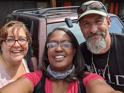
When I arrived in Reno, Bobbi had already arrived the night before and we were picked up by my friend Elsye "Chardonnay" Walker, a triple crown hiker and a fellow ALDHA-West board member during my tenure with the Board. She lives in the Tahoe area and was very gracious to come pick us up in Reno and drive us the 90 miles to South Lake Tahoe!

We arrived early in the afternoon and checked into the Beckett Hotel right in the heart of the South Lake Tahoe Heavenly Village area.
You get a great view of the Monument Peak and the Kingsbury South area, where we started out hike last year.

Of course our first stop had to be BaseCamp Pizza and a fix of the Curry Chicken Pizza that you can get nowhere else and is fantastic
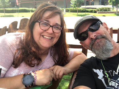
In addition hanging out on the sidewalk deck of California Burger Company and enjoying the late afternoon

Hanging out in the deck chairs
C.B.C specializes in the best adult (alcohol) milk shakes (Shake, Rattle, and Roll is the best- see the recipe from our hike last year)

We were assisted by Suzanne, a Trail Angel (who is someone that helps hikers at no charge get to and from trail heads). She had picked us up last year from Echo Chalet and was nice enough to agree to take us back there this year.

The houses along both lower and upper Echo lakes can only be reached by boat and some are just outrageous, including this one that reminds us of Hagrid's Hut in the Harry Potter movies


Here you enter Desolation Wilderness, arguably the most rugged and beautiful section of the TRT.


I love this wind swept tree


Heather Lake has a shore of nothing but Talus and some rather long shear drops from the trail


You pass out of Desolation Wilderness so our permits are complete (above) We arrived at Richardson not long before sundown and it was a beautiful sunset.


The overlook to McKinney Bay (8256')


We camped for the night, just up in the pines, right below the peaks where the PCT meets the TRT again.


As soon we started our day we came to the marker that denotes the separation of the PCT (which we had been on since our start) and the true TRT that goes toward Tahoe City, which was our destination for today.


We managed to secure another night at the Boatworks in order to sort out what we would do. That meant not having to hike in the morning but waking up and going to have breakfast at Rosie's, a must breakfast location in town!


We did manage one more day hike, although cut short as Bobbi was having problems with the smoke, into Van Sickle State Park, which borders both Nevada and California.


And then it was on a plane and back to home.

Day 1
12.14 miles
7'21" total time
A perfect day to start our hike at lower Echo Lake.


Looking at Upper and Lower (behind) Lakes as you rise above them on the trail


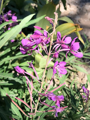
We saw a huge amount of wildflowers last September, but here in August there was still plenty to look at along the trail


You soon enter the "lakes" section. I have always thought this first lake (Lake Margery) was one of the prettiest with the mountains, Angora and Cathedral, in the background.


Aloha Lake is certainly the crown jewel of the lakes with Pyramid Peak, the tallest on the left. You can see Pyramid Peak from around the lake and the trail


Past Susie, where we camped last year, and up the hill is Gilmore Lake our first day stopping point.

Day 2
16.36 miles
8' 0" total time
Day 2 dawned beautifully and since we had made it to Gilmore lake we were already part of the up the hill to Dick's Pass. After reaching Gilmore Lake last night I was in some pain from my recovery, but I did manage to eat dinner, However this morning the pain was a bit more and I needed a pain pill, which meant I didn't feel like eating any food this morning

Dick's Pass in the steepest climb on the TRT but the views just get better and better as you climb
At the false pass (above) you look down directly on Dick's Lake, but it is still a bit more uphill to reach the actual pass (below)

Reaching the top you get some fantastic panoramic views from the flat stretch that lets you look in all directions. We stayed a while for a well deserved rest at the top and I tried to eat something but I still could not get down any calories.

Fortunately it is all down hill for the rest of the day (almost) so it was easy to come down from the pass (seen in the background below) we passed Dick's Lake, Fontanillis Lake (below) and the Upper and Middle Velma Lakes.
We took lunch here, but again I just rested and didn't eat.

Why do I feel like someone is watching me?

We debated on where to finish today with me feeling tired, but we finally decided to stay on schedule and make it to Richardson Lake. After passing middle Velma you go back up for about 2 miles, but then downhill 4 miles to camp.

It had been a long day with lots of elevation gain and loss, Bobbi was able to make dinner, but as soon as the tent was up I was lying down. While I probably burned 6000 calories today, I probably only consumed about 300.


Day 3
13.5 miles
6'58" total time

The first half of the day was nice and pretty straight forward. I still had issues with frequent wound care and lack of appetite but the walking was nice. We knew that after lunch we would have a significant climb around Barker Peak to the overlook of McKinney Bay (8256') and then way down only to go way up to Twin Peaks (8509').


13.5 miles
6'58" total time
Another fine but hot day, we got up and out early to try and avoid some of the midday heat, this temperatures have been a bit higher than predicted for this elevation all week.

Barker Peak from Barker Meadow (below)

We had a stop and long rest at Barker Pass around noon before tackling the toughest part of the day.


I had a nap!

After about a 90 minute siesta we started up the first hills.


You drop way down into the next valley before going up again (you can see Twin Peaks in the background just left of center)

Better view of Twin Peaks

There is a series of 6 switch backs through scree and forest to get you back up to Twin Peaks


Finally arriving at the top and Twin Peaks


Day 4
13.15 miles
6'20" total time
Yesterday was a another beautiful day, but I just was still having issues, mostly with wound care, which I had to do multiple times during the day. In addition I just couldn't eat any dinner. I was not taking many pain pills, in fact I was biting them in half so only one full one during the entire day. To add insult to injury when I was breaking down the tent I discovered that some inconsiderate person had pooped on the ground and it was now all over parts of my tent!
GROSS!


The views today were very nice as most, if not all day, was downhill, except for a nasty bit of uphill just past Ward Creek parking area!
But it was just about at this beautiful spot in the day that I told Bobbi I was done and didn't feel like I could go on after Tahoe City. I was managing the pain and the wound care, but it was the lack of calories that was making it difficult to put in the days we needed to complete the trail in time.

Ward Creek bridge (above) this is usually the place to get water but it is not easy to reach in the steep ravine, there is actually a secret lovely, cold and clear spring just half a mile past here where the water tastes great coming right out of the ground!

You spend a good deal of time on this dirt road heading out to the Ward Creek parking area (above) but after you have a very steep climb to Page Meadow, before making your final descent into Tahoe City.

Tahoe City is a lovely, small, expensive town right on the Lake and it was a welcome site in the early afternoon

We didn't even waste any time as we headed straight for the first restaurant with BIG burgers and cold cokes! We knew about the Tahoe Brew Haus from last year and even I was hungry for real food!

I could only eat less than half my food, but I took it with me and did eat it all by the end of the day. What they did have was homemade sodas. I had the rootbeer and the blackberry soda and it was sweet and cold and delicious. It was all the refills you wanted and they lost money on the amount of cold soda I drank!

Bobbi had booked us into the Inn at the Boatworks. They had taken over the closed hotel we had seen last year in Tahoe City and have started to rejuvenate it. The Boatworks is a large commercial company that owns a shopping mall area and lots of property along the water in Tahoe City.
They have done a good job in getting some of the rooms redone and it was a fine place to stay albeit obscenely expensive for what you get, but that is the nature of Tahoe City. I was really only interested in the shower as I had not had any since leaving 4 days ago, as you can tell from my feet (below)

The rest of the day was really spent figuring out what to do next. This town seems to be a nexus for bad outcomes for me. We were only suppose to stay the night and I told Bobbi that I would support her continuing on without me if that is what she wanted to do. As it turned out her resupply box from home did not arrive via UPS (it was still in Sacramento, despite being sent more than a week earlier) and she was also harboring some aches and pains, she had been struggling toward the end of each day, so by the end of the night she decided she was done as well.
I really didn't want to go home yet as I had not had a vacation in two years and with all our previous plans cancelled, I just didn't feel like going home yet, but we couldn't stay here as it was just too expensive.


During an excellent breakfast (these are stock internet photos above and below) as I was too busy eating my pancakes, eggs and sausage to take pictures) we decided to go back to South Lake Tahoe, which was much cheaper and stay the remaining 4 days and just hike locally and in general relax and rest (which suited me just fine)

It became site seeing day, mixed with movie watching and just laying around. However in the evening we did go for Mexican food at another spot in town the Blue Agave.

This time I did take pictures


A little whimsy around town

The next day our friend Elsye came again and was so kind to drive us back down to South Lake Tahoe. As it turned out this was fortuitous as unbeknownst to us the smoke from the wildfires in California were on their way and arrived in the Lake Tahoe area, hundreds of miles from their origin at those fires.

Arriving back in SLT the smoke had started to obscure all the views and in fact it would only be a matter of days before most new hikers were abandoning their starts and those are the trail were getting off, because of no views and the decreasing air quality, until as of posting this account weeks later, the entire trail is closed to to wild fire activity.
We would not have been able to finish our hike with any quality as we would have been on the northern part of the trail which was most effected at this time.
Everyday the smoke got worse for the remainder of our trip


We took a casino shuttle back to Reno, where we managed one more dinner (only my second sushi meal ever!)


In the end I have to say a fairly disappointing adventure, although the scenery on the trail was beautiful and our timing with weather was great to get the first four days in. Tahoe has been a difficult area for me and one that I think I will now leave alone for good. Don't let me account put you off, this trail is well worth doing but the logistics to get to it, from anywhere except local, is difficult and expensive and the weather can be, (and has been for me) very challenging.
In fact, this trip solidified a decision that I have been wrestling with for many months now and that is my decision to effectively retire from long distance backpacking. For a variety of reasons I have not been getting the same enjoyment out of being out for multiple days as I once did and so it time to lay that down and think about what will again recharge my batteries moving forward....
Special thanks to "The" Bobbi Walters for being such a good sport. We have not been good at actually getting a hike done anywhere, but I appreciate the company!
Subscribe to:
Posts (Atom)