I started from the Round Spring Upper Canoe Access parking lot just north of the Current River bridge. There is also a small loop trail here called the Round Spring Spur Trail that I decided to add to the hike.
The Spur loop claims to be 3 miles around, the Connector Trail about 12 miles and Brushy Creek loop about 14, making it about 41 miles total in two and a half days, certainly a doable distance.
There is very little beta on the Round Spring Connector, just being finished in November of 2019 and while the Brushy Creek loop has been marked for sometime, even on the Ozark Trail Blair Creek map set, there is also not much in the way of information on trail conditions either.
An Adventure.
Leaving the Truck in the parking lot at 8 am. I was the only vehicle there other than the river rafting companies, who had parked their school buses and trucks at the far end, as it had just been announced that all private companies serving the river ways had to shut down.
For late March it was a usually hot and humid day. The skies were overcast but temperatures where close to 85 with almost 90% humidity and no breeze at all. In fact it was really not a great day to walk, but it had taken me 3 hours to get here so off I went.
Day 1
You cross Hwy 19, the Round Spring Spur Loop and the Connector trail are accessed just at this end of the walkway into the woods
I would come to find out that what these trails lacked in information and indeed trail would be made up for in signage! To say these trails where well marked would be an understatement.
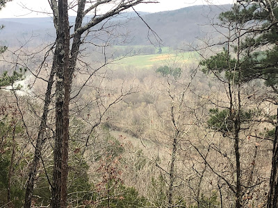
From the intersection you climb up to the ridge going clockwise. This is a typical pre-spring view from the Missouri woods, the next ridge line through the bare trees
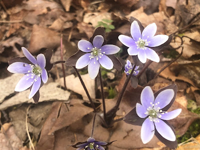
Small Spring flowers were up everywhere, pushing up through the duff.
Reaching the 1.9 mile mark, of the loop, you join the Connector Trail
The trail for the most part was dry, except in a few of the hollow sections.
There are many old forest roads, logging roads and access roads, some are marked on maps and some are not. The ones that dead end near water or a stream tend to be trashed as locals use them for access and dumps!
The Connector section does walk next to some of the best looking creeks I have walked by on any trails in Missouri. The muted light of the day doesn't lend to great pictures, but they were all flowing with many water features. They also were just wide enough and just deep enough to keep your feet constantly wet for most of the day as the trail crossed about half a dozen times during the day.
A group of wild horses were hanging out along one of the lower sections grazing on the short new green grass. These were all white!
As you climb up above the Current River you get to see a bit more of a view along the bluffs. The trail in this section was rocky and had a very pronounced slant making most of the walking "side hilling" easy spots to twist an ankle. It is a good thing mine have always seemed to be made of rubber!
Open grazing land across the river
Some great bluffs with really interesting rock formations high above the river. (See the video for a better look at this section)
You drop way down to the river level again and follow the flood plain for a bit.
Lots of water flowing. There was no problem getting water all weekend and I only carried 750ml at any one time
There was a big section of logging along the trail with really fresh signs of work, as if they are still currently working in this section. I am not quite sure I understand how they pick the trees they are harvesting and why they seem to leave most of the trees they cut. They had done an OK job of clearing the actual trail but in several sections you had to make your own way around to rejoin the trail.
Don't count on this trail being all that visible, you are mostly looking for the orange markers on the trees. In this section a few of the downed trees are the ones with the markers.
More great spring flowers
A hidden spring coming right out of the rocks, which had a beautiful patina of green moss
Right at the 13 mile mark for the day (11.4 on the Connector) you come to Big Creek. Now I had a map and the basic GPS track, but to be honest I didn't notice the size of Big Creek!
Big Creek feeds into the Current River and is a couple hundred yards across and today was only calf deep, easily managed by simply crossing on the slightly higher sand bars avoiding the deeper sections that the water currents cut (in some spots those would be over my head), but it is something to be noted as Big Creek could be quite a bit higher if you try it after a few days of rain.
Looking back across, as I am almost across
Not too much trouble today
Following Big Creek you climb again from the river level and in one section you pop out on a disused old jeep road that has a ridiculous grade going up!
And the same going down the other side!
I reach the end of the connector trail and the beginning of the Brushy Creek loop section at 17.4 miles for the day or 15.5 miles on the actual connector, quite a bit more than on the GPS track I had, but looking at the track it does not really include the many switchbacks, twists and turns the actual trail takes. I would count on a few more miles than advertised.
Of course the end of the Connector was marked by more streams to cross and also a few abandoned roads and even a house foundation. An old car from the 50's sits back in the woods "historic trash." I can't image the roads were ever good enough to drive here, but I have seen many old photos of cars traveling on roads that would be considered four wheel drive roads today
Crossing over the last of the streams that seem to all meet at this point. I decided to make my own adventure for the end of the day. Instead of following low along the creek beds as I had done for many of the miles today, I decided to head up an old jeep road to the ridge line and walk high for the remainder of the day and the morning tomorrow and rejoin the loop. This turned out to be a great idea as after an initial very steep ascent I was walking up on the primary ridge line with really good view through the trees.
The old jeep road alternative is in yellow and my campsite in marked with the red X
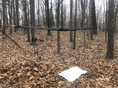
Just short of 2 miles I arrived at close to the high point of the ridge at around 800' There was a possibility of storms later in the night, so I didn't want to be on the top, but just below to shelter from any strong winds.
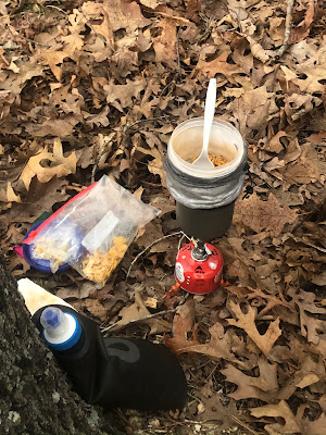
Everything set up for the night, it was dinner time. A trail classic Andrew Skurka's recipe for beans and rice with sharp cheddar cheese and Frito corn chips
Drying sweaty clothes and time for an early bed. The temperature is still in the 60's early into the evening.
19 miles for the day, with some healthy elevation changes
Up about the same time so I was walking by 8 am. Everything cleaned up as if I was never there.
I followed the ridge line and the old jeep road until it dropped down to meet up with the Brushy Creek loop again
Regaining the Brushy Creek loop the first thing you notice is there is no trail. For those that understand how trails are generally routed you can see the very faint indentation of a trail in some places (as you might see below) but you are simply looking for the next marker on a tree. This has been greatly hindered in the fact that while there may be many markers, the trail designers only used one nail to hold the marker to the tree. This has two problems; one, the markers are easily dislodged from the tree and you can see many of them on the ground and two, the markers tend to twist. This is particularly bad as a twisted marker is usually a sign the trail makes a turn in the direction of the twist.
Once the trail meets the Ozark Trail connector (the blue line moving off to the right below) the trail starts to follow a creek bed again and is again no problem to follow

The Creeks really were very pretty all weekend
This creek bed trail is also an old jeep road and the Western outer loop of Brushy Creek uses this for most of the rest of the way around to rejoin the Round Spring Connector. I chose to cut the loop in half using the trail marked with a #2 on the trees. This seemed to offer the chance for more scenery up a bit higher on the ridge.
It did, but occasionally it still dropped you down to cross some pretty beautiful flowing creeks, but in general the grade was very consistent on this section
About half way through the connector #2 section I was startled by a dog wearing a GPS collar. I am not sure the real purpose of this other than to have the dog track down bear or deer for hunting purposes, but I can tell you I hate it and the people that do it. This dog had a decided limp on one back leg and I had no idea how long it had been out here. He was very friendly and decided I was good to follow for about an hour or so along the trail. It was also lightly raining at this point of the day.
As we walked eventually I heard a vehicle up on a forest road and the dog took off running up the hill. I can only hope that was the dog's owner. I made sure to stay low and out of sight along the trail otherwise I might have been tempted to have words with the owner, but being unarmed I thought better of it given the circumstances.
I eventually came back to the place I had started the loop and crossed the series of creeks again by the old abandoned vehicle and had to go way up that brutal incline from yesterday.
I carried a couple of liters of water up that hill so I could camp at the top and have great views of the sunset and sunrise. It was again suppose to storm as it had been raining lightly on and off all day today.
I found a couple of trees just off the ridge again, encase there was wind and settled in for the late afternoon. I had done my 18 miles by 3:30 pm and while I was thinking to carry on back to at least Big Creek, this seemed just fine.
Very pretty sunset
Day 2 stats
Day 3
Sunday dawned just as a spring day should in March. A front had moved through last night (lots of wind) but had lowered the temperature 40 degrees overnight to the high 30's, low 40's. My forty degree quilts left me a bit chilly toward morning, but I had brought my puffy jacket so I was quite good until I needed to get up. I was up and away again by just 8 am but this time in the sunshine of a beautiful sunrise
Back down that awful elevation of the jeep road. At least it was down to start.
A couple of miles and back to Big Creek. A bit deeper this morning over the sandbar, about knee deep.
This time the flood plain was bursting with flowers I had not seen on Friday.
At about noon I was very close to the end, but hungry so I stopped with this lovely view to have lunch
Thai chili tuna on a tortilla with some extra mayonnaise. Yum, the best lunch
It was only about ninety minutes to the end as I finally picked up the Round Spring Spur loop and followed it back clockwise on the part I had not seen yet.
Back to the beginning
And down to the parking lot
Day 3 stats and the end of my adventure.
It appears about 3 miles of the beginning of the day did not record.
A note about this trail. I am hesitant to use the word expert, as who is an expect and what does that mean? However I will say that I would not attempt this section if do not have a good deal of experience in hiking Missouri trails. It is longer (53 miles) than the present maps indicate it has a significant elevation profile that happen in very short distances. In addition the tread on parts of the trail, even though it is new, are very narrow and slopped, strong ankles are required. It is also very difficult to follow on the ground and I am not sure about the longevity of the trail markers on the trees. I am very appreciative of the many volunteers and the many hours it took to complete and mark this trail. I hope it can remain for years to come.


