Author's note- I am still working on the blog for our two week RV trip to Universal Studios and back. - coming soon
Vicky had some commitments this weekend so I decided to do a short overnight. But where to go. Since retiring from long distance backpacking, I have been doing shorter trips, day trips, biking, some overnights. As I think I have hiked every designated trail in Missouri at least once, if not more, I have tried to challenge myself to do more obscure destinations, trips off trail and trails long forgotten. So this weekend needed to continue that theme. I have been reading posts from many members on the Ozark Trail Section Hikers and Backpackers (OTSHAB) Facebook page, (by the way, this name should also be extended to included bike riding and kayaking, Andi, I am talking about you! 😉) about a spur hike on the Council Bluffs lake trail up to a place called Johnson Mountain (1660'). Now I have been around that lake several times but never heard of this. The posts and photos look beautiful and the overlook appears to rival that of Bell Mountain. (1702'). And let's face it, Bell has become practically a tourist attraction and has been loved to death, taking it off the list of hikes to do again.
A little investigating and a couple of instant messages and I had found it. It turned out it is actually on the All Trails hiking app, but not on Gaia, which surprised me. The All Trails app wasn't quite right but close enough. In the end it turned out to be in the category of forgotten trail as it is wide and easy to find. Off we go.
No need to get up early as this is only about 4 miles in, so I didn't get to Council Bluffs until around 2 pm. It has been a really hot and humid day, so waiting for the worst of the heat to be over was the plan. The parking lot was packed, as I would soon remember, this is the site of the nice swimming beach and concession stand that Cory, Joe and I had stopped at on our trip around the lake trail. This is my first time parking here to access the trail and it is an honor fee area of $5 per day. So parked and paid my money and it is a good thing I did as you will see tomorrow. Took the high trail around the beach area, it was really busy, but today would have been a good day to be in the water.
hmm, what kind of bait and for what?
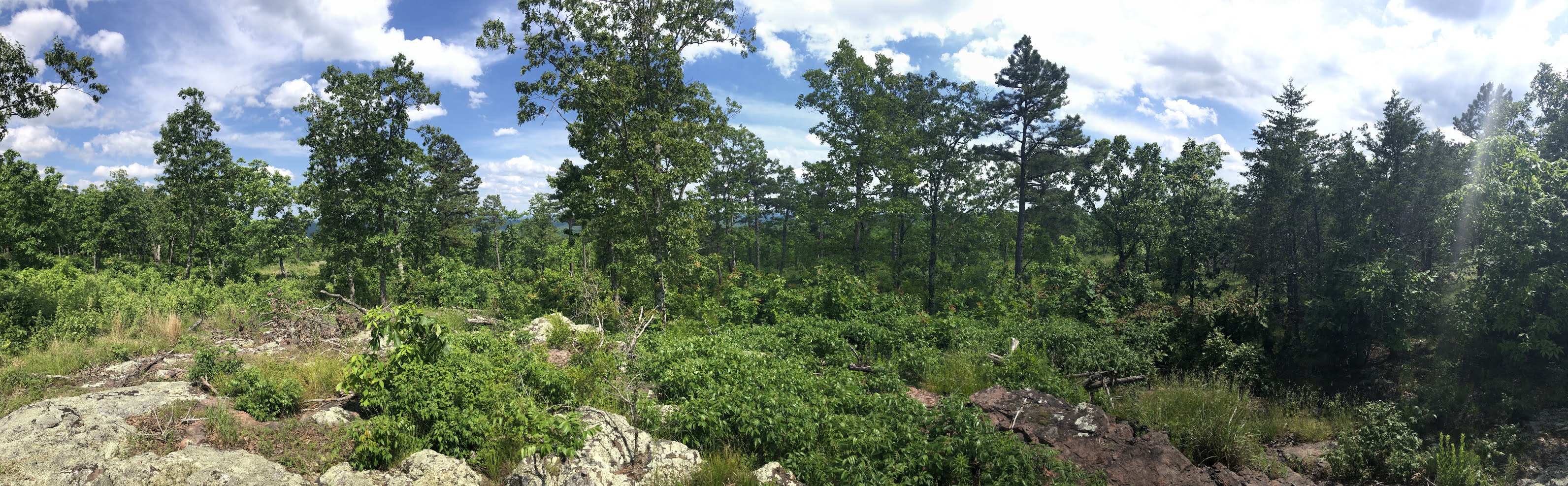
Heading out from the beach area
Turning off the gravel and on to the single track
This lake overflow spillway has some really interesting rock formations Just over the spillway and out of the bright hot sunshine and into the woods
Just about a mile from the beach is the boardwalk out onto the lake. it doubles as the outtake for the continuation of the Big River. which The Big River starts up near St Louis as an offshoot of the Meramec River. Out at the end of the boardwalk
The earthen dam that formed Council Bluff Lake. No one has mowed the trail yet this year. Fortunately no ticks were found 😌
In just about another mile, if you look at a map, you come to a point of land jutting out on the lake. At this point you also see a rock wall, probably a remnant of a retaining wall to keep the old forest road to the left in this picture from becoming too steep this close to the lake Looking left going south on the trail, you clearly see what remains of an abandoned forest service road. This should lead pretty much directly up to the top of Johnson Mountain
There a few downed trees and some brush when you first start up this old road, probably to discourage anyone from really going in this direction, but once you past that, you can clearly see this is an old road, probably used for logging in the 40'sAbout a half mile in, you come to a natural clearing of exposed granite and you can also make out a few other paths intersecting at this site
Another half mile and you can see on the map that the contours get tighter so the trail gets steeper, this was not meant for people or horses and clearly for vehicles. This portion where it gets steep has been eroded by the constant water run off since the grade is pretty much straight up.
The uphill does not last long and within a half mile you are up meeting the gravel road, that is on on the top of Johnson Mountain
The actual top of Johnson Mountain doesn't really have any great views at least not after the trees have gotten their leaves, but I wasn't going to come up here and not go to the top! Top of Johnson Mountain (Below), with a bit of water being held by the granite outcroppings at the top (above)
Summit photo!
Lots of really pretty wild flowers on the top
Ok so the reason I came up here was to get to the cliff edge just below the summit. I left the top and took what appeared to be an obvious trail back in the direction of the original trail. Indeed it did come out back on the trail and then I retraced my steps to the approximate location of the cliff edge. There are a couple of clues as there were to hop off trail. Someone has actually put blue flagging tape on a tree right where you need to head into the woods. the second is you can see a faint social trail heading off in that direction. Something has happened up here to cause a huge number of small trees to be cut. This is National Forest land, so I hope this is just not random people felling trees to gain easier access to the beauty spot, but these smaller trees have definitely been cut down with saws.
It is actually quite difficult in a few spots to step over and round the vast number of trees that have been cut down, but you get through that and you emerge on the cliff edge. If you look at a google satalite image of the area, you can easily see the cliff band you are aiming for. (you can see this in later photos below)

It is a fantastic spot. You can see over a vast amount of National Forest land and back down to Council Bluff Lake
Closer view of Council Bluff Lake below
Selfie off the edge
I scared off some really big turkey vultures that were sunning themselves when I arrived
I too decided to sun myself for a bit. A view from my pitch, just in the tree line off the edge. It became the perfect shady spot in just a short while
With nothing left to do today, It was time to relax, which was the reason for coming up here today. I had carried two beers, and one liter of water from the car, and added two liters of water from the lake before I started up the hill.
Around 6 pm it was time for dinner, a homemade sandwich and a hard cider.
The forecast for today and tonight was 82/67 with only 6% chance of any precipitation. These clouds rolling in around 8pm made me think the weather man was going to be wrong again.
What is a person to do? Drink another beer. The last of my special stash of Vlad by Royal Docks Brewing at a very nice 12.5% abv.
The breeze had picked up as the clouds kept rolling through making the temperature very nice, especially with the sun hidden. Not one bug was flying and had also realized that I would be fantastically alone up here tonight and by nightfall there was probably not going to be another person within 10 miles of me.Some exploring all the cliff edge and the moss and lichen that covers the granite outcroppings
Nothing to do but watch the sunset
and enjoy the colors of the evening sky
Beautiful pink sky

I didn't really get the best sunset, but who can complain here anyway. I was hoping to get some night sky pictures, but that was not to be.I also didn't make a fire after processing a bunch of downed wood, as the wind was just too strong. It will be there for the next adventurers
The breeze of the day started to get stronger as the night wore on. I went to bed without my tarp deployed as it felt great with just gentle swing in hammock and the Pine trees I was attached. About midnight, however the weather front arrived. It started to sprinkle, so I deployed my tarp, but it was the wind that really picked up. In fact you could say that up on that cliff edge, it was blowing a "hooley"
It stayed at about 5-10 mph and as the front moved in as wave after wave the gusts could easily have been 20-30mph about every few minutes
Below is a recording around 1 am of the wind as it beat against my tarp.
I paid for my restful day yesterday, with not the most restful nights sleep in the howling wind. Around 5:15 am it was light enough to see without my headlamp, so I decided to pack up and head down.
I never had any fear that my set up would hold and I wouldn't be safe, but I had plans to spend a lazy morning lounging around and making coffee and watching the sunrise. With the weather like this, that didn't seem likely and while I figured this would all burn off by mid morning and be hot and sunny again (which it did) I didn't have any reason to lay there and listen to the wind.
My morning view, not very promising


Up and away by 6 am. I had found the other half of the horseshoe in last night while exploring. You simply follow the cliff edge down and around to reach the trail again. I had not noticed it yesterday but someone had also marked this location with flagger tape that I noticed when I regained the original trail.
Mega Fauna? Black Bear? I noticed this coming down in the morning. More pretty summer flowers
Large granite outcroppings I scared two turkeys on this trip, one yesterday out of its roost in a tree and another later this morning in the tall grass, but this was my closest encounter once I reached the main lake trail again.
View coming back across the earthen dam in the morning lightOutlet station and boardwalk
Back across the spillway
Lots of tadpoles in the shallow water holes
Back by the now deserted beach. No one will want to swim on this misty gray day. I was surprised that no one else had stayed in any of the campsites that are available around the lake. This confirmed that I was really alone last night. Across the wooden bridge back to parking lot.
What was a completely full parking lot now only has me remaining.The beach area doesn't open until 7 am. It is still just before. The nice people that run the area left me a note on my windshield telling me that they left the road gate "fake" locked and I could get out when I wanted and that I should just lock it behind me. That was very considerate.
Below are a few maps of this trip.
Day 1 parking lot to top of Johnson Mountain and then out to the cliff edge which was real destination for the day.
Day 2- Walking down the cliff edge back to the original trail and back to the parking lot
Below is a composite of the two days. The red line is the "trail" toward the top of Johnson Mountain. The yellow line is the horseshoe that takes you to the cliff edge that you can easily see on this google earth view. This is at 37.73, -90.89.
A couple of follow ups. I found this hike far easier than I thought, as I expected to be bushwhacking up the mountain for most of the way from the lake. As I said above I would classify this as a more forgotten trail than anything else. I cleaned out the fire ring at the camping spot, thinking I was going to have a fire, which I didn't, but I did clean out the fire ring of very old beer cans and tinfoil. The area doesn't look like it has received much pressure and the area was for the most part very clean, except as I mentioned the troubling situation of all the small trees being cut down. I hope it remains "hidden" or if you find it, please take care of it.
I did manage to roll my ankle coming down in the mountain in the early morning, which I almost never do, but it did hurt! in addition I got a flat tire on the way home. Fortunately my tire sensor came on just before Potosi and I was able to pull into a gas station and change my tire off the road.
bag o' trash