Glacier National Park- Bonus Material

While waiting for the final installment of our hero's to exit Glacier National Park, enjoy some of the prettiest macro flora photographed by Joe. We would wonder were we left him while our heads were up looking at all the mountainous beauty. He was crouching down to catch the smallest of wonders along the trail
Thanks Joe


Photos by Joseph Choka

Glacier National Park- Many Glacier Loop- Day 8

All good things must come to an end and so it is with our hike, but not to get ahead of ourselves as there is a great day ahead and much to see. Waking up at Elizabeth Lake Foot campsite we have 10.1 miles to the parking lot at Swiftcurrent where we started. Another big highlight of the trip is coming up to, the Ptarmigan Tunnel at the apex of our uphill today. We have 2518 feet of elevation gain to get there and a total of 2665 feet of elevation loss by the time we reach the end.


We are up early and everyone is in good spirits to start the day.


The trail marker just next to ELF shows us that we have 4.4 miles to the top of the hill! 

Right out of camp is a great suspension bridge. It really wobbles and moves as you cross it. It is rated at "one at a time" 
Waiting my turn at the suspension bridge across the Belly River

looking back as we cross the river into Elizabeth Lake
The trail starts up in the woods 

but soon breaks above treeline to expose some fantastic views of the mountains as you climb higher and higher. 

the boys climbing higher 

A view back. The smoke seemed to be considerable less this morning. The peaks were starting to glow a bit as the sun came over the mountains. The combination of shadow and light made for some fantastic viewing.  The wind was very strong again this morning and a bit chilly. When it hit you in the face it held you back, but when you would hit a switchback and change direction, it would actually help push you up the hill. 

This peak (below) is the back of the Ptarmigan Wall and (above to the left). Above in the center just visible is Natoas Peak and then to the left of center is Mt Merritt and that is not a long low cloud, but the Old Sun Glacier.
As you almost reach Ptarmigan Tunnel the trail work becomes magnificent. It really reminds you of other CCC trail work in Zion National Park and the Grand Canyon. 

Finally you level out and reach the tunnel entrance

Don't hike into the light! but in this case it is actually ok 

You emerge on the other side with a fantastic view of the trail down toward Ptarmigan Lake

Long easy switchbacks take you down and it is down, down, now all the way to the end. 

Ptarmigan Lake

Back into the tree line and much wider trails. We start to see dozens and dozens of day hikers going to the tunnel or Iceberg Lake

The junction with Iceberg Lake Trail and the Ptarmigan Trail means only 4.1 miles to go till the end. 
We have come back into the same valley we started out hiking 6 days ago. Looking back you get a few more good views as the sky (which looked like rain for awhile) is clearer than it has been for days.

looking into our start valley (Swiftcurrent) to Swiftcurrent pass at the very end and Grinnel Glacier on the left. (below)

one more downhill turn and into the parking area. 

Back into the parking lot and getting the pack off.  The condition of my shirt after 6 days on the trail... Yuck!

Celebrating at the Swiftcurrent Motor Lodge restaurant with beers and burgers. With the Going to the Sun road closed it will be almost a 3 hour drive back to Kalispell.  However it is only 1 pm and we have plenty of time. We covered that 10.1 miles in just 4.5 hours 

The drive back was uneventful through East Glacier. Once back in Kalispell it was time to clean up, shower, do laundry and then more calories needed be consumed.  MacKenzie River Pizza was recommended and it did not disappoint with great pizza and good beers on tap


they ran out of flight glasses, so I got one big one!
After a good nights sleep in a bed! it was off to home

A beautiful morning sky to fly. While the scenery was not ideal this week the adventure was epic.
65 miles of backcountry travel in one of the most beautiful settings in the world. Glacier is truly the crown of the national parks


 This trip would not have been nearly as good if not for the great companionship of my hiking buddies. They made it a really special week. 
Joe (Gideon) above
Cory (Disco) below. 
Thanks guys for everything. We make a great team. 
Where to next? 


All photos for this adventure were either from Skygzr, Disco, or Gideon. except as noted for internet photos. 


Glacier National Park- Many Glacier Loop- Day 7

Day 5 in the backcountry. Today was supposed to be another easy cruise from Cosley Lake to Helen Lake. 8.5 miles with just 475 feet of elevation gain with 240 feet of elevation loss. Helen lake being the apex of the trip for Cory as all the pre-trip conversation was about how beautiful the mountain scenery would be at Helen. Things don't always work out the way you think and that would be the story of today. As you can see from the map we did go down to Helen Lake, but then left to return to Elizabeth Lake Foot campsite for the night....


Today started out as yesterday ended, A firery red sunrise with smoke and heat. The first order of the day was to walk to the end of Cosley Lake and cross the end of the Mokowanis River that feeds all these lakes over the past two days

You can make out the cable going across the lake that helps with fording in higher water (it was up to our waist close to the other side)

Combination of all the types of terrain today


The sun continued to look red and made for some very eerie photos

Dawn Mist Falls, could be one of the most beautiful falls I have ever seen 
Dawn Mist Falls

Cory spending the time to get the perfect shot, just above Dawn Mist Falls.

The perfect shot (photo by Cory)
We passed several Thru Hikers completing their CDT hike this year. They have had several diversions in the Bob Marshall Wilderness and Glacier due to fire and their only finishing spot now was Belly River at the Canadian Border. 

After just 4.2 miles we reached a decision point at the junction for the Ptarmigan Trail. If we continued on to Helen Lake it would be 14.5 miles to reach the parking lot at Swiftcurrent tomorrow, or if we went straight out now it would only be 10.1 now
I voted out, as there was a burger and a beer calling my name, but to be fair this was Cory's ultimate destination for the trip and there was no way we weren't going down to Helen to make sure we did everything we had planned. 
Below is a glimpse of the way up to Ptarmigan tunnel we would see more of tomorrow.

Elizabeth Lake from the ELF campsite 

Just past ELF We were immersed in a sea of butterflies

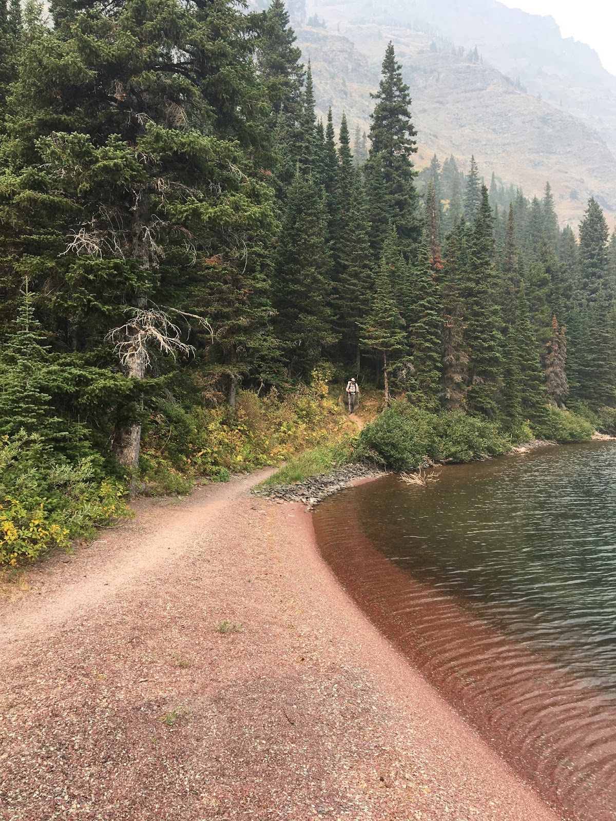
What a wonderful beach along Elizabeth Lake
once you are past Elizabeth Lake Head (ELH) campsite the trail gets a bit overgrown as Helen Lake is a purpose destination as it dead ends in the bowl of valley against a mountain background. 

Still more great trail work with excellent bridges to cross creeks and streams

Was it a lake at one time? or a burn area? 

We arrive at Helen Lake, 4.3 miles south of ELF in what can only be described as a squall, not of rain but wind and smoke. the wind is blowing around 40-50 MPH and the entire area is shrouded in smoke. 


There are only two campsites at Helen Lake and we look to be the only people here as we didn't any people south of ELF campsite 
We glimpsed Helen Lake from above on the Day 4 post when we were on top of Ahern Pass. Below is what we were expecting this week.
Despite knowing deep down we would not see it like this, we still had to keep to our official schedule. The arrow marks the spot we viewed Helen Lake from above on Ahern Pass.

when we got to the edge of the lake in this same position this is all we got.

Caught in the wind

We left it up to Cory, but he wasn't keen to stay in this wind tunnel breathing this smoke all night, so we decided to head back the 4.3 miles up to ELF to evaluate how we felt.

Getting back to ELF we just hung out until well past evening to make sure we were not taking anyone's permit site. The campsite was not nearly full tonight as we suspected the backcountry ban that was now in effect as well as the smoke had made lots of people change their plans about hiking in the last few days.

A couple of groups were in the campsite and we all sat in the designated eating area for dinner 

Set up for the last time in Glacier National Park. I managed a neat tent sight just in the trees. This was also the first night I finally got everything situated just right, so I got a good nights sleep. 

The evening was warm and mild. For the first time in a couple of days we did see some blue sky overhead

The moon made an appearance hanging over the mountains after sunset 

In the end we hiked 12.8 miles today with only a slight change to the elevation profile. Leaving us 10.1 miles to complete our hike
Tomorrow the conclusion of our tale... maybe
Support Our National Parks - Preserve - Protect - Enjoy