The trail marker just next to ELF shows us that we have 4.4 miles to the top of the hill!
Right out of camp is a great suspension bridge. It really wobbles and moves as you cross it. It is rated at "one at a time"
Waiting my turn at the suspension bridge across the Belly River
The trail starts up in the woods
but soon breaks above treeline to expose some fantastic views of the mountains as you climb higher and higher.
the boys climbing higher
A view back. The smoke seemed to be considerable less this morning. The peaks were starting to glow a bit as the sun came over the mountains. The combination of shadow and light made for some fantastic viewing. The wind was very strong again this morning and a bit chilly. When it hit you in the face it held you back, but when you would hit a switchback and change direction, it would actually help push you up the hill.
This peak (below) is the back of the Ptarmigan Wall and (above to the left). Above in the center just visible is Natoas Peak and then to the left of center is Mt Merritt and that is not a long low cloud, but the Old Sun Glacier.
As you almost reach Ptarmigan Tunnel the trail work becomes magnificent. It really reminds you of other CCC trail work in Zion National Park and the Grand Canyon.
Don't hike into the light! but in this case it is actually ok
You emerge on the other side with a fantastic view of the trail down toward Ptarmigan Lake
Long easy switchbacks take you down and it is down, down, now all the way to the end.
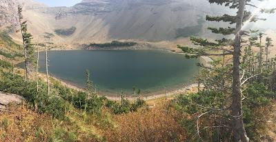
Ptarmigan Lake
Back into the tree line and much wider trails. We start to see dozens and dozens of day hikers going to the tunnel or Iceberg Lake
The junction with Iceberg Lake Trail and the Ptarmigan Trail means only 4.1 miles to go till the end.
We have come back into the same valley we started out hiking 6 days ago. Looking back you get a few more good views as the sky (which looked like rain for awhile) is clearer than it has been for days.
one more downhill turn and into the parking area.
Back into the parking lot and getting the pack off. The condition of my shirt after 6 days on the trail... Yuck!
Celebrating at the Swiftcurrent Motor Lodge restaurant with beers and burgers. With the Going to the Sun road closed it will be almost a 3 hour drive back to Kalispell. However it is only 1 pm and we have plenty of time. We covered that 10.1 miles in just 4.5 hours
The drive back was uneventful through East Glacier. Once back in Kalispell it was time to clean up, shower, do laundry and then more calories needed be consumed. MacKenzie River Pizza was recommended and it did not disappoint with great pizza and good beers on tap
they ran out of flight glasses, so I got one big one!
After a good nights sleep in a bed! it was off to home
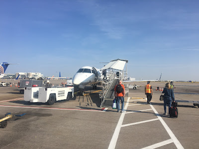
A beautiful morning sky to fly. While the scenery was not ideal this week the adventure was epic.
65 miles of backcountry travel in one of the most beautiful settings in the world. Glacier is truly the crown of the national parks
This trip would not have been nearly as good if not for the great companionship of my hiking buddies. They made it a really special week.
Joe (Gideon) above
Cory (Disco) below.
Thanks guys for everything. We make a great team.
Where to next?
All photos for this adventure were either from Skygzr, Disco, or Gideon. except as noted for internet photos.


This was sure a great hiking adventure. I believe the pictures of this last leg of your journey are some of my favorites. You guys were lucky that you were able to do all this even though you had the fire and smoke all around you. On to the next challenge---although I'm not so excited about your travel to a snow and ice covered mountain. Thanks for the great narratives--you know how your Mother enjoys a good story!
ReplyDelete