The Marble Creek section of the Ozark Trail (OT) is a small section that sits off to itself on the unfinished "horseshoe" side of the OT. Some day it might be connected to the Taum Sauk section to the north and the Wappapello Section to the south. This section connects the Marble Creek campground to Crane Lake roughly nine miles away. I have never been to either the Marble Creek area or the Crane Lake area. I had planned to make this an easy overnight, walk down to Crane Lake (9.4 miles) and then come back a mile or so and camp, then walk out the next morning.... easy.
The weather forecast a few weeks in advance was great for this weekend. However a couple days before starting, the forecast changed to 70% chance of severe thunderstorms by 6 pm Saturday night. Anybody who knows Missouri, or the Midwest for that matter, knows that Springtime storms are not to be taken lightly. Strong winds, lots of rain and the good possibility of hail and tornados. I have ridden out several of these in my hammock and tarp over the years, but I would rather not if given the choice.
I still wanted to go and walk this section, so I decided to try doing the entire round trip in a day and beating the storms in the early evening. This is all good on paper, a little under 20 miles and my average pace is a little over 3 mph, no problem. In reality I have not walked this distance in a single day in more than a year, I have not even skated in 3-4 weeks and I am carrying about 15 pounds around my middle that shouldn't be there. What could go wrong?
It meant that Saturday morning I needed to leave my house by 5 am to get to the trailhead just after sunrise to get the most out of the day. It was 51 F degrees when I left my house at 5:10 am. The drive down to Marble Creek campground is 130 miles from my house and it was a perfectly clear sky with a just waning full moon. I arrived at the trailhead at 7:40 am and the temperature was 37 F degrees!
The drive down Hwy E, by the way, from Hwy 67 at sunrise is spectacular, as you follow the St Francis river, which was over its banks and running fast.
Arriving at Marble Creek, the campground is still closed for the winter season, but there is parking outside the campground gates for OT parking as well as those day fishing in Marble Creek, which was also running up and fast.

As you might image I was the only one here and thought that I really wouldn't see that many people today as this is a rather "obscure" portion of the OT. I was right, I saw no one on the trail all day and lots of evidence this trail is not used much.

There has been no reports of cars being vandalized here, but a quick photo of the truck just in case and off I went

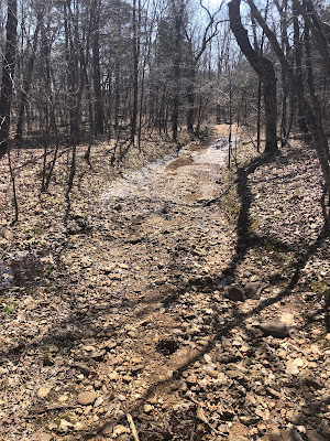
The trail starts off muddy, again due to all the rain so far this month, and up!


It is about 3/4 mile till you reach the crest and the ridgeline


There were several signs of spring, Apple Blossoms (smell fantastic)


The OT guide for this sections reminds hikers that there is very little water on the Eastern side of the trail (the side I am starting from) but today there was water everywhere. Every time you went down into a hollow, there was a good running creek.


There might have been fire run through here at some point in the past as this section is thinned out and a lovely walk up on the ridge line.


The trail signage does improve once you are down this initial decent


As you drop into the Crane Lake drainage you find what is might be a creek with no name, but it was full today.


In fact it was wide enough that it needed to be waded. Not even half way through the day, I didn't want to get my feet and socks wet, so I had brought my almost new sealskin waterproof socks. I spent a few minutes pulling off my shoes and putting on the waterproof socks for just wading over. Much to my annoyance the socks after only wearing them about 5 times since I purchased them had a hole in the toe on one and in the heel on the other from wear.... so my socks got wet!


A nice flat walk on another forgotten road toward the lake


This is a very rocky section and as you get closer to the lake's spillway, you have to climb up out of the creek and over the top of the bluff. It is steep in this section.


Walking further along the bluff you get your first view of the lake and the spillway


A couple of miles around the lake and you arrive at the parking area for Crane Lake. the OT map has this as 8.8 miles from Marble Creek, my Garmin watch had it at 9.4 miles.


You cross over a concrete roadway that goes over the inlet to the lake which is also Crane Pond Creek, which was dammed to make the lake


Crane Lake Pond Road around the lake


The road ends just before the spillway and you can walk up on the spillway from this side.


The F.R. was almost completely flat so just easy walking, but it had actually turned hot in the sun. The temperature had gone from 37F this morning to 80F now. Since I am always carrying my umbrella, I used it for shade on the road walk


Out of the woods and back into the parking lot.


End Thoughts:

Another example of a tree (below) that was purposely bent when young as a trail or direction marker by the native people that lived in this area. This was a well known practice by the Osage people. These Nations are believed to have lived in this area 1000 years before the French, Spanish and English arrived and Indigenous people are thought to have been in the Missouri area up to 10,000 years ago.


Only just above my ankles but wasted time putting them on anyway!


You will come to a split in the trail for the loop that goes around the lake, I choose to stay with the officially marked OT for my direction around the lake, which makes it counterclockwise. The Crane Lake Pond creek, which is created by the outpouring from the lakes spill way was really moving and there are several shut ins along this section, that today looked spectacular with all the water.


More of the shut ins you can see from the trail


Looking down from the top, gives great views of the creek and the surrounding hills


Spillway


The trail around the lake is really just Crane Lake Pond Rd. It is a nice walk as the road is closed by a locked gate so no cars will be on the gravel road.


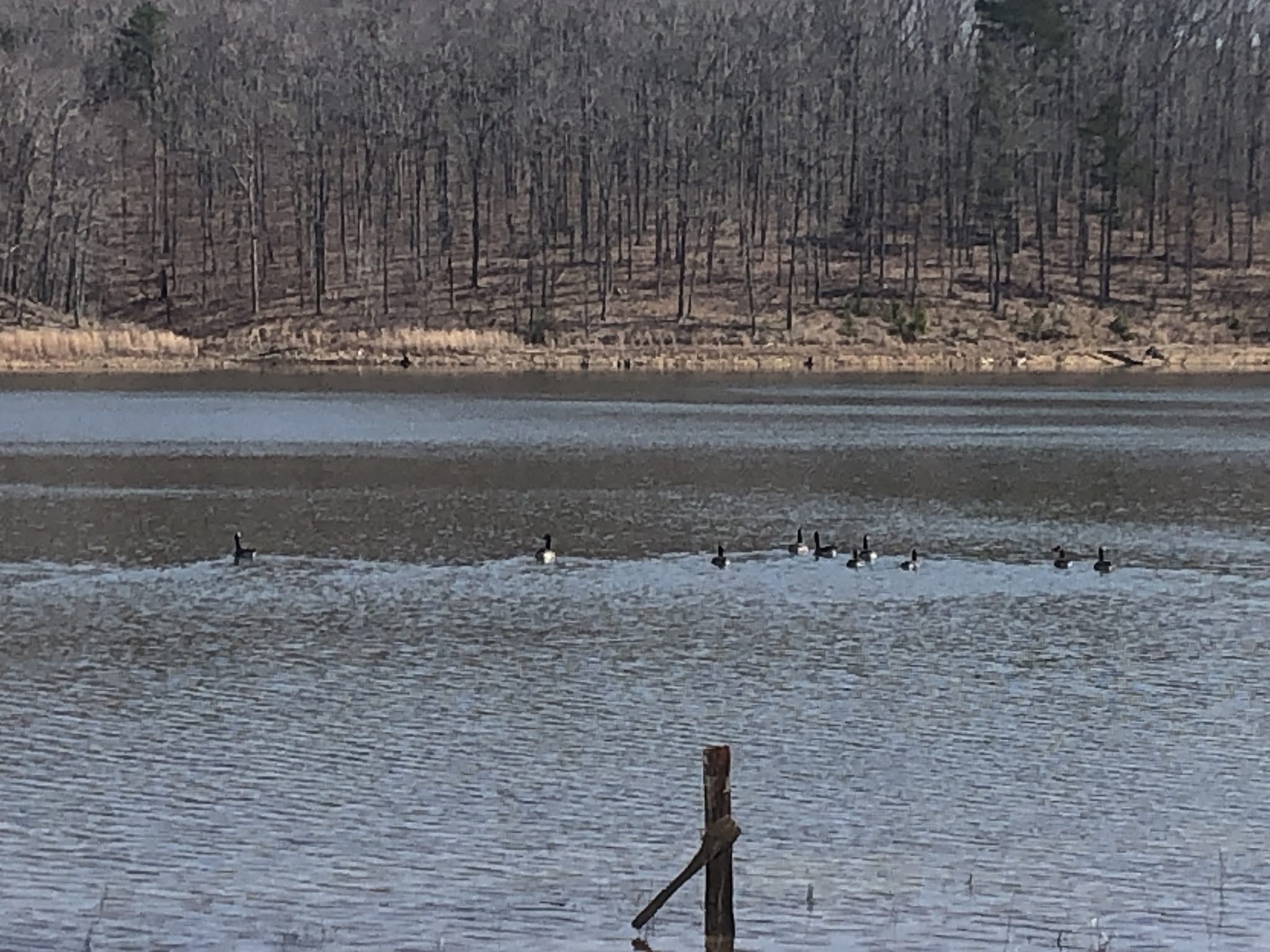
Geese on the lake


Spillway move (below)
Getting out on the spillway can be a bit tricky..

You will need good balance, not recommended

More spillway movie
After the spillway you go immediately uphill following occasional silver or blue diamond trail markers. You will gain another very old forest road, I would just follow that, it leads you to the same place in the end. there are several splits but you want to parallel the creek, just higher up. You will be faced with several forks, just stay to your left in this direction.

A few hundred yards there was a good flowing spring flowing across the trail, I looked down and saw a cascading series of small pools with running water. Perfect for lunch. It was 12 noon and I could use a stop and to soak my feet. I had come 12 miles and that was more than I had done in quit sometime in my day walks near home.

Soaking my feet in the cold clean water for 45 minutes, having lunch in the shade and enjoying the perfect day and surroundings in my private fairy wonderland


After lunch, my feet good and numb and the return trip to contemplate I carried on until the trail dumps you at the crossing of the Crane Pond Creek outlet, which of course you saw how much water was being released. naturally this crossing was deep and wide

At this point the waterproof socks would not have helped as this was knee deep, plus they had holes in the them. So nothing to do but walk in and get wet.


Looking back, my feet were still numb from lunch, so a little bit more water didn't matter a bit.


I do despise walking back the same way I have been before, so at lunch I was looking for alternative ways to return to Marble Creek and perhaps avoid that 1 mile section of very ankle breaking trail and the big climb in the opposite direction. The highest point on the trail marked at the 4 mile mark on the OT map there is an obscure old logging road that leads uphill a few hundred yards and joins forest road 2120. This follows the ridge line and avoids all the nasty bits and then rejoins the OT at the animal pond mentioned earlier with only 2.4 miles left until the Marble Creek parking lot.


Back on the trail and only one uphill till the end


A long single day on trail for sure without much warm up. Feet are sore and soggy.

I got off the trail at 3:36 pm, well ahead of any storm clouds as the weather was still hot and sunny. Driving home however around 5 pm I looked back in the direction of the trail today and you can see the big storm building. I am glad I did make the decision to try to get it all done in one day, even though the last 3 miles were very tiring.

I highly recommend this trail as a day hike. It is beautiful and provides a lot of flat walking with just a few twist, turns and up-hills to make it interesting. Park a car at each end or if you don't care about hiking together then exchange keys as you pass each other. I do not recommend doing it as an out and back in one day!
The trail around the west side of Crane Lake is just a boring road walk and if you do the complete loop you will have to contend with the crossing of the outflow of Crane Lake Pond, This is not something everyone will be comfortable with. I am surprised this is not even noted on the OT map. I do not recommend it is worth doing the loop. Go down the east side to the shut ins and back for a more scenic view and the same walking distance and you can get down to the spillway from a blue blazed trail from this side.
19.03 miles in 7'50" @ 2.6 mph. this includes the 45 minutes sitting for lunch, so it was have been more likely 2.8 mph.
Starting temperature 37 degrees F, ending temperature 80 degrees F.
I tried something new on this hike. (for me) I knew I would need as much energy as possible but usually I just don't eat much of anything on a day hike, but today I tried to eat 230 calories every hour plus stopping for lunch. I missed my last snack because my snickers melted, but all in all this worked very well and I stayed much stronger and more alert consistently all day.
The extra 15 pounds I have been carrying on my mid section, which I was starting to be fine with, was a major pain and has to go as I could really feel it late in the day! So diet and more exercise is coming 😅 maybe less Craft beer ?
