As you might remember, I am a member of the Ozark Trail Section Hikers and Backpackers (OTSHAB) Facebook group. Part of what makes this group great is that it promotes hiking and camping for everyone, including beginners. A few times per year there are trips that are scheduled for people wanting to get out and try hiking and camping for the first time. This is not just a meet up, but a very involved multi month process, with many Zoom meetings, discussing gear selection and fitness, First Aid course, and many many posts asking and answering questions before you can participate. I have been fortunate enough to act as one of the "Experienced" Backpackers (EB = read mentor) for these trips. This particular trip was our first Winter outing and it was only open to those that participated in either the spring or fall Beginner Trip.
The purpose is to ease "newbie's" into Winter camping and hiking. Six miles of walking each way and an overnight in-between and hopefully weather that won't be too severe but will offer a taste of walking and sleeping in the cold and all the added nuances that entails.
All of these trips are very well thought out and organized. For the Winter Trip we would have almost a 1:1 ratio with BB and EB. Four or Five BB's with Four or Five EB's in each group and we had three groups.
The hike is scheduled to start on Saturday morning at 11 am and last until Sunday afternoon at around 2 pm.
It was proposed that anyone that wanted to meet up on Friday night should camp at Berryman campground. This is a no fee site, but it does have a pavilion and a privy. It is at the south end of the Berryman loop trail.
I set up a canopy because the forecast was for some chance of rain
Since it was my Birthday, I decided to treat myself to a steak and sides with an excellent 14% stout, homemade by Cory. (Black Pine Brewing)
Vicky had gotten me a sheet cake and I brought 3/4 of it that was left to the campsite for everyone to share as a dessert.
As you can imagine since it was essentially car camping, we had a rip roaring fire
Russ, another of the EB's, being the fire master had brought some homemade wax candles (accelerants 😁) that formed a fountain of fire.
Fire!
The next morning dawned and I was glad I just slept in the truck as there was a layer of good frost on everything. It got down to about 20F.
I had also packed some bacon and cinnamon rolls for the group for breakfast. I went a bit overboard with the set up, but it was easy to break down and with my work schedule I don't get to come out with the group as much as I would like. It is a good thing that a few of the BB's came out last night as well. They did use their winter camping set-ups and a few needed some adjustments as they were cold and where concerned about spending another night out. Adjustments were made, some gentle advise was given and everyone would carry on.
Our group was designated to hike a portion of the Trace Creek section of the Ozark Trail. We would meet everyone in our group at the North Hwy DD Trailhead (by the entrance to Council Bluff Lake) and then shuttle everyone to the 6 mile mark on the trail below to begin the hike to Hazel Creek campground (top left of the map below)
Meeting at the trailhead and making introductions for those not at the Berryman campsite last night. In addition, this time was meant for helping with pack fittings, pack shake downs, last minute questions, etc.
A great group photo before anyone is lost in the woods!
photo from Brian & Regina Peak
Brian and I being the designated shuttle drivers for the hike, loaded everyone up and drove the 6 miles to the 6 mile marker spot where the Trace Creek Section crosses a gravel road and dropped everyone off to start hiking toward Hazel Creek campsite/trailhead. There were eight hikers off into the woods.
Brian and I would drive up to Hazel Creek campground, park our trucks and then hike the opposite direction to meet the group at about the 3 mile mark.
Hazel Creek campground gets its name from Hazel Creek, a rather large creek that you need to cross twice. The second time being a rather wide crossing that usually means getting at least your feet wet, if not more.
The water was rather low with only about a twenty five foot section to cross that was about knee deep. However as luck would have it, there was a tree limb that had been placed across the water and while it wasn't the most stable, we made some adjustments to it, and then it was just a matter of not falling off in order to stay dry. Which was great as the water was very cold!
On the gravel bar, we found some turkey prints. They were exceptionally large prints, so perhaps velociraptors.
At almost exactly half way (3.2 miles) we met the group and stopped to have some lunch or snacks.
Turning around, we all headed back toward Hazel Creek.
It turned into a great day to walk in the woods. Temperatures reached into the high 40's with no wind at all.
Hazel Creek becomes quite large and looks pretty down below, through the trees.
Perhaps an unusual find, what looks like bear scat on the trail. They might still be awake even in January. This looked to be very fresh, filled with seeds of some kind
Reaching Hazel Creek crossing again, it was time for the whole group to cross. With only minor hesitation and a few bobbles, everyone made it across that wanted to try the log, we had one BB that decided to change into her water shoes and just wade it, probably the smartest of our bunch!
Discovering an old cistern or root cellar near Hazel Creek campsite
Reaching Hazel Creek campground everyone was free to spread out (we seemed to be the only ones spending the night) so we could pick our own spots. My hammock set up for the night, with a couple of tents in the background.
More tents
and even more tents
and even some more hammocks. There were three groups in total, each with about 7-8 people and we all converged on the Hazel Creek campground for the night.
Dinner time, with a few Piney River Brewing beers!
I had made a homemade dehydrated trail tomato pasta from the Backcountry Foodie website. I find all their recipes to be excellent and well worth supporting.
Sunset was excellent
Of course there was more fire!
and more fountains of flame
photo from the shared group album
The next day dawned beautiful as well. This really turned out to be a great weekend. The temps were forecasted to edge a bit lower, but it looked like everyone would get on the trail dry and we should finish in the good weather window.
Breakfast with my campsite mates; Tracy and Vickie
With the sun coming up the groups were getting ready to leave. My job again was to hike in and meet them from the opposite direction and then when everyone was back to the 6 mile mark trailhead, shuttle everyone back to their cars for the finish.
My departure right after the groups was delayed because of this campsite. I just couldn't leave it in this state. In fact the entire campground was completely trashed from careless users. The campsite I had slept in was not awful, just the usual micro trash and then bottles and cans thrown into the trees (well there was an old rusted car jack!) but that was easy to clean up. This on the other hand would take some time.
About 30-45 minutes and all is much better. There was even string in the trees and other really nasty stuff just in the tree line, but fortunately I had packed a 40 gallon trash bag, but still it was completely full.
Ironically a sign posted at the entrance to the campground reminds users to clean up their campsite.
I took the trash over to Council Bluff Lake boat ramps where they have trash dumpsters and then made my way back to where I was suppose to pick everyone up. I would need a couple of trips to get everyone back to their cars as Brian needed to get to work this morning, but just as they were due to arrive, Russ called and said to pick him up along another road and he would help me shuttle as well, so we could do it all in one trip.
Having picked him up and retrieved his truck we were ready for our group to arrive.
and arrive they did, everyone safely out of the woods
Russ getting all the packs loaded in the back of his truck
Back to the starting point with everyone packing up and heading out.
Making sure everyone makes it out of the parking area. The potholes in the dirt road had filled with water.
Map of out and back walk on Saturday
I think everyone had a good experience and hopefully will add the winter months to their options for camping and hiking. Thank you everyone for making is such a great weekend. Really enjoyed everyone's company. Looking forward to the next one.
Leading up to New Year's Day there had been a lot of posts on social media about what hikes people are going to do for New Year's Day. Your (First Hike) of the year. I had not given it much thought until a week or so ago when it appeared the weather would be good for this day and I didn't have any hockey games scheduled to officiate on a Sunday (surprise!)
I wanted something close, also maybe something I had not done before (that is a tough one!)
I was about to settle on the Wilderness Trail in Meramec State Park, which we have walked many times as well as stayed in the RV park. Then I thought of Green's Cave. I had hiked to Green's Cave from the Sleepy Hollow side in December of 2020.
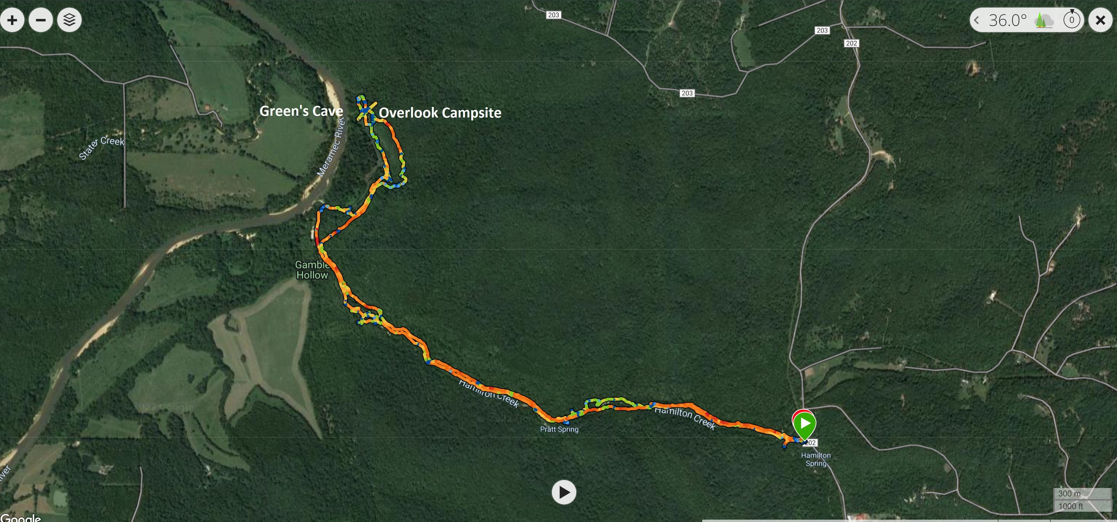
I could do the same hike from the opposite side, The Hamilton Hollow route. It is an out and back walk of about 6.5 miles total, but it does have the added spice of technically being a bushwhack.
Now bushwhack might be a strong term here, as it was for the Sleepy Hollow side. Enough people have gone this way to make a trail through the woods and dales that it would be a pretty big stretch to call it a bushwhack, but in this case the "way" is unmaintained and there are places where you just don't see a path or that many paths have been trodden by both people and animals over the years. What also makes these types of hikes appealing is that they are all usually associated with old homesteads or really neat geological features that don't really invite constant tourism. In this case both. It is really fascinating and sobering to think that homesteads were this far back in the woods and people lived and prospered so far from our modern roads and towns and how on earth did they get these abandoned cars and trucks so far back in the woods!
At this end of this hike is also Green's Cave, one of the best and most scenically located caves in Missouri, right on the bluff's of the Meramec River.
It is settled, off I will go early in the morning of the first day of 2023 for a bit of an adventure.
The day did cooperate spectacularly. The morning even before sunrise was cold but clear and because it was warmer than all the days leading up till now, fog hung in all the low areas.
Just occasionally you catch one of those spectacular morning sunrises that make you glad you decided to get up early and get out. Leaving my house I travel a series of "backroads" to reach the major highway that take me south of St Louis to most of the good walking.
The small town of New Melle, just a few miles south of my house, has a large, for the town's size, cemetery. It is never anything to really look at, but today it was glowing with an other worldly light and color, combined with the lingering fog of the morning. It was just one of those times that demands your attention.
Onwards to more pleasant subject matter.
It is about 60 miles from my house to Hamilton Hollow TH, just inside Meramec State Park, near the town of Sullivan, MO. This is a popular area, as it tells the story of an old iron works facility. This plant was active in the mid to late 1800's
The parking lot is good off Sleepy Hollow and Hamilton Hollow gravel roads. Plenty of people live in this area so there is no issues getting here. However, the water can come up very high over the road in several places, so low clearance vehicle should be careful after very heavy rains. This trail follows Hamilton Creek and the Meramec River. This is not a walk you would want to do after any heavy or prolonged rain or anytime that the forecast is for swollen rivers and creeks.
The Park provides a nice interpretive kiosk for the area just off the parking lot.
It was a really nice morning. As you can see the sky was clear and blue. The temperature was 38F. (3C)
There is a 1.5 mile loop walk that takes you around all the old equipment in the iron works facility
This is the remains of the old blast furnace.
On to the "trail". The path starts just behind the kiosk. There is no sign or markers, just a path in the grass.
The trail immediately drops into Hamilton Creek drainage and you stay pretty much next to the creek for the entire walk up to the Meramec River.
This is the type of path you get. The first bit was overgrown with wild thorny bushes. This is not something I would even think about doing in the summer. I will mention this now as in the Summer the best way to do this first half of the walk would be to just wade the creek.
just slight indentations in the ground
The path drops you directly into the creek bed a few times and you can cross. If you look at my GPX track, at the bottom of the blog, you can see there was some route finding on the way out (I did not cross the creek) but on the way back I did. There are many paths leading in the way you want to do and you are free to choose your own adventure, but it is sometimes just a matter of taking the line in the direction you want to go that has the least resistance.
The opposite side of the creek (south side) also contains Pratt Spring (which you can easily see flowing into Hamilton Creek) but also Hamilton Cave (it is gated) as it is the more interesting side with the limestone bluffs
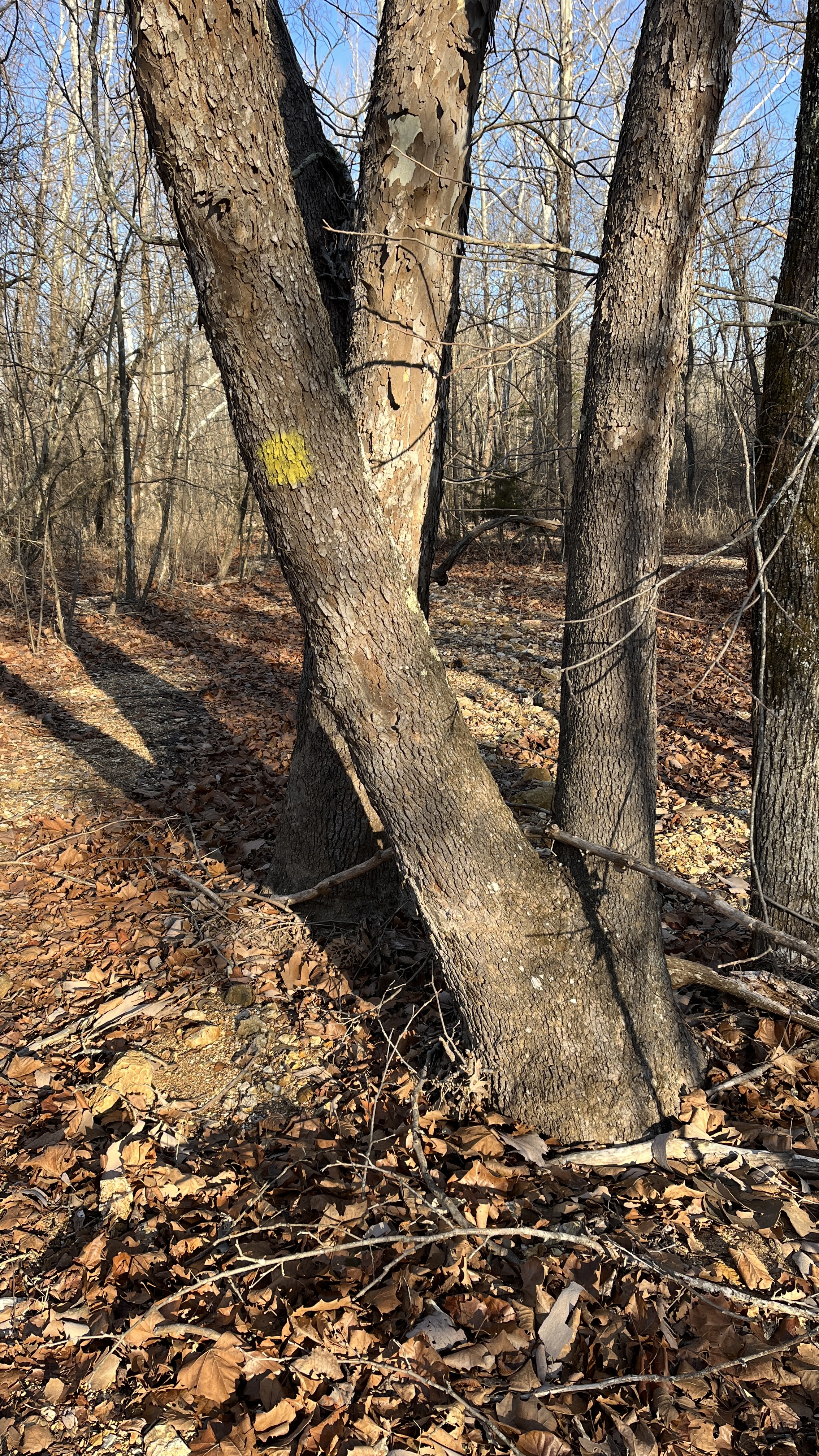
As I mentioned since there are no markings for this trail you can choose your path. The next time you get dumped out directly into Hamilton Creek you will see on your right an auxiliary creek bed (this is a flood drainage) so it was mostly dry today. It does have a yellow marker on the largest tree at its mouth.
I followed it.
It does lead to a wet crossing a bit further on. I had an old GPX track I had downloaded to give me a general idea of where the trail went and it showed crossing at this point.
Crossing led to this swampy mess
and then this! This is not the way
Doubling back, you are meant to stay on the other side of the bank, do not cross the creek in this area.
Once you reach the Meramec River drainage the old GPX has you walking what is clearly more flood plain to the River. Don't do this. Stay east of the drainage as you can see in my GPX track coming back later in the day.
Fortunately for me, a well placed beaver dam saved the day and I simply walked over the marshy bit and back on the bank
There is really no path here, you just know you need to follow the Meramec River North
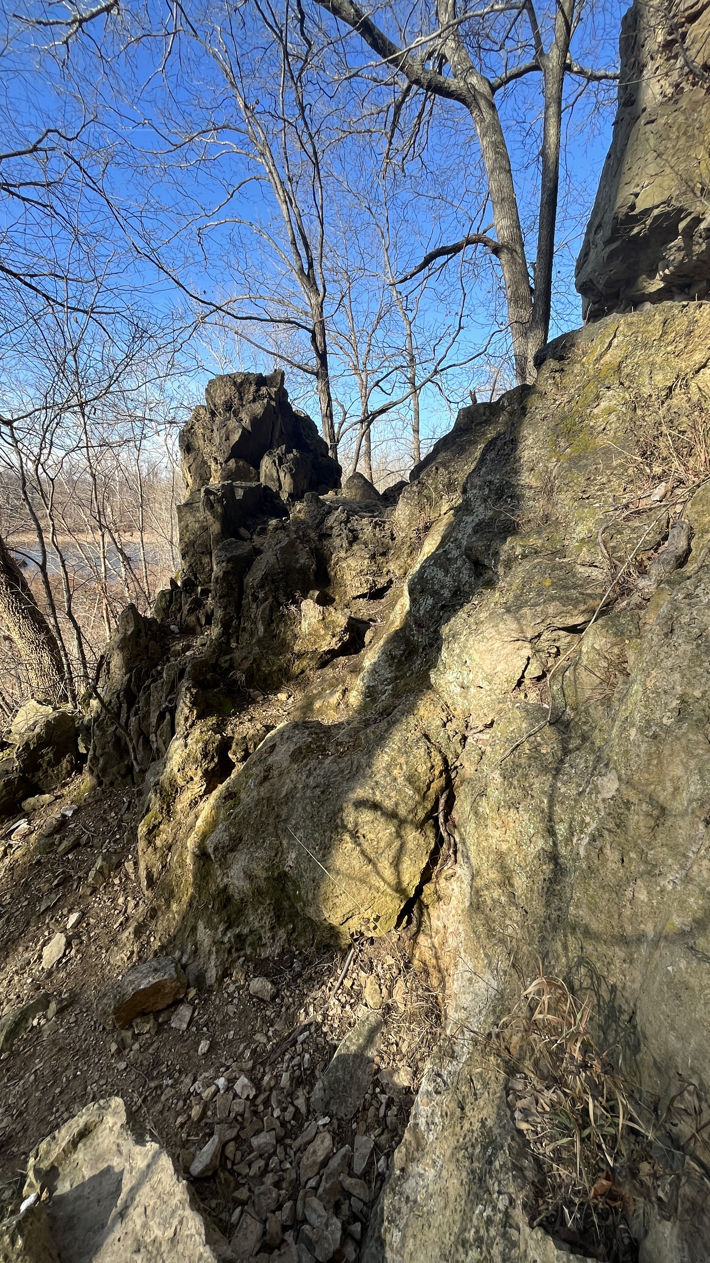
You will eventually get squeezed more an more against the river as the bluffs start to rise up on your left. It helps here that you pick up a well worn path now that will lead you directly to Green's Cave.
You will start to notice more and more smaller caves and other weathered features in the rocks
Green's Cave will tower above you. Even with a few missed steps, this is a great walk, it is about 3.5 miles and 1hour and 45 minutes from the parking lot to here.
Having been here before I was not going to stay long and the cave is posted as "temporarily" closed, which is to say permanently closed. "Nothing lasts longer than a temporary Government program"- Ronald Reagan
But you are asked not to go into the cave, so staying within the mouth of the cave is all I have ever done
A few photos and I was off again.
From just inside the mouth of the cave, looking out. You can get a better sense of how large the opening is. It is 91' high by 108' wide. (6.5 stories tall)
It is up and over some rocks to get out of the cave area and then straight up a ravine to get on top of the Cave complex.
The overlook from the top of the Cave Complex is fantastic and gives you views of the entire Meramec River valley looking North
Southwest
Panorama looking West
Here is where my day changed just a bit. I had intended to continue back toward Sleepy Hollow as far as the old homestead (the path I had walked in Dec 2020, about a mile and a half) and then turn around there and come back to the Cave, but this time I would go over the ridge, above the cave (true bushwhack), and then down a ravine I had seen early and rejoin my steps back to the T.H. However, standing at the overlook I heard some dogs and people coming from higher up on the bluff. The dogs running ahead greeted me on the trail and the owners soon followed. A nice couple that had spent the night at a primitive campsite created just up the ridge, where you can do repealing by permit. I knew that might be a good spot for more lovely views, after exchanging New Year's greeting and chatting a bit, they continued down and back to their car via the low route both of us had come up and I continued up.
What I discovered made me sad and a bit angry.
This put me off my day as it did take about 30 minutes to make sure that the fire was completely out, pick up all the trash and secure it, so I didn't really have the time to walk the extra mile and a half each way to the homestead and then get back home in the time I wanted.
While I was finishing up my clean up I did get to see a small plane flying low and slow over my location and up and down the river. From my height the plane was actually below me.
After securing all the trash I headed up through the woods to get on the ridge and walk back.
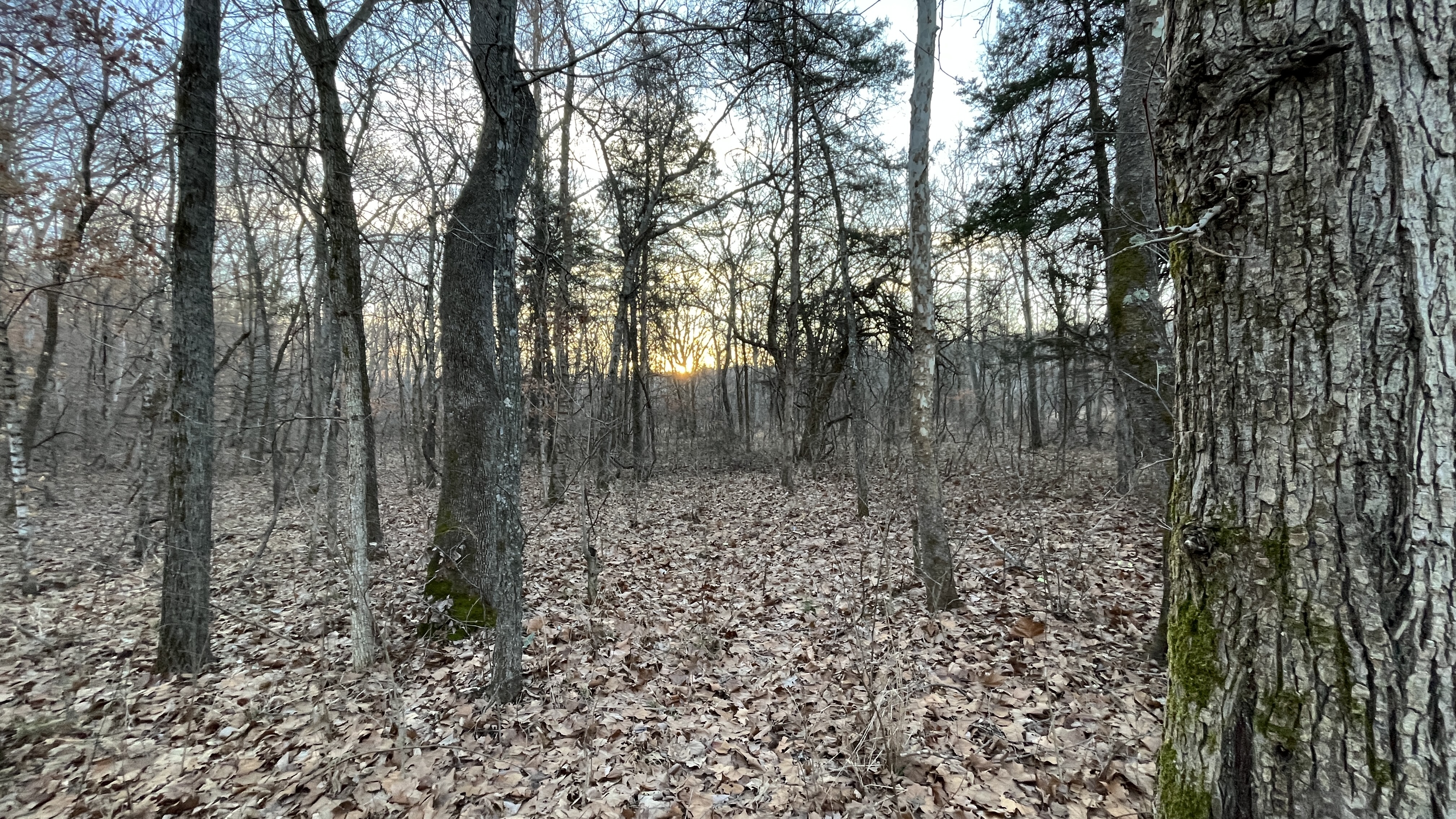
The ridge walk was great, easy walking amongst the trees with lots of space to navigate.
The ravine was right were I had thought it would be and while steep, was not problem to rejoin the river below
Looking up from half way down
Looking down
Taking a straighter line to rejoin Hamilton Creek and avoiding the beaver dam crossing
Back at the car in 3.1 miles in 1 hour and 15 minutes. I actually caught up to couple and their dogs watering at the Hamilton Creek/ dry creek intersection, but I did not mention the trash or the fire. Not sure if that makes me a bad steward or not, but didn't want to embarrass them, or get into a confrontation on New Year's day. I was hoping they would see the big water bottle strapped to my pack and say something. Perhaps the fire was their only issue and the trash had somehow been there before them. (but I doubt it). I will think of the trash being from 2022 and not spoiling the new year.
Stats for today.
The temperature when I started at 8:00 am was 38F, when I finished at around 11:45 am it was 65F. That is Missouri weather for you.
As long as you are comfortable with some route finding, I highly recommend this walk.


.JPEG)


.JPEG)