Buford Mountain Loop January 21, 2017

I have been staring at Buford Mountain every time I go to Bell Mountain and wondering; "that looks like a great hike, I wonder if I can get up there". Then I saw a post about the top 10 "peaks" in Missouri and at the same time someone posted about an obscure hike called Buford Mountain. It all fell into place for a day out on a new trail and a new hill.
Buford Mountain is in that pocket between Caledonia, MO and Pilot Knob, MO. a mix of farm land and hills. It turns out it is easy to reach off Hwy U, just off of Hwy 21.
There are two parking areas. the lower is just off the road and if the gate is closed you have to walk the gravel road a mile to reach the actual trail start point, but today the gate was open and so I drove up to the trailhead.


I arrived at 8:15 and was on the trail at 8:25. Just 2 weeks ago we were on Bell Mountain for the Frozen Butt hang and it was -2F. Today as I hit the trail it was almost 50 F with the expectation that it would be in the mid 60's F by the afternoon.
It was going to be a fantastic blue sky day.

The trail starts out a bit muddy but goes almost immediately up hill from the parking lot at 1l00 feet to the high point of the day, Buford Mountain at 1740. the 4th highest hill in Missouri. The trail is steep but also very rocky. Just the type of rocks that you are always going to turn your ankles the whole way, it is just a case of being as careful as possible. 
 You see evidence of an old boundary wall about half way up and lots of great granite outcroppings every where.


at the top of the initial uphill, which takes about 1.5 miles of uphill you reach Buford Mountain. Like most high points in the state other than Bell, there are really no great views. 

 With the winter leaves off the trees you can get some views beyond the tree line. The granite outcropping are nice, especially with the long shadows of early morning sun.


 The path leading up to the summit was a path of soft moss. 

Leaving the summit, the trail does a series of small roller coaster ups and downs as it follow the ridge you are now on, but the trail is surprisingly nice to walk on. No big rocks and the ground is soft

Reaching the split for the loop. This trail is actually more like a lollipop than a loop. I chose right to hit the high points first. 


 an intermediate overlook along the way. 

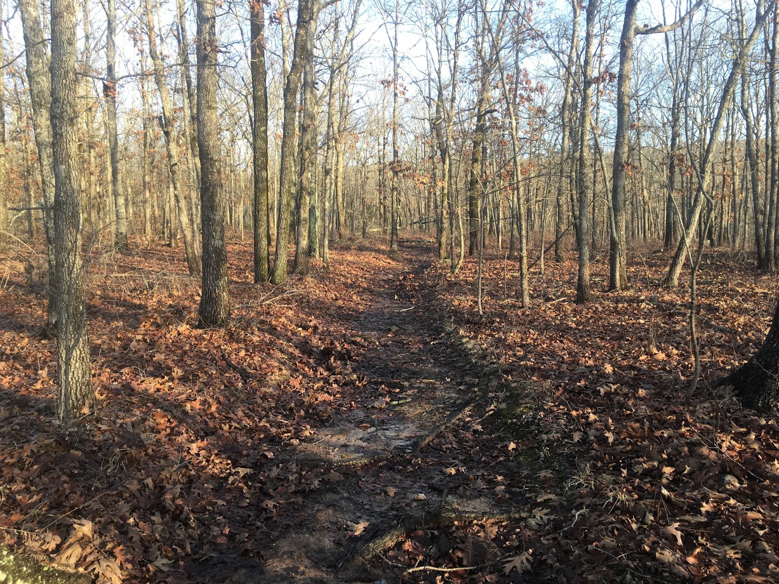
The sign at the beginning of the trail clearly indicates no motorized vehicles (below) yet someone has brought a large tracker (above)over the entire trail not only rutting out badly in the muddy parts but the trail is twice as wide as one needs for a foot path.... 
Another small up and down along the ridge and we reach Bald Knob, the 16th highest point in Missouri but the spot with the best views along this trail. This would be great place to come and hang and stargaze this coming Spring. 
A view from the top. You can see a long way, including Bell, Goggins, Proffit, Wildcat and Taum Sauk Mountains in the distance. 

 Down from Bald Knob there is a stock pond, one of four around the loop

A very steep uphill takes you to an unnamed peak at 1613 feet 
 Then you take a 2 mile decent of 600 feet into the valley behind the mountains with a creek. Most trails in Missouri are designed this way. A loop that has a high point, but also always goes through a creek area with water.

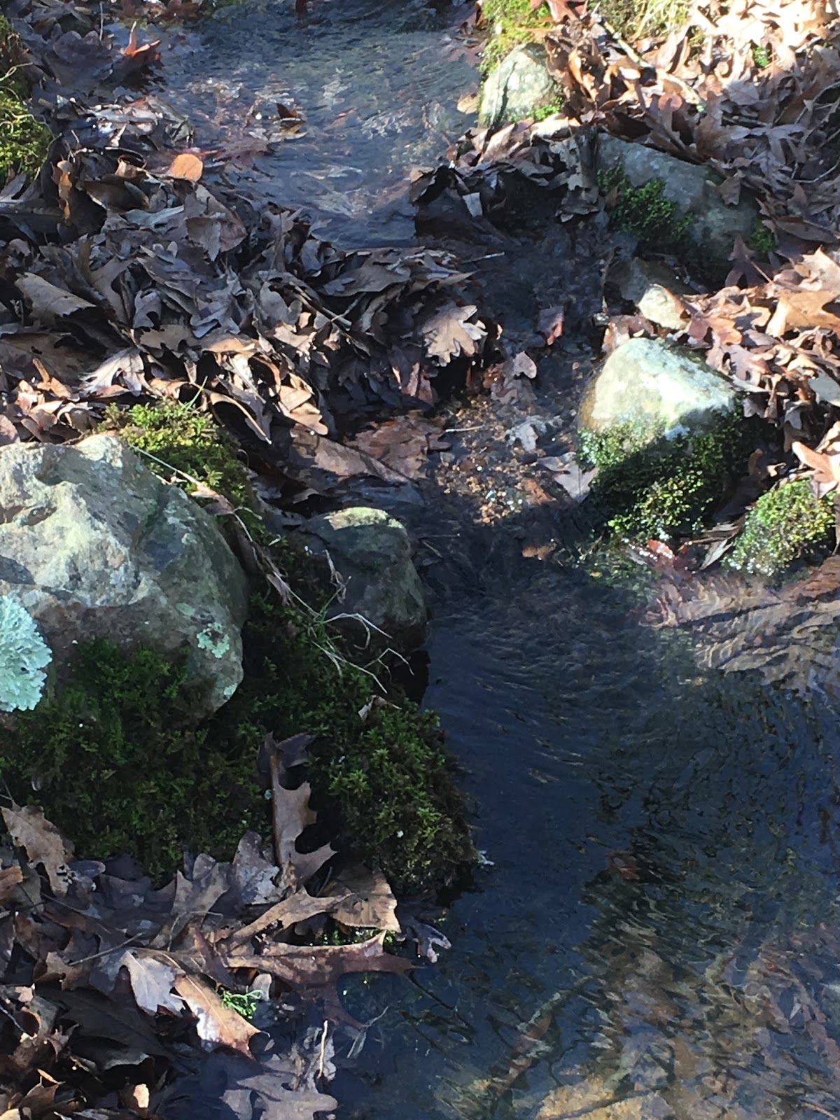
In this case because of the light snow and the warmer temperatures the creek and the trail have become one for about a half mile. 


 I am never sure how you would have gotten cars back here, especially in the 20's and 30's but you find lots of Model A car parts around the woods in this part of Missouri.

I did finally see a few people on the trail today and one of them (Lee) told me he did some rock art along the trail. I found it half way up the uphill from the Creek. You have to go the same 900 feet in 2 miles going back up the other side of the loop! 

Then you see the same trail as you started with just shy of Bald Knob down to the parking lot, although since it was now 68F degrees the trail had become a bit more muddy. 

It is a challenging trail and I am glad that I found it and did it. I will certainly be back and I might even spend the night on top as most people hike up to Bald Knob and then return to the car. 

It took just over 4 hours, which included lots of stopping for pictures and video to complete the 10 mile hike. 


Video Buford Mountan Loop Hike

The video comes first this time. The 10 mile Buford Mountain loop hike.


Missouri Frozen Butt Hang- Bell Mountain Jan 6-8 '17

Try to predict the coldest weekend of the winter in Missouri and then plan a camp out for that weekend... Sounds like a perfectly reasonable idea... right? Actually we have a history of these "Frozen Butt" weekends. I go all the way back a few years were I attended the Minnesota versions and set personal bests at -19F, -21F (-28, -29 C) for the nights. I was not excepted to be that cold, but certainly we were hoping for 0F (-17C). The actual outing was scheduled for just one night Saturday the 7th, but since one participant was coming from Tennessee, a far distance, it was planned to add an extra night to make it more worth his while.

I arrived at the trailhead parking lot on Friday the 6th at around 3:30 pm and it was 14F when I arrived. 

It was decided to stay in the campsite near the trailhead Friday night, instead of going up to Bell Mountain, as some more were joining in the morning and we would go as a group.

 getting the hammock system set up for the night- first just the hammock- DIY table cloth hammock

Then two down underquilts, a 40 degree full length (black) under the 0 degree full length underquilt (green) Both by Hammock Gear
 The 0 degree top quilt (hammock gear) and then the cuben tarp also by Hammock Gear

That took 30 minutes, now what to do for another few hours until it gets dark? 

Fortunately "TwentyBelow" was an excellent bushcrafter and brought a load of firewood making it easy to sit by the fire and still stay comfortable.  it was also good that I had brought plenty of warm drink mixes to have and I made one of many hot chocolates that afternoon. I also had a excellent beans and rice dish that has been a staple of mine since Andrew Skurka posted it on his website.

The sun set about 6 pm and we stayed by the fire for awhile but the temperatures were going down and speaking of down, you have to be careful warming yourself around an open fire when you are wearing all down! 

Crawling into the hammock around 8 pm. I had brought the Ipad knowing I would be in the hammock a long time, so I watched a bit of Embrace the Brutality a great CDT documentary by Shane "jester" O'Donnell
Easier to put up with your own brutality when you are watching the suffering of others! :-)

 Selfie of waking up in the morning. Slept well for the most part, can't say I was warm, but I wasn't cold.

Morning view from the hammock- Got down to -2F (-19C)

"TwentyBelow" was well prepared for cooking over the campfire and had himself real eggs and sausage for breakfast. I just had oatmeal!


As the sun go higher, I broke camp and made everything like I was never there.

 staying warm waiting for everyone else to arrive

 We didn't actual hit the trail to the top of Bell Mountain until 10:30 am. A few people had some issues last night, being this was the first time they had ever camped in temperatures this low. In these conditions it is not the time to test out gear you don't have confidence in, but fortunately they could just walk to their car and turn the heater on to get warmed up. 

The low light and the little dusting of snow made the 6 mile walk up a great day. When the sun came up it got to about 10F (-12C)

The one spring that is reliable was still flowing dispite the cold temperatures and you could have gotten water from it, but everywhere else the water was frozen, sometimes in spectacular ways with ice crystals on the surface 

 beautiful if you look close
The first few miles of the trail is on the Ozark Trail, then you reach the turn off for the last 3.5 miles to the top of Bell Mountain. 


Some how I ended up in front today, which very rarely happens, but it made my day to be able to know I was human to be up this way since the snow and that the trail had been used by so many animals in the past few days.

Turkey

Bobcat


 Mouse 

Fox

making it to the top of Bell Mountain is always a treat, but today was just beautiful. Cold, clear and with no wind, very still and quiet. 

 Everyone always takes the picture looking off the summit, but if you just turn around the ridge top is beautiful as well

Selfie at the top- I had about 30 minutes alone, before Disco was next to show up.

The is still always something green if you look for it. In this case the color really "pops" in the light blanket of snow.

The air was so clear, I count 10 ridge/valleys I can see in the distance. Reminded me of the view in the Smoky Mountains

Everyone made it to the top and it was good to get a group shot 
(Left to right) Disco, Skygzr, Loaner, TwentyBelow, JeremyC, Gideon


We all relaxed at the top for awhile and then the guys started getting their hammocks set up. I have had gotten a second cortisone shot just yesterday, a particularly deep one and my shoulder was not enjoying the cold. JeremyC did not have the set up to stay the night at the top, and his knees were also hurting him, so I decided to accompany him down the hill 
 Along the way the light was again low and the woods looked great.

Sunrise on Sunday morning from the top of Bell Mountain, courtesy of Disco.
It only got down to 10F (-12C) so everyone survived and had an excellent time. 


Thanks Gideon for the planning and company.

Support Our National Parks - Preserve - Protect - Enjoy