Superior Hiking Trail- Pre-Trip- July 2010

Pre-Hike overview-

The Plan was to hike 60 miles north to south on the SHT from Hwy 6 below Caribou waysite back to the parking lot starting point at Hwy 301. I have given myself 4.5 days.
What started out to be a simple plan to get away for a couple of days has turned into a major introspective journey and a questioning of many issues that have been brought up by this hike.
Will my knee hold up? What about the problems I have been having with my feet? Or the pain in my hip?
Then there is the issue that I haven't done any long distance adventures in more than 10 years without Christine as a partner, and she is the better navigator.
In fact this will be the longest hike I have done alone. And this is suppose to be a warm up for the 160 mile solo hike I have planned in the fall in GSMNP.
I am in Duluth now less than 12 hours from the start. the pack is a comfortable weight of 20 lbs that includes food and water for 4.5 days. The shuttle will pick me up at 8:15 am from the 301 parking lot and I should be on the trail 60 miles away by 10:30 am. The first day is the only other issue. 15 miles of unknown in what I consider my half day. Nothing to do now by get some sleep.

Pre-hike packing- 4.5 days of food packed and labeled and fitting neatly in one UL sack.
Everyday has a Breakfast (poptarts- rasperry 400 calories for 2)
3 Snacks- peanut butter crackers, beef jerky, pringles
1 Dinner ( noodles or potatoes) this is the only hot meal
1 Dessert - snickers

The whole pack with food and 1 liter of water is 20lbs. This should be a very do-able weight.
ready to go!

Superior Hiking Trail - Day 1- Saturday July 10

The plan is to have me get picked up by the Superior Shuttle Service ( a service I can highly recommend, even if alittle pricey at $40 for a 40 mile trip) and drop me off 60 trail miles at the CR6 trail access point. I will then hike the trail North to South back to the CR301 parking lot. This was so I would not have to worry about getting a cell signal and call them the day before I wanted to be picked up at the 6 parking lot. This turned out to be a good decision as well as walking North to South had a much better flow and more gradual climbs than South to North.
The shuttle was not scheduled to get me until 8:15 am, but I was at the trail head and ready to go at 6:30 am!

At CR6 you immediately climb to the ridge line and this is the first view I got after only a few minutes of Minnesota woods from the SHT
I am very happy to be here

I will be following the blue blazes on the trees to mark the SHT, and the wild flowers were still in bloom even in July


The Wolf lake area is a wilderness retreat area, with a big lodge on the bluff of the lake. The area has lots of snowmobile and cross country ski trails
In order to keep my pack weight down to a total of 20 lbs with 4.5 days of food and water included. I am only carrying 1 liter of water. This means I need to refill my water about every 4 to 6  miles or so, when its hot. My first stop for water was Kennedy Creek and look at the color of the water AFTER it has been filtered! This turned out to be the clearest of the water I would get
Next up was Tettegouche State Park. This was a beautiful park with a nice suspension bridge over the river and waterfalls.
I took an hour long nap under the bridge and got more water.
This was by far the hardest and toughest day of the trip. I had planned to do 15 miles from CR6 to Bear lake campsite. and I didn't start until I was dropped off at 10:20 am. This a step section leaving the Park below
Mt Trudee is the highest point on this section. It has been 12 miles since my starting point and I still have 3.3 miles to Bear Lake... I am not going to make it! My feet are starting to kill me ( more later) and it is about 4 pm. I think I will look for the next available campsite.
The views from Mt Trudee are spectacular in all directions. It was a great day
I am one whipped puppy
The first available campsite is Palisades Creek, 1.5 miles from Mt Trudee. It is a double campsite ( East and West Palisades Creek). I am wasted, but there is already 12 college kids camped all around. I managed to squeeze in, since I have a small tent and took a 2 hour nap. I didn't even get out of the tent until 7:00pm to make myself dinner.
By the way the water here had the color of beer!
Summary for today-
13.5 miles in 7.5 hrs, with 2 major stops, one of about an hour- 
1 mile (1/2 mile each way) lost to taking the wrong fork coming out of Tettegouche Park.
Elevation change- Sawmill Dome, Raven Lake, Wolf Lake, Baptism River, Raven Rock, Mt Trudee.
Stung by a wasp on the upper arm 1 mile from the campsite.

Superior Hiking Trail- Day 2 Sunday July 11

Last night I thought the college kids had a disco light show going on, except it was the lighting and rain. Did I mention that my tarptent had never been tested in the rain. It is a single wall shelter with nothing between me and getting completely soaked except a micron thin layer of sil-nylon. I did seal the seams when I got it.
It worked fantastic, not one drop of water got through and it RAINED buckets all night
The next day I was up early and away, it was wet but another nice trail to walk.
I am glad I didn't attempt to get to Bear Lake the day before. It was not so much the distance as it was a lot more up and down today. The ridges do give a good view though
A view of Bear Lake and Bean Lake behind. you can tell another storm in approaching


I past a couple of tents pitched here on the ridge above Bean Lake ( below) I wonder how they liked the storm last night being so exposed.
The rain moved in quickly and I just barely had time to get on my rain jacket
After the rain storm my camera was too wet for photos. There was a really lovely camping spot called Beaver River, with a nice double waterfall, but I pushed on. When I got to Fault Line Ridge campsite (below) and dried everything out, the camera started working again.
Nearing Penn St parking lot, the end of the last section, I was joined by a couple that I had camped with last night and they were kind enough to give me some extra moleskin and tape for my feet. After I got everything dried out, I took a look at how my feet were doing... The extra supplies I got will be needed.

Dried out and relaxing
The mosquito's were particularly fierce here tonight, with the beaver pond was just 200 feet away

dinner and some orange drink to help the brown water! (above)
Great view from laying in my tent as the sun sets ( below)
Summary:
14 miles in 7.5 hours.
Up and over Round Mountain, Bear Lake, Bean Lake, finish at Fault Line Campsite.

Below are 2 videos from day 2. I had made a video describing the coming storm and just after the storm began


Superior Hiking Trail- Day 3- Monday July 12

Day 3 started out bright and sunny and was a wonderful section to hike I had the whole campsite to myself and didn't get out of camp until 8 am. There were some elevation changes but they were gradual both in the ups and downs and made for a very pleasant day.
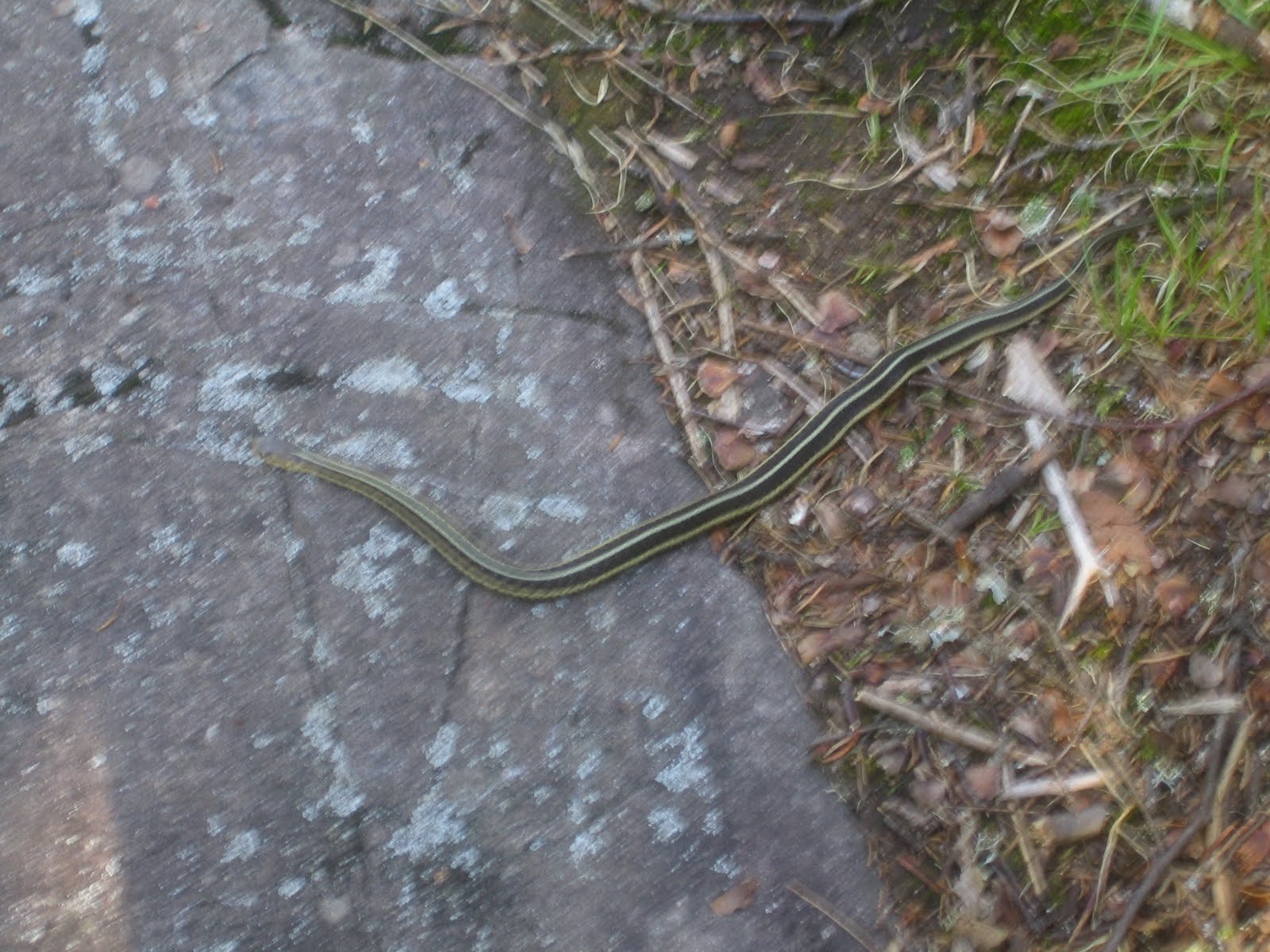
A little friend sunning himself early on a rock across the trail. This was the second green snake I had seen, the other was the very first day as soon as I got on the trail
More ridge walking early gave great views across the trees
The trail has been in very bad need of some lopping, but it started to actually disappear in places
This boardwalk and beaver pond was the first place I could get more water today, but I just couldn't reach the water without falling in, so I would have to wait for the next stop

lots of wildflower fields today
Across Christmas Tree Ridge I can see the way ahead
Kennedy Creek (beaver pond) was where I could finally reach the water and refill
The wildflowers around the pond were very nice
The trail now takes me into Split Rock State Park. I get a view of Split Rock Lighthouse from high up on the ridge.
Entering the park is the first "shelter" I have seen along the trail. I stopped here for a rest. It was at the top of the entrance to the park and you could see for miles. You could also hear the construction traffic on HWY 61. The "beep, beep" of the back up signal was a constant companion all day and night as they work 24 hours on the road.
Split Rock is a beautiful park and the trail goes up one side and down the other ( 5 miles up and back)
A bridge at the top of the park takes you across the river and over to the other side
I decided to cut the day short and stay at one of the campsites in the Park, I arrived at 1 pm. I laid everything out to dry and since it seemed I had the whole park to myself ( I had not seen anyone at all for almost 2 days) I decided to soak myself in the river and enjoy "nature"
After my soak in the river and drying everything out and redressing my feet, It was 2:30 pm. I felt so good I packed up and decided to press on to the next campsite. Another 4 miles away
One of the famous "split rocks" the park in named for (below)
The walk out of the park going from Split Rock toward Gooseberry Park was spectacular and I am glad I decided to do it. The temperature was fine and the mosquitoes had gone away with the ridge line breeze
Camping tonight was alone again at Blueberry Hill campsite.
So how long does it take to start hallucinating when you are hiking alone. I fell asleep about 9:30 pm and was awakened at 1 am by hearing a zipper open from a tent. I figured someone must have arrived late and was just slipping out of their tent to "answer the call of nature" and I would have company in the morning. In the morning there was not any sign that anyone else had been in camp that night!
Dinner tonight was mac and creme pesto (my own recipe)
Even though my feet are in pretty bad shape at this point ( see epilogue) it was a great day and I managed 15 miles and caught up with exactly where I was suppose to be at this point. I have just 18 miles left and 2 full days to finish it.
view from my tent as the sun sets, a beautiful night. The milky way and stars were spectacular when I got up later in the night

Summary:
15 miles in 8:30 hrs with at least 2 hrs worth of breaks

Support Our National Parks - Preserve - Protect - Enjoy