Day Around Bell Mountain July 29, 2017

What a difference 24 hours makes. My hike on the Chubb trail was Thursday and it was hot and humid, Friday remained the same, but Saturday started cool and clear. Joe had invited me to our weekly 50 something unemployed meeting (hiking a trail) and I was eager to accept. He wanted to work out his uphill stamina for Glacier and that means one place- Bell Mountain.
we have been there literally dozens of times, but don't really do it in the summer so it did look completely different all leafed out. The temps were in the high 60's to start.

Forgive me if some of the photos are the same ones as I have taken many times on this loop, but I like coming here, so here goes

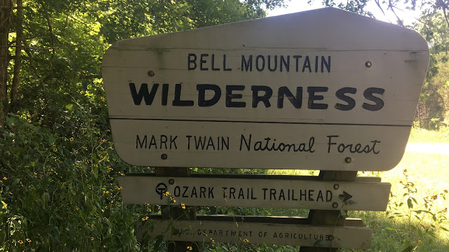
We hit the trail right at 8 am. This is also part of the Taum Sauk section of the Ozark Trail and there as been this very useful plaque up at the beginning of the trail for quite some time. I like these very much.

The first section tops out at this overlook, which didn't have much of a view with all the summer time trees, but it marks the end of the first uphill push from the parking lot.  This is obviously facing west as the sun is rising on the other side of Bell Mountain

Lots of really great small flowers hidden in the grass along the trail today

sun streaming through the trees.

A large section of exposed granite is always a nice place to take a break


End of section 2 is at the Ozark Trail Bell Mountain split. the Ozark Trail continues south while the Bell Mountain trail breaks east

this is my photo this time as more spiders were just mouth high all morning strung across the trail
this is a Micrathena gracilis from the orb weaver family. They look like they have sea shells on their bodies 

Joe kept a very brisk pace taking his hill training seriously. We averaged about 3 miles per hours for the whole 12 miles. 

High Point marker on top of Bell Mountain. For those that have never been able to find it... it is under where the old fire lookout tower used to be 

Not much of a view today from the top of Bell Mountain, but lots of very nice clouds

Snack at the top was a cheese, onion and potato pasty from London Calling in Springfield Mo. 

Our usual spot on the top of Bell looks pretty used. Someone has broken off the excellent rock bench on the right and the fire ring has been damaged

A bit further along the rim there was a bigger opening to get some views of the valleys below.

I spotted the biggest lizard I have ever seen sunning himself on a rock. He changed color to try and blend in to the granite he was sitting on.

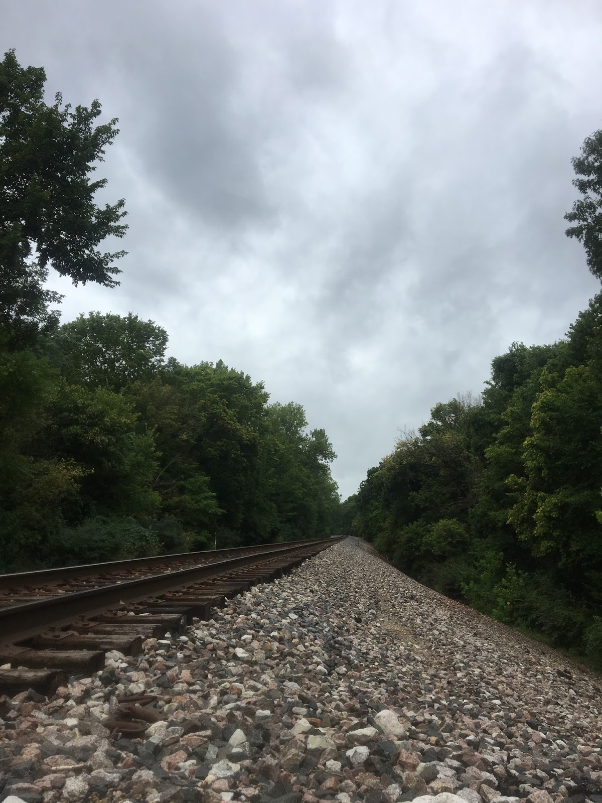
Loop completed and heading back out. Joe and I back on the Ozark Trail portion of the trail 

a mile and half from the parking lot, or the same from the end, this spring has always had water in it every time I have been here, except today it was bone dry. This is usually the only reliable source of water except for Joe's Creek at the bottom of the loop hike, which did have water in it today. 


12 miles in about 5.5 hours. Not bad, but we need more time to really get ready for 60 miles in Glacier at the beginning of September, but with any luck we will both be ready.


Chubb Trail July 27 2017

The Chubb trail is the connector trail that runs between West Tyson Park and Lone Elk park. These parks are between Hwy 141 and Hwy 109 off  Hwy 44 in St.Louis County. Lone Elk park is known for its herd of Elk that populate the park. I have always wanted to hike these trails, but being so close to home I think I just ignored them in favor of trails further way. (if it is farther from home it must be better, right?). Having some time on my hands, I decided to do this on a Thursday morning as I knew I was likely to be the only one out there and I was. It rained the night before so I also knew the trail was likely to be muddy as parts of it follow right beside the Meramec River.


 The Trail below shows the start and stop for the day. This was an out and back, so I covered the same trail coming back, but it always looks different to me going in the opposite direction


As I suspected I was the only one at the trail head at 9:30 am on a Thursday
the weather was typical Missouri summer weather. It had rained last night and that only served to increase the humidity. It was overcast with some light drizzly rain. 

 The trail starts out steep


 the first of some confusing signage along the trail. I think this is meant to keep people from following an established trail which must originate outside the park but it would have just been better to have a consistent sign post pointing in the right direction

example of the normal sign posts in the park. the trails have names on the map, but are given icons on the trail posts. The Chubb trail is the tree with blue back ground. the Flint Quarry Loop is the "rock slide" icon. 

 At the two mile mark and at the top of the climb there is a picnic table. A very welcome site for sure.

The trail goes mostly downhill from the picnic table

 It is used by mountain bikers as well, but I don't think many will try and ride over this feature. I think called the "staircase". You can notice the thick are from the high humidity in the photo below.

As it drops lower you start to get more lush overgrown vegetation. you don't need to worry about eating a big meal before hiking on a Missouri trail in the summer. If you are the first one on the trail you will be getting your fair share of extra protein in the form of spiders and spider webs in the face. 

 Internet web photo below but pretty typical 

Reaching the bottom of the hill you enter the Meramec River flood plain. This is very fertile land that was some of the first settlements (farms) in the area. 

 Railroad tracks crossing the trail

Along the Meramec River portion


Meramec River

the rain last night, but mostly recent flooding has actually washed away parts of the trail (they have been re-routed with pink flagging tape) and made others very muddy

one of the feeder creeks into the Meramec River, dry now, but very dangerous during flash flood times
At the 5 mile mark the trail crosses the railroad tracks again and heads for Lone Elk park. It is also teh start of the Castlewood Loop. I planned to turn around here and was glad there was some flat dry area around the tracks to have a rest and some lunch
 Just before noon. Something I hardly ever due, but need to do more, is rest when I am going solo.
there is always this feeling to rush or keep moving when I am alone. I need to stop more and relax.
I did actually sit here for a whole 30 minutes.

The view from my lunch spot. The sun was not shining but the temps were still close to 85 degrees F with the same amount of humidity. 

 Single plank over a washed out bit coming back


red tailed hawk? feather

Quite drenched with sweat in the end, but a very nice diverse walk. On a slightly cooler day, the extra 4 miles to Lone Elk and all the way back would have been easily doable in a morning walk. 


 Three pounds of weight lost on the walk today, even drinking 3 liters of water and eating lunch...


Buford Mountain Loop July 20, 2017

After a most difficult week for me and the same type of difficulties for my friend Joe. We decided it was time to go to the woods to sweat off some of your worries, and that we did. With a heat advisory in effect in the Midwest for the last week. We walked 11 miles in 90 degree heat with 90% humidity.
Joe had not been to Buford Mountain and I had only been once, so we met at 8 am at the trail head and off we went.

 no one around on a Thursday morning.

It is all uphill to start.
The high point of Buford Mountain. 1740 feet (5th highest in Missouri, but all of the top 10 are within 100 feet of each other)

Lots of really nice summer flowers along the trail 


 There is no actual view from Buford Mountain, but further along the trail is Bald Knob (a rocky clearing) with nice views to the farmland below
Joe on Bald Knob
 Panorama from Bald Knob 

 summer flowers

Several rock walls along the trail marking old settlements 
 more pretty flowers

There is lots of old car parts along a section of the trail, how they got the cars back here in the 30's or 40's is beyond me

 some colorful fungus along the trail

 We both had issues with the heat coming up the last long hill that seemed to go on forever. It was time for a rest right on the trail.

Even our lizard friend was not moving very fast

We had plans to go right over and climb to the top of Hughes Mountain, but it was 5 hours to do the loop in this heat and we both decided that there would be no more walking for today
Thanks Joe for the company and great conversation... 

Video from the top of Bald Knob. 


Support Our National Parks - Preserve - Protect - Enjoy