Click the link below to open the video windows
Taum Sauk Trail Videos
Two videos to follow up the written overview of the latest hike of 30 miles of the Taum Sauk Section of the Ozark Trail in Missouri.
Hammock Forums Missouri Hang #5 Taum Sauk Trail Hike May 3-5, 2013- Day 3
Day 3
The day with the least chance of rain was not to be. We woke up early and did get a chance to pack up all our gear before the rain started and would last all day. This day was another challenging hike of 12 miles with the most elevation gain up to Mina Sauk Falls and then on to Taum Sauk Mountain proper.


 The Park was trying to keep wild hogs out of a new growth patch with an electric fence on top of the mountain.
 and no matter how far in the woods you get, there is civilization- power lines cutting right through the wilderness and across the trail- Giants in the fog!

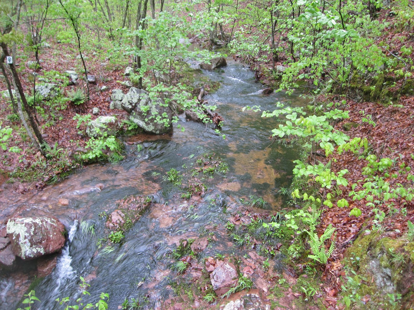
The rain didn't stop all day, but the afternoon brought some nicer scenery and of course more water.


 Mina Sauk Falls had more water than I have ever seen or heard about before. It was quite a sight.


 Celebrations by all at the highest point in Missouri, Taum Sauk Mountain 1772', and a finish that was well deserved and earned by all


The day with the least chance of rain was not to be. We woke up early and did get a chance to pack up all our gear before the rain started and would last all day. This day was another challenging hike of 12 miles with the most elevation gain up to Mina Sauk Falls and then on to Taum Sauk Mountain proper.

The day started out much like the first. Not as much rain, but cold and wet.
The terrain over Proffit Mountain was very rocky and rough. You had to watch every step to keep from slipping on a wet rock or turning an ankle or knee.

The top of Proffit Mountain (below) reminded me of Thunderhead Mountain the Smokies- it actually started to snow on us for a few minutes today!


The rain didn't stop all day, but the afternoon brought some nicer scenery and of course more water.

the small was as pretty as the large

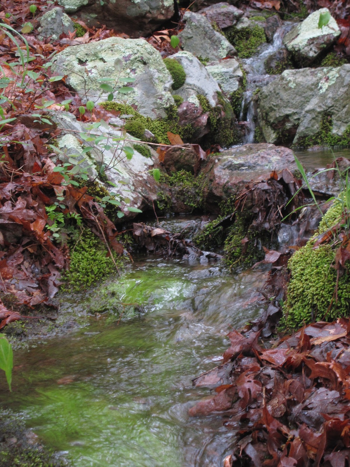
and more water


Devils Tollgate (above) is a famous feature of the Ozark Trail- Two large pieces of Granite spaced close together along the trail.


Gideon- His two longest trail days ever and his longest single outing to date. Also his last hike in Missouri before moving to a new job in Ohio

Disco- Organizer of the hike and he had just hiked the same section a month previous- a mad man!

Spiffyguy- The smile never faded regardless of the conditions.

the Group along with Digitizer101 (center), who was the jackrabbit of the day, finishing 90 minutes ahead of us all, but was great to wait for us at the end.
Hike:
12 miles in 6 hours.
Hammock Forums Missouri Hang #5 Taum Sauk Trail Hike May 3-5, 2013- Day 2
Day 2
Sometime during the night it stopped raining hard and the day looked like it might actually clear up. the forecast had been for 100% chance of rain on Friday, 70% on Saturday and 40% on Sunday, but it looked like we might beat the odds this morning. I made it through the restless, cold night with a low of 37 degrees.
In the morning the water had gone down to just ankle level and it was running clear so you could see the bottom and made it easy for the rest of our group to cross. We were all assembled again and ready to go by 9 am.


 Going through the Park we got to view the actual "Shut Ins." Two places were the river is squeezed into a narrow section around giant outcroppings of granite.


 We are all very happy to have made it over some very rough terrain today and makeup all the trail miles we missed by stopping early the night before


Sometime during the night it stopped raining hard and the day looked like it might actually clear up. the forecast had been for 100% chance of rain on Friday, 70% on Saturday and 40% on Sunday, but it looked like we might beat the odds this morning. I made it through the restless, cold night with a low of 37 degrees.
In the morning the water had gone down to just ankle level and it was running clear so you could see the bottom and made it easy for the rest of our group to cross. We were all assembled again and ready to go by 9 am.
The sun came out as we started and since it was a nice day I got a chance to notice more of the Missouri wildflowers that were on the trail today. The temperature has been so cool that they are behind, but despite the conditions this weekend, they were all over if you just looked.
The panoramas were more enjoyable when you could at least take off your rain gear. A view from the a Missouri ridge line

The trail was very touch and rocky today but did have several lovely spots as water was coming off of every rock and out of the ground everywhere.

We were suppose to cross the Black River at this point (below) Not going to happen. We needed to make a detour of about 3 miles through the Johnson Shut In State Park campground and visitors center and do a road walk to get around the Black River.
Once getting into the park and about 3 miles left in our day, we decided for a late lunch and used the general store for soda and ice cream- we felt like true "Thru Hikers"

Leaving Taum Sauk State Park required the road walk (above) to get over the Black River (below) by road bridge


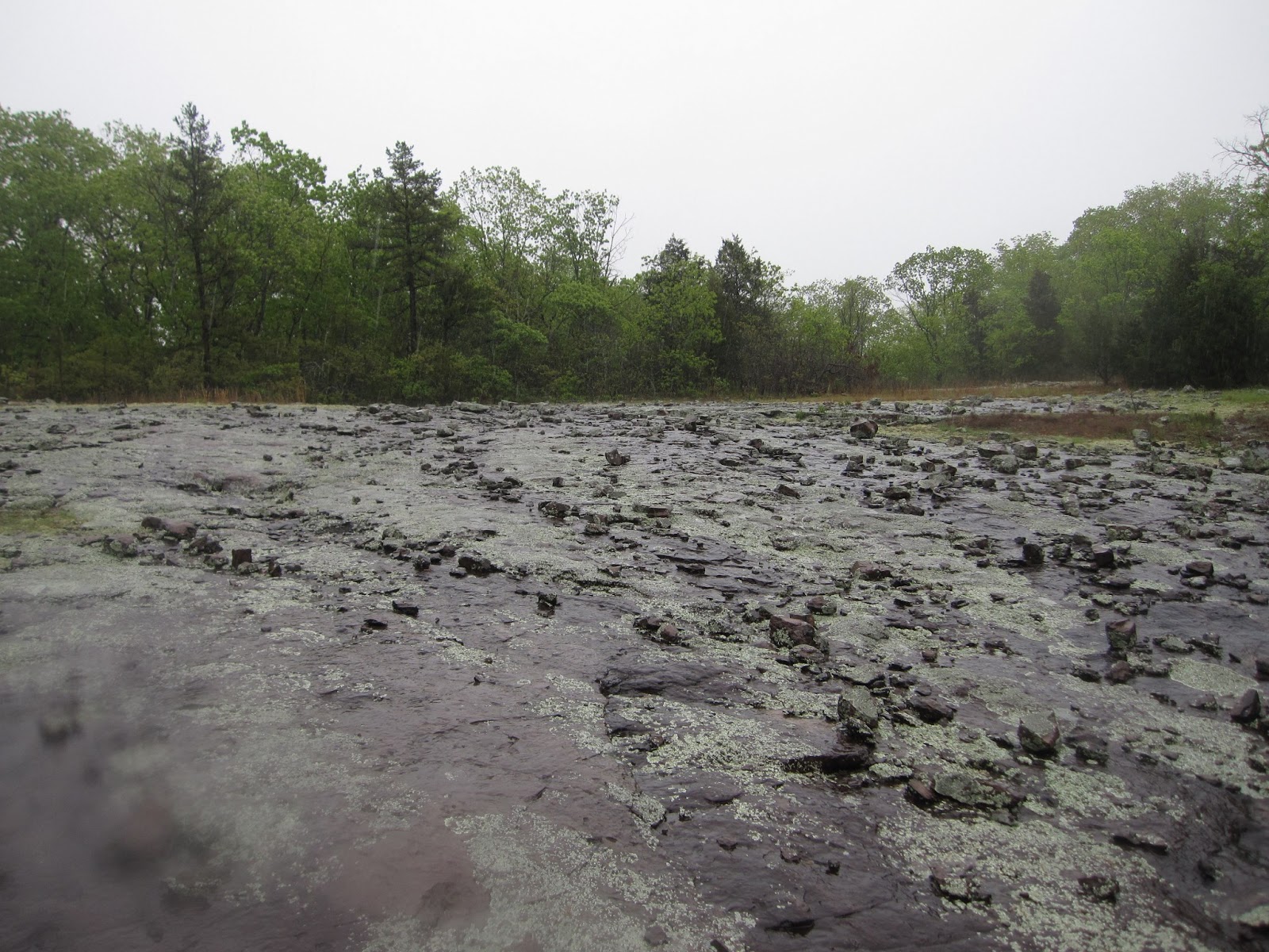
The "Scour" (above) was caused by the Taum Sauk Dam, which was made of earthen material breaking a few years ago and letting one trillion gallons of water escape into the woods and shut-ins. it carved out (scoured out) this path of destruction. You can see the new very large concrete dam in on top of the hill.

The sun came out in the evening and the wind died down and allowed for a nice time to dry out gear and eat together-this was where we planned to be and we were back on schedule.

Day 2:
Hiked 14 miles total including park and road miles
total time 7 hours
Hammock Forums Missouri Hang #5 Taum Sauk Trail Hike May 3-5, 2013- Day 1
Day 1
By far, one of the hardest hikes I have ever been on! This trip planned by forum member Disco would cover what is considered the hardest section of hiking in Missouri. Starting at Hwy A (Bell Mountain) Parking lot and going 30 miles to the Taum Sauk Mountain (Highest Point in Missouri) parking lot. This section covers the 1st, 3rd, 4th and 5th highest points in Missouri. It is challenging in good dry weather, but we would have some of the worst weather you could ever image being outside in for 3 days!


We had a total of 12 people say they wanted to show up for this hike but when the day arrived only 7 were at the trail head (Momedic and his wife, having spent the previous night outside decided that they would not participate and had I been them I would have said the same thing)


By far, one of the hardest hikes I have ever been on! This trip planned by forum member Disco would cover what is considered the hardest section of hiking in Missouri. Starting at Hwy A (Bell Mountain) Parking lot and going 30 miles to the Taum Sauk Mountain (Highest Point in Missouri) parking lot. This section covers the 1st, 3rd, 4th and 5th highest points in Missouri. It is challenging in good dry weather, but we would have some of the worst weather you could ever image being outside in for 3 days!

Arriving at Taum Sauk Parking lot the temperature was 35 degrees and raining
We had a total of 12 people say they wanted to show up for this hike but when the day arrived only 7 were at the trail head (Momedic and his wife, having spent the previous night outside decided that they would not participate and had I been them I would have said the same thing)
This left us with 5 intrepid adventures, Disco (Corey), Spiffyguy (Scott), Digitizer101 (Doug), Gideon (Gideon) and myself.

Everyone pilled into Disco's Jeep and drove from the Taum Sauk parking lot to the Hwy A trailhead. We were on the trail about 9:30 am Friday morning
the entire day was cold and damp with not many views because of the overcast and rainy skies
my waterproof camera was even wet.
The day was planned for 12 miles to end at the Walker Branch Creek campsite. But at the 6 miles marker we came to Padfield Branch Creek. Normally a small creek that you easily step across had become a torrent. Disco and myself made it across, I have crossed these types of creeks before, but the others were not comfortable with the depth and speed (as they had never experienced this before). The remaining three would search up and down the bank to see if there was a more natural and safer place to cross. Nothing was found. We made a plan that usually the water level is reduced in the morning, especially if the rain should stop, so we would end our day here at 6 miles and look at the situation in the morning.
Disco and I camped by the old homestead and spring just across the creek, while the others did the same on their side.
We cooked dinner right over the side of our hammocks.

I was in the hammock from 1:30 pm Friday afternoon to 7 am Saturday morning. I was completely soaked from the rain and the creek crossing and the temps where around freezing. I already new I did not bring enough insulation in my set up to be comfortable even if I was dry. The only way I was staying warm was to keep moving on the trail. I had thrown in a Patagonia Nano Puff insulated jacket at the last minute and I am glad I did. I got out of my wet cloths and got in the hammock in my 40 degree quilts and spent a very uncomfortable night.
Distance:
6 miles in 4 hours
Sleeping set up:
40 Degree Hammock Gear TQ and UQ
Patagonia Capiline 2 bottoms
REI L.S. Fleece top
Patagonia NanoPuff pull over
Possum Down gloves and Socks
Mountain Goat wool hat
Subscribe to:
Posts (Atom)