From time to time, one of the Facebook groups that I belong too has a get-together of the 'regular' or founding members of the group. The group has been doing my kayaking trips, which I don't participate in as I am not a water person, but this weekend was a hiking trip, so I was going. The trip was going to hike the lower section of the Current River portion of the Ozark Trail. This is from around Peck's Ranch to the Hwy 60 Trailhead, about 24 miles spread out over a day and half of hiking.
Friday night we all arranged to meet at the Sinking Creek trailhead on the Ozark Trail, in the Between The Rivers section south of Hwy 60 and Fremont Mo., and camp.


It is a lovely spot with a fire tower and a little wardens building that has been converted into a cabin you can rent nightly, from the Forest Service.


I found myself arriving early, around 3 pm, and with nothing to do, the firepit and yard needed to be "tidied" up. The firepit was full to the brim and there was a good amount of micro trash laying about. The forest service had a trash can on site with a clean fresh bag, so I used it.


I hung my hammock and took it easy while waiting for more of the "regulars" to arrive.

Everyone started to show up around 4 pm and started to find spots around the lawn. and by 6:30 people were starting to make various dinners

Michelle, who owns the fantastic Bourbon Bread and Coffee Saloon made a salmon and risotto dish for her and Russ. I actually made some very nice grilled hot dogs for myself, but did not get any pictures. I also brought my banana bread. The boys from Oklahoma (Jason and Lance) arrived and smoked some various meats on their grille and Jason had some fantastic music playing all evening.

The night went on with much talk around the fire. I had been fighting a bit of a sinus infection and also my stomach started feeling queasy, so I went off to the hammock a bit early, hoping to wake up feeling better for the hike, but I was close enough to hear the chatter as it continued into the night.
"how many butterscotches can you fit where?"
 \
\In the morning, I was up and had my hammock down early

The fire was re-lit and burning for warmth and coffee

Everyone was suppose to be ready for a group photo at 8 am, before heading off to the trailheads.
Getting everything into or out of vehicles. (below) Most of the group was going to be "slack packing" just taking water, snack, first aid, letting a few of the others, who were not hiking this weekend, because of the possibility of hot weather (more on this later!) transport their packs. I decided to carry all my gear.


photo by Michael Kurtz
Most of the group was going to start at Peck's Ranch. Peck's is well known in Missouri as the location where Elk have been re-introduced into Missouri's ecosystem. You can see their starting point in the purple circle below. Two of us Brian Andrews and myself were going to start from Rocky Falls about 5 miles to the North. (in the yellow circle) it would give us a day of 14 miles and the others a day of 9 miles to our designated campsite.

The map below shows our campsite destination for the night (in the white circle) and also our finishing point. (in yellow again at the bottom)
Below Rocky Falls, each of the red squares on the map is 1 square mile

Rocky Falls is a beautiful natural falls on Rocky Creek, today just the normal amount of flow, but after a really heavy rain it can be quit a spectacular sight. It is a very popular and busy spot on hot days for swimming. We started out at 9:30 am. Today's forecast was for hot weather around 90 F.

The half mile connector trail from the Falls to the main Ozark Trail was lined with late summer wildflowers


Reaching the Ozark Trail proper and the familiar trail marker for the intersection

This section leads up to Stegall Mountain bald and over the other side toward Peck's Ranch in a about 4 miles.

The pass has a bald that gives great views off both sides to the surrounding area.

The other side of the bald. The day was starting to get hot now!
 |
Coming down, this section is very rocky under foot


Getting down to Peck's ranch boundary there is a stream that crosses the road. The creek was flowing and I got myself a liter and half of water here as well as soaked my bandana. I had already drank about that much in the first 5 miles. I was starting to feel very hot by now as the temps were climbing toward noon.

Hiking through Peck's ranch is usually dry except for the occasional Elk ponds, but those can be pretty nasty in the summer months. (below) is pasture 22 which is a good spot to see Elk, but not in the middle of the day. They are much smarter than people!

They have done a good job of clearing up the trail through the Peck's Ranch portion. It had been very overgrown with a lot of blow downs blocking the trail.

I have experienced this before and know how to deal with it, but I didn't find out until later that the temperature actually got to 93 degrees at this time. I was already a little underpowered with the small sinus infection I have been battling and stomach upset I had last night. I knew that I had to sit and let my core temperature come down. I also needed to eat, even though the heat made that ever unappealing. I had enough water because of stopping once at the creek.
So I sat for 45 minutes and just rested.


I continued to rest and drink and managed to eat about 220 calories before moving on. Unfortunately, the road that I was near, was not the road with the water cache and I was still almost 2 miles from the water! (below) I was resting in the yellow circle. I had thought the water was going to be at the yellow triangle, road CR-1. The water was not placed for me until the blue rectangle at the bottom of the map, CR-7. I had drunk most of my water before starting out again, thinking I would get more as I reached that first road. After crossing the road and not finding water my spirits sank a bit, I felt fine at the moment but knew I would need more water before I reached camp for the day, which you can see again as the white circle on the map in the beginning of this post.

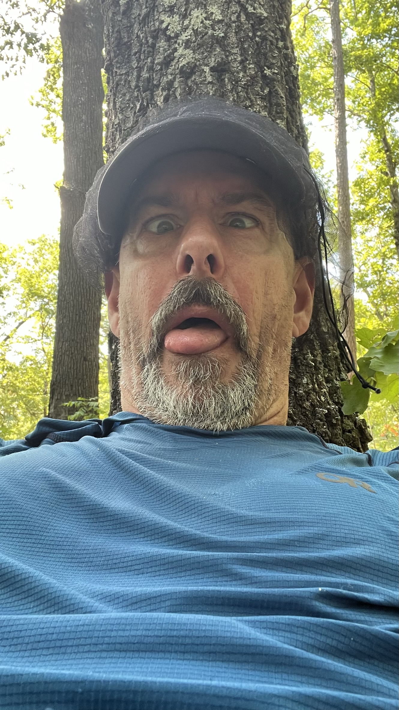
I am still in control (as below with a funny face) however I had been under the assumption I had been moving well and covering a good amount of ground. However I would learn later that my Garmin watch was way off due to settings that had been restored and was operating under the GPS tracking only, making me at least 5 miles off my actual amount by the end of the day! I did have cell service here and got an email from the trips coordinator and Admin for the Facebook group, Andi Lowry. She had said that other in the group where worried about me as I had not passed through the water cache station that was pre-planned for everyone because of the dry nature of this section. She had said that they had tried to send me a Garmin inReach message. I did not receive a message so checked my inReach to find the battery was completely dead. At some point the inReach must have gotten turned on and the battery had gone dead in the last 24 hours. I assured her I was fine and in fact I was only half a mile from the water cache.

I was on the look out for possible water, the ponds were still not my first choice but I would have used them if I had too. I found about a foot of clear water in a root ball in what was a dry creek bed. Perfect and I filtered another liter. After that I did reach CR-7 and found a gallon of water waiting for me.
I drank almost the entire gallon, and showered with the rest!. I tied the empty bottle on my pack and away I went.
The day was still miserably hot and the next bit was an exposed farm track for a bit under a mile.

Throw in a re-route to the trail in the last 2 miles that had a good size uphill at the end and I made it to camp around 4:30 pm. The fabulous Michael Kurtz had volunteered to bring pizza for everyone and it was good he did because I would have not have had the strength to cook and I had only eaten 220 calories all day. In addition Stephanie had been kind enough to put some ice in my bandana and that allowed me to bring down my core temp again to feel much better and finally eat some real food after a bit of a rest. Oh, and Dia had given me some wonderful elixir in the form of some iced coffee that as heavenly.
(below- I feel much better than I look!)


After pizza and a beer I got my hammock set up and just laid down! I got my tarp up just a a series of storms rolled in and out for most of the remainder of the day and night. The sun did look fantastic streaming through the trees between the rain storms.


Brian and Regina are delightful people.

Today dawned much cooler, the high only suppose to reach 80 degrees. Everyone decided to get on the trail around 8 am, so we could finish the trail miles (only 8 miles to the Hwy 60 trail head)

The woods looked great in the morning sun


Unusual rock formations that almost look like structure foundations

Passing through a bit of private property just before Pike Creek. We had started out in a big group this morning but the youngsters had jack rabbited away. Jennifer and Gwenda had come along as a duo and I had a lovely time walking and talking with them for most of the morning.


Don't even think they got their feet wet at the crossing point.


Turkey Tail growing on a downed log


Jennifer giving the classic Explorer pose down to the valley and Hwy 60. This was the only real "view" today.


The culvert has seen some flooding but is surprising free of graffiti


Reaching the trail head. Jennifer and myself, no worse for the wear today.

photo by Stephanie Pyland
Celebration beers. Most everyone decided to head into Van Buren for brunch at Pop's Café. I had agreed to officiate a hockey game at 7:50 pm tonight, and it is about 3 hours and 30 minutes to home from here, so I had to start home right away, I was sorry to have missed the meal with everyone.

Brian Andrews and his wife were going to pick up his car as it was parked at Rocky Falls as well. So off we went, I was a bit glad to be done with the walk for the weekend, although today was an easy walk I was sorry to not have felt well enough to really interact with everyone in a way I wanted but it was delightful to spend more time walking and talking with this great bunch of people.
Thanks'