A site to keep track of the adventures of Craig "Pisco"
New Year's Day Walk- Green's Cave via Hamilton Hollow- January 1, 2023
Leading up to New Year's Day there had been a lot of posts on social media about what hikes people are going to do for New Year's Day. Your (First Hike) of the year. I had not given it much thought until a week or so ago when it appeared the weather would be good for this day and I didn't have any hockey games scheduled to officiate on a Sunday (surprise!)
I wanted something close, also maybe something I had not done before (that is a tough one!)
I was about to settle on the Wilderness Trail in Meramec State Park, which we have walked many times as well as stayed in the RV park. Then I thought of Green's Cave. I had hiked to Green's Cave from the Sleepy Hollow side in December of 2020.
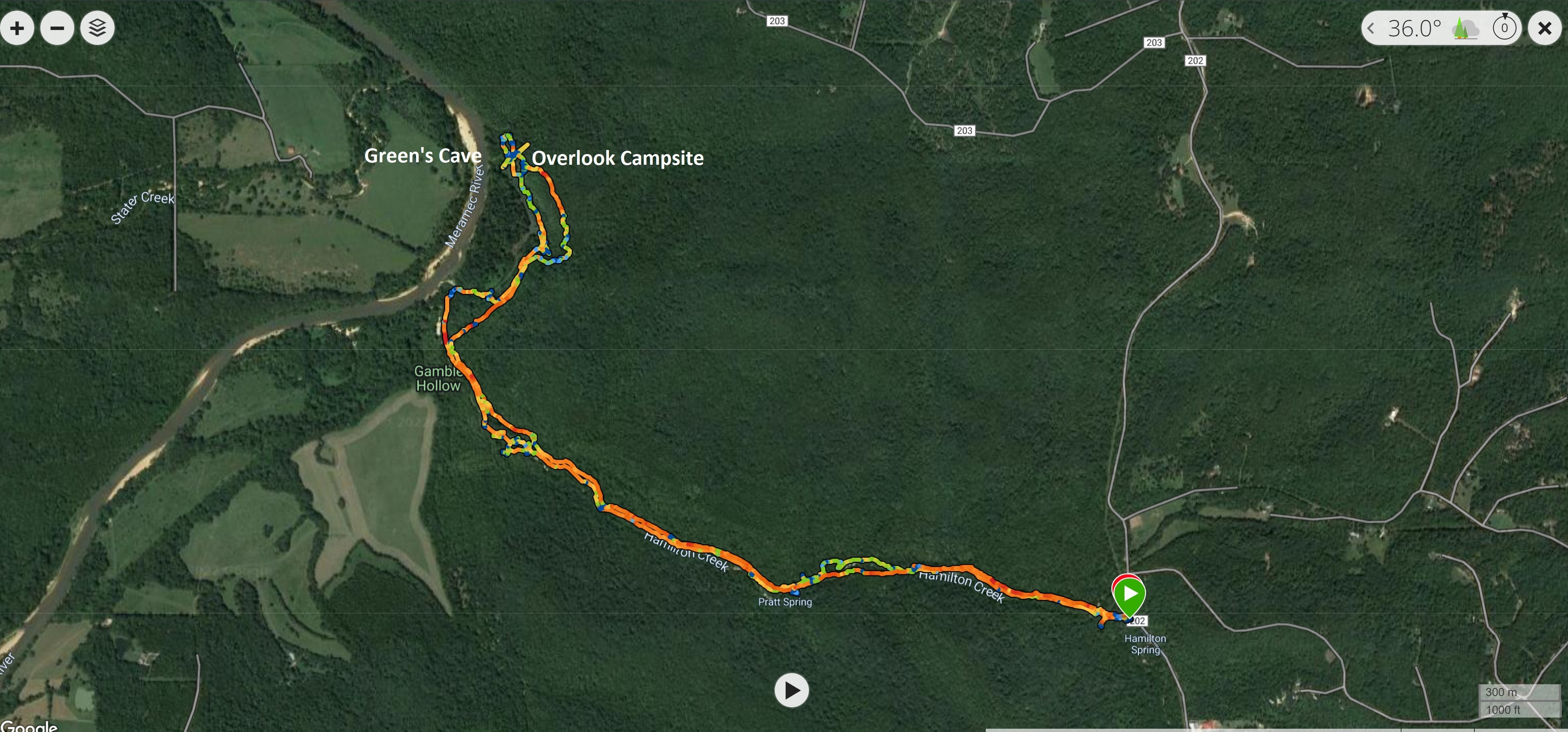
I could do the same hike from the opposite side, The Hamilton Hollow route. It is an out and back walk of about 6.5 miles total, but it does have the added spice of technically being a bushwhack.
Now bushwhack might be a strong term here, as it was for the Sleepy Hollow side. Enough people have gone this way to make a trail through the woods and dales that it would be a pretty big stretch to call it a bushwhack, but in this case the "way" is unmaintained and there are places where you just don't see a path or that many paths have been trodden by both people and animals over the years. What also makes these types of hikes appealing is that they are all usually associated with old homesteads or really neat geological features that don't really invite constant tourism. In this case both. It is really fascinating and sobering to think that homesteads were this far back in the woods and people lived and prospered so far from our modern roads and towns and how on earth did they get these abandoned cars and trucks so far back in the woods!
At this end of this hike is also Green's Cave, one of the best and most scenically located caves in Missouri, right on the bluff's of the Meramec River.
It is settled, off I will go early in the morning of the first day of 2023 for a bit of an adventure.
The day did cooperate spectacularly. The morning even before sunrise was cold but clear and because it was warmer than all the days leading up till now, fog hung in all the low areas.
Just occasionally you catch one of those spectacular morning sunrises that make you glad you decided to get up early and get out. Leaving my house I travel a series of "backroads" to reach the major highway that take me south of St Louis to most of the good walking.
The small town of New Melle, just a few miles south of my house, has a large, for the town's size, cemetery. It is never anything to really look at, but today it was glowing with an other worldly light and color, combined with the lingering fog of the morning. It was just one of those times that demands your attention.
Onwards to more pleasant subject matter.
It is about 60 miles from my house to Hamilton Hollow TH, just inside Meramec State Park, near the town of Sullivan, MO. This is a popular area, as it tells the story of an old iron works facility. This plant was active in the mid to late 1800's
The parking lot is good off Sleepy Hollow and Hamilton Hollow gravel roads. Plenty of people live in this area so there is no issues getting here. However, the water can come up very high over the road in several places, so low clearance vehicle should be careful after very heavy rains. This trail follows Hamilton Creek and the Meramec River. This is not a walk you would want to do after any heavy or prolonged rain or anytime that the forecast is for swollen rivers and creeks.
The Park provides a nice interpretive kiosk for the area just off the parking lot.
It was a really nice morning. As you can see the sky was clear and blue. The temperature was 38F. (3C)
There is a 1.5 mile loop walk that takes you around all the old equipment in the iron works facility
This is the remains of the old blast furnace.
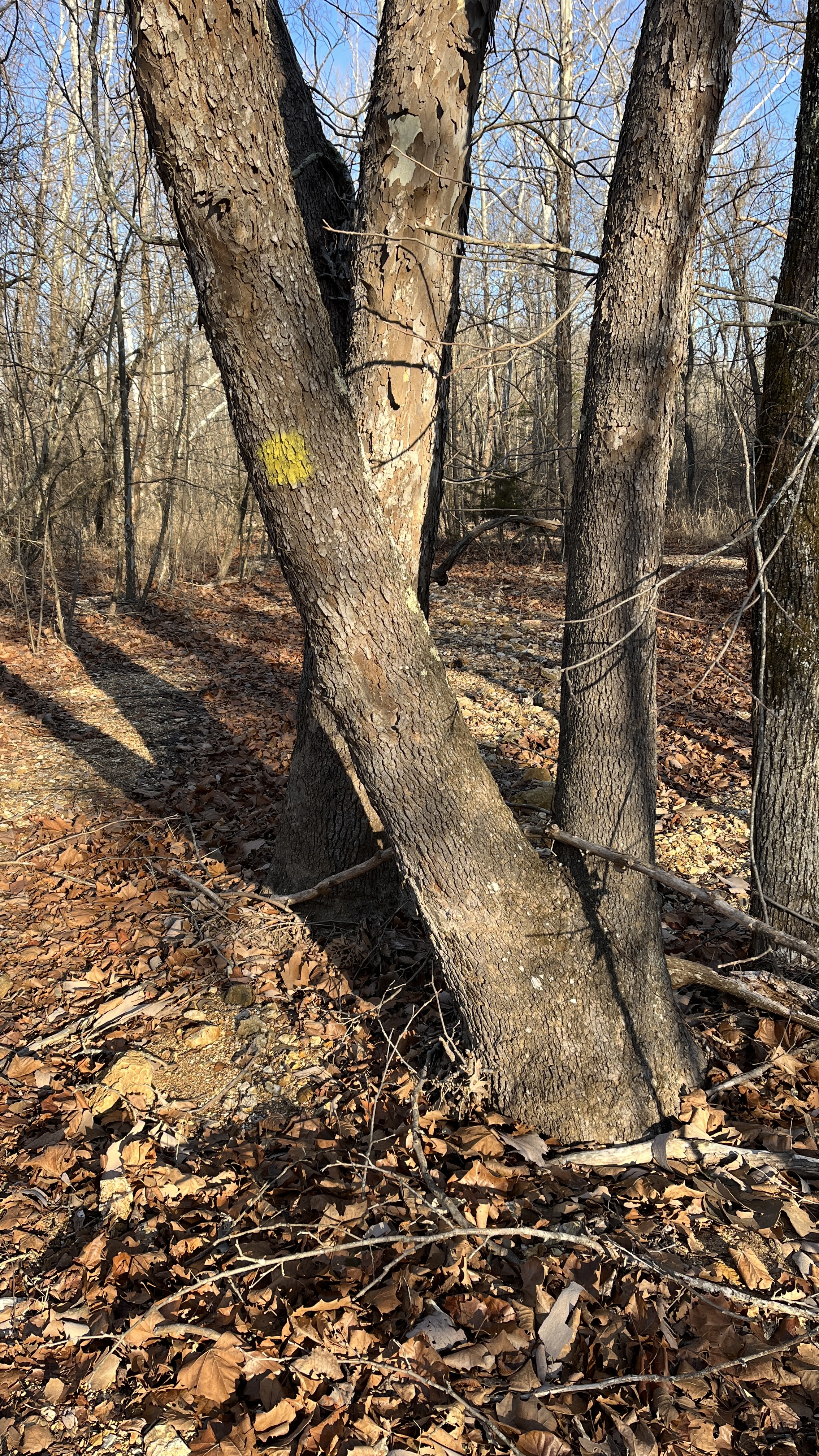
On to the "trail". The path starts just behind the kiosk. There is no sign or markers, just a path in the grass.
The trail immediately drops into Hamilton Creek drainage and you stay pretty much next to the creek for the entire walk up to the Meramec River.
This is the type of path you get. The first bit was overgrown with wild thorny bushes. This is not something I would even think about doing in the summer. I will mention this now as in the Summer the best way to do this first half of the walk would be to just wade the creek.
just slight indentations in the ground
The path drops you directly into the creek bed a few times and you can cross. If you look at my GPX track, at the bottom of the blog, you can see there was some route finding on the way out (I did not cross the creek) but on the way back I did. There are many paths leading in the way you want to do and you are free to choose your own adventure, but it is sometimes just a matter of taking the line in the direction you want to go that has the least resistance.
The opposite side of the creek (south side) also contains Pratt Spring (which you can easily see flowing into Hamilton Creek) but also Hamilton Cave (it is gated) as it is the more interesting side with the limestone bluffs
As I mentioned since there are no markings for this trail you can choose your path. The next time you get dumped out directly into Hamilton Creek you will see on your right an auxiliary creek bed (this is a flood drainage) so it was mostly dry today. It does have a yellow marker on the largest tree at its mouth.
I followed it.
It does lead to a wet crossing a bit further on. I had an old GPX track I had downloaded to give me a general idea of where the trail went and it showed crossing at this point.
Crossing led to this swampy mess
and then this! This is not the way
Doubling back, you are meant to stay on the other side of the bank, do not cross the creek in this area.
Once you reach the Meramec River drainage the old GPX has you walking what is clearly more flood plain to the River. Don't do this. Stay east of the drainage as you can see in my GPX track coming back later in the day.
Fortunately for me, a well placed beaver dam saved the day and I simply walked over the marshy bit and back on the bank
There is really no path here, you just know you need to follow the Meramec River North
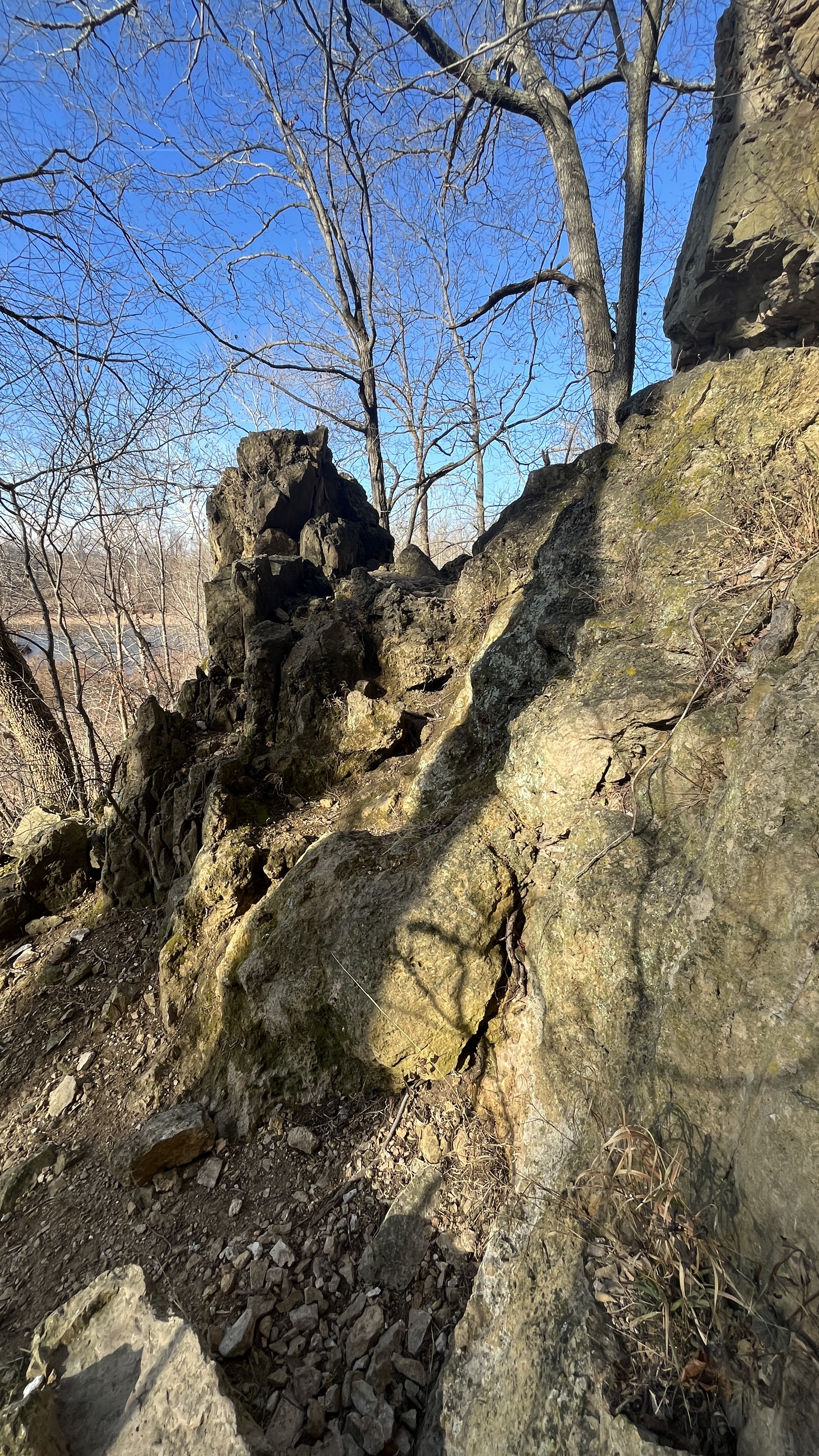
You will eventually get squeezed more an more against the river as the bluffs start to rise up on your left. It helps here that you pick up a well worn path now that will lead you directly to Green's Cave.
You will start to notice more and more smaller caves and other weathered features in the rocks
Green's Cave will tower above you. Even with a few missed steps, this is a great walk, it is about 3.5 miles and 1hour and 45 minutes from the parking lot to here.
Having been here before I was not going to stay long and the cave is posted as "temporarily" closed, which is to say permanently closed. "Nothing lasts longer than a temporary Government program"- Ronald Reagan
But you are asked not to go into the cave, so staying within the mouth of the cave is all I have ever done
A few photos and I was off again.
From just inside the mouth of the cave, looking out. You can get a better sense of how large the opening is. It is 91' high by 108' wide. (6.5 stories tall)
It is up and over some rocks to get out of the cave area and then straight up a ravine to get on top of the Cave complex.
The overlook from the top of the Cave Complex is fantastic and gives you views of the entire Meramec River valley looking North
Southwest
Panorama looking West
Here is where my day changed just a bit. I had intended to continue back toward Sleepy Hollow as far as the old homestead (the path I had walked in Dec 2020, about a mile and a half) and then turn around there and come back to the Cave, but this time I would go over the ridge, above the cave (true bushwhack), and then down a ravine I had seen early and rejoin my steps back to the T.H. However, standing at the overlook I heard some dogs and people coming from higher up on the bluff. The dogs running ahead greeted me on the trail and the owners soon followed. A nice couple that had spent the night at a primitive campsite created just up the ridge, where you can do repealing by permit. I knew that might be a good spot for more lovely views, after exchanging New Year's greeting and chatting a bit, they continued down and back to their car via the low route both of us had come up and I continued up.
What I discovered made me sad and a bit angry.
This put me off my day as it did take about 30 minutes to make sure that the fire was completely out, pick up all the trash and secure it, so I didn't really have the time to walk the extra mile and a half each way to the homestead and then get back home in the time I wanted.
While I was finishing up my clean up I did get to see a small plane flying low and slow over my location and up and down the river. From my height the plane was actually below me.
After securing all the trash I headed up through the woods to get on the ridge and walk back.
The ridge walk was great, easy walking amongst the trees with lots of space to navigate.
The ravine was right were I had thought it would be and while steep, was not problem to rejoin the river below
Looking up from half way down
Looking down
Taking a straighter line to rejoin Hamilton Creek and avoiding the beaver dam crossing
Back at the car in 3.1 miles in 1 hour and 15 minutes. I actually caught up to couple and their dogs watering at the Hamilton Creek/ dry creek intersection, but I did not mention the trash or the fire. Not sure if that makes me a bad steward or not, but didn't want to embarrass them, or get into a confrontation on New Year's day. I was hoping they would see the big water bottle strapped to my pack and say something. Perhaps the fire was their only issue and the trash had somehow been there before them. (but I doubt it). I will think of the trash being from 2022 and not spoiling the new year.
Stats for today.
The temperature when I started at 8:00 am was 38F, when I finished at around 11:45 am it was 65F. That is Missouri weather for you.
As long as you are comfortable with some route finding, I highly recommend this walk.


.JPEG)


.JPEG)


Thanks Craig, Enjoyed your Weekend Presentation!
ReplyDeleteThanks Buddy
Delete