The Bartram Trail is a bit longer at 117 miles as opposed to the 88 miles of the Foothills trail. The Bartram Trail is split by the town of Franklin, NC. and has much more road walking (both normal gravel and but also real black top traffic roads) this is where the plan gets a bit complicated. I had originally decided to do this solo a few years ago, but it kept getting put off until this year when Jeremy "Ramen Shamen" decided he wanted to join me. I decided to plan it as a "flip flop" We would shuttle to the northern terminus of the trail and hike back to Franklin to resupply and then get another shuttle to the southern terminus and hike north this time back to Franklin. In both cases walking back to our hotel/car.
Day 1
The northern terminus of the Bartram Trail is Cheoah Bald. (5062 feet). It can't be reached by car. You have to either hike 8.5 north on the AT from the NOC (Nantahala Outdoor Center) or 6 miles south from Hwy 143 and the Stecoah Gap AT crossing. (We decided to do this)
A note here, you could park at the Winding Stairs TH and hike up to Cheoah Bald and then return the same way (DO NOT do this-more later)
Shuttle service. Ron Haven is very well known in these parts as the former owner of the Budget Inn (which we stayed at) and an AT shuttle driver. He still does shuttles but on this trip we got his sister Veronica. She was very nice and accommodating and picked us up right on time from the hotel
(stock photo)
picked up at 6:15am for about a 45 minute drive to Stecoah Gap.
You have about 2000 feet of elevation gain to reach Cheoah Bald and it starts right away from the parking area.
The day didn't contain much in the way of big views just to the first tree line as it has been raining and cloudy in this area for more than a month and it was heavy fog today. The weather forecast was very volatile for the next week or so.
Lots of small things to see.
The Rhododendrons and Mountain Laurel are already set for Spring.
The AT is well graded and has a few switch backs but it is a steep climb up to Cheoah Bald. About .5 mile before the actual Bald the official Bartram trail meets the AT.
Starting on the official Bartram trail and dropping off the backside down toward Winding Stairs TH is extremely steep. It was hard walking going down and I can't imagine going straight up the hill if you were coming from that side. I would not do this trail south to north and wouldn't even want to hike up to Cheoah Bald as a day hike using this side.
The Bartram Trail is blazed in yellow and is easy to follow
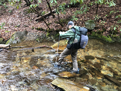
the grade lessens only slightly after the coming down for about 3 miles and you start to cross the same creek over and over again. In fact the steepness comes from the fact you are just coming down the same ravine containing Ledbetter Creek.
Bartram Falls
Rhododendron tunnel
A rare view on this day of fog
Once you reach the road, Winding Stairs TH (Hwy 19) you cross the Nantahala River
Once you reach the power plant (2000 feet ) you use the access road to climb again to the water tower at the top of the ridge. You are continuing to climb to Rattlesnake Ridge (3750 feet)
Surge Tank on top of the hill
View from water surge tank area
We continued to climb about half way up the ridge and stopped for the day. Just short of small stream described in the guide. This is a small saddle with nice views and some good trees we could use across the trail for our hammocks.
14.5 miles
7 hrs 9 min moving time
3559 total ascent, 3515 decent
moving speed 2.0 mph.
Day 2
We made camp just about 20 minutes before dark and actually ate after dark, but all was well and the hammock was warm. I had brought my 0 degree underquilt and top quilt, so while more bulky made sure I was going to sleep warm. We had seen that temperatures might really fall in the coming days. The previous day and night had stayed in the low 40's.
Day two actually started out with a bit of sunshine but that quickly changed to the expected rain by 9:30 am
Bridges across various creeks were very slick in the rain
Beaver activity
We actually stopped about a quarter of a mile before Appletree Group campsite which I couldn't see on my Gaia phone app, but then we stopped at Appletree to take a break from the rain and a hot drink for a bit.
After leaving the campground it was more more gravel road walking for almost 5 miles. Below is a view from under my umbrella which was a life saver as I could actually get almost dry while walking in the rain under the umbrella.
We then came across a surprise. We needed to cross the Nantahala River on a low water bridge/road crossing.
Once over the road it was up again on some steep climbing to a great waterfall, which I can't find any mention of in the guide book, but it is the biggest waterfall on the entire trail so far with a small campsite right at this point.
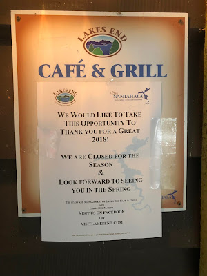
After some further trail winding around some fabulous lake homes you emerge onto the road by a gas station and further down a bar and grille
Here we would have paid $100 for a bowl of spaghetti and a place to dry out our clothes.
Walking further down another half mile or so you pass Wine Spring Creek, where we got water before heading steeply back up off the road into the woods. This was an awful climb through choked rhododendron and small brush of 10% grade in 1 mile. It was still raining hard and about 5:15 pm. So it was time to get under shelter before it got dark. Again not any established campsites or even a lot of space off each side of the trail, but with hammocks you don't need much and we found a few trees bordering the trail to set up.
15.2 miles total
9 hrs 17 min total time
6 hrs 23 minutes moving time
2165 feet ascent, 1870 feet decent
Day 3
Set up tarps first, get out of the rain and then get wet cloths and gear off and into dry cloths and hop in hammock! The wind was fierce up on the ridge. Gust at 30-40 mph pulled a few tarp stakes out but in general we both stayed warm and dry. The rain stopped around 10 pm and the snow started around 3 am.and with it a plummet of the temperature. We had set up camp with rain and temps in the high 30's. sunrise showed snow and ice on the tarps and a temperature of around 9 degrees.
If you were not wearing it or had it in your hammock under your quilts it was frozen solid. Jeremy could have driven a nail with his frozen shoes and my hiking shirt that was hanging to dry was now able to hike on its own, as stiff as a board.
The only warm dry clothes are the ones we are wearing, which is fine, but it is snowing and temperatures are not expected to rise. If we wet out these clothes we have nothing to change into to keep our quilts dry, if we can't make a fire somewhere during the day, and if we move forward we have 20 miles to reach the hotel. We had figured one more night out. Error on the side of caution, we only had a little over a mile back to the Bar and Grille and could call a shuttle to come get us....
Jeremy with shoes completely frozen walked back in his camp Crocs.
Just the mile back to the pick up spot my pack is frozen solid with the light snow/rain mix
Frozen trail art. gloves, gaiters, socks and a frozen shoe.
Day 4
Normally we would just regroup, dry out and head back out again the next day where we left off, but this weather pattern was now expected to repeat itself, extremely low temperatures then 60-90% chance of rain every few days in Franklin, which meant snow up higher. The southern section is 5 days, in more remote woods, further from a road, so, disappointed, we decided this just wasn't the time to head back out on the trail. We are disappointed to not get to the southern end as this was the most remote and scenic, usually this part of the country remains a bit more mild during the winter, but according to the locals it has been a cold and wet winter.
Dry and happy to not be in the freezing rain
In the end I think it would be worthwhile trail to go back and do, it does have a lot of road walking in the Northern section above Franklin, and I think it should only be done north to south even though the guide books are written south to north.
Things to know:
Franklin NC
Budget Inn (formerly Haven Inn)
433 E. Palmer Street
Franklin, NC 28734
(828) 524-4403
Website pricing has not been updated since 2011 it is now $59 per night
Shuttle
Veronica- Ron Haven's sister (828-332-8363) very nice and accommodating
Food
Yonders- only open till 2 pm, might be the best breakfast ever! Real food, farm to table
2720 Georgia Rd, Franklin, NC 28734
Motor Company Grill- good burgers and other diner type food
86 W Main St, Franklin, NC 28734
Mi Casa Mexican Restaurant- Burritos as big as your face!
788 E Main St, Franklin, NC 28734
Bartram Trail Societies.
North Carolina side
https://ncbartramtrail.org/
their facebook page link is broken.
https://www.facebook.com/NC-Bartram-Trail-Society-116986498317631/
Georgia side
http://www.gabartramtrail.org/
Trail guides and maps
https://ncbartramtrail.org/maps/
Thanks to Ramen Shamen for tagging along despite the outcome. Some days you get the bear and some days the bear gets you!


