Theme for this trip
Johnson Mountain is a spur off the Council Bluff Lake loop. I have been up there once before in June of 2021 and it a beautiful place to camp. I had 24 hours free this weekend and decided to go again. Well a lot has changed since my last visit and you can compare as the link is above.I suspected I would be alone this weekend, not just because Johnson Mt is a spur off a fairly popular trail but also the early season. Despite it being 72 degrees on Friday I saw only 1 person with a boat and just 3 mountain bikers on the main trail. Venturing out in the very early months of the year is a fantastic time if you like the trail to yourself and absolute quiet. (well maybe not so quiet... read on)
Council Bluff recreation area was for the most part closed. the road to the hiker campsites was closed and gated off, so was the road to the beach. The only section that was accessible was the boat launch parking area, which I planned to park at anyway as it adds about two miles onto a fairly short walk.
Just as a note, The boat launch and beach area are both a $5 per day use area.
After parking my truck and paying my $5 I was off. I decided to make this my first shake down trip for my upcoming trip back to Scotland for the TGO Challenge in May, so I was carrying all the same gear I would use but only one day of food. With food and 1 liter of water I was around 14 pounds
The Lake Loop Trail leads right off the parking area. (not sure what they mean by no camping! 😃)Council Bluff Lake boat launch area
Missouri is known for its unusual granite outcroppings and there are several around the lake You can see Johnson Mt in the background just left of center.
Just under 2 miles from the boat launch you come to the beach area, where I had parked in June. No one on the beach today, despite the very warm temperaturesAfter the beach you cross a natural outlet for the lake. I like this area as it has some great granite features again and it creates many pools for the water to stand in.
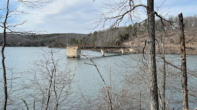
You then enter a small section of pine forest The spillway was gated and locked. This is new as you have always been able to walk out on the spillway and it is a great view. Someone has probably done something stupid and ruined it for the rest of us!
The earthen dam (In June this was up to my waist in tall grass)You can see the exit of the lake below and source of the Big River.
Here is a shot of the intake/spillway from the other side of the dam This area was part of prescribed burn last fall and the cleared and blackend forest makes the moss on the trail really snap with color
I had not realized how much of this area was encompassed by the burn. This whole side of the lake was effected. More of the huge granite outcroppings
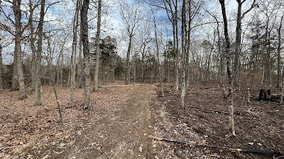
The trail up to Johnson Mountain proper was part of the fire line. Notice the burn area on the right and no burn on the left
Now reversed, burn on the left and clear on the right. There is real skill involved in doing these control burns to help manage the forest, but not letting it get out of hand. It is a rather brutal uphill grade for just a bit to reach the top of Johnson Mountain. This area, which is the part with the view is actually not the very top (no view from the actual top) but is only a few hundred yards from the actual top.
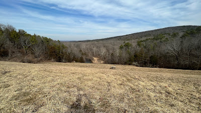
You can now see what the burn area has done to the landscape Council Bluff Lake below
Here is a close view in June of last year. Big change
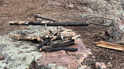
When I was here last year, I processed a lot of firewood and could not use it, because of the high winds on this exposed overlook area. I processed more wood and cleaned up the area, but again could not make a fire as the winds were "howling" from sundown to well past sun up.
My plan had been to "cowboy" camp on the edge tonight, but with the wind, I set up the tent back in a remaining stand of trees just off the edge. It didn't help much

I did not start up until mid afternoon, so now just time to relax and watch the sky and sun change for the evening. An eerie and somewhat sad panorama of the top. It will be decades before the tree canopy returns
The sunsets are the same
Trying to relax "on the ground" !
The sun tried just before the end to come outI was trying some more cold soak recipes. This one tonight was tomato pesto pasta. It was very yummy
Picked up a local hard cider before the trip up. Added weight, but a nice addition to dinner.
Evening lightLovely
It was a long and restless night with the wind howling all night long. The dawn didn't bring any relief from the wind but it was beautiful
The morning light was spectacular What a view
I tried to capture some of the big wind gusts during the night, but it was easier to capture it in the morning. This is a tame compared to some of the really big gusts that occurred during the night. The tent did not move however, but the noise made it difficult to get quality sleep. Hammocks are much better!
There is a lovely sounding little bird, braving the wind, in the bush right outside my tent
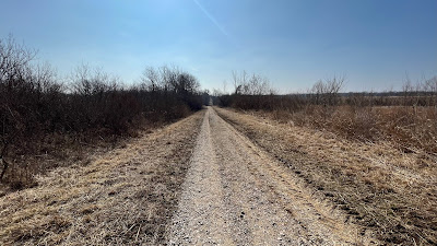
Didn't want to hang around at the top, so just packed up and headed down. The fire crews had used this old forest road to access the burn areas, so now it a rather large forest track Back down at lake level
I stopped at the beach area, seeing I had the whole place to myself and had breakfast
Had my overnight oats, another cold soak recipe (oats, milk powder, chia seeds, maple syrup and some dehydrated strawberries) and made some coffee. I did a little trash clean up and used the facilities while I was there. empty beach
Around the lake and back to where I started. Only 5 miles each way, but I got to experiment with a few things and gave me some things to tweak for Scotland. I don't think I will return to Johnson Mountain again. I think its south facing location makes it a natural wind funnel area but for a day hike it is well worth the effort for the views though