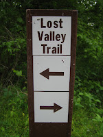
The turtle was more bitter than sweet. I should have known when it started to unravel early. First the Little Missouri River, normally a sleepy shin deep wade, transformed into a 7 foot deep torrent best suited for a kayak running at 7900 cfs.
But my hopes were still alive for a thru hike, until the bridge that I planned to use as a bypass turned out not to be a bridge at all, just a low water crossing 4x4's can use during normal flow of the Little Missouri, which is hardly now. Steve at the Forest Service in Medora said that with the mud lining the river bottom he wouldn't trust a tank to cross the river at the moment. So with my only way across blocked my thru hike was over, but I figured I would still walk the same distance just by going to the half way point and turning around and coming back the way I had come....
The plan was set and I was off at 5:30 am Saturday morning. Medora was still fast asleep as I walked through town.
Past the entrance to the Theodore Roosevelt National Park
The day looked inviting a crisp and cool 37 degrees
the walk in was very nice
Several Elk did not survive the winter and they were an easy meal for the coyotes and mountain lions that roam the area
over the first set of hills and into the inner valley. The high plateau in the background is my goal and then 13 miles further to Wanagan Camp site
It never looked like much when I first walked up to it, but Knutsen's Creek was the end of the line.
The entire inner valley is ringed by this creek. this is 3 times its normal size with all the snow and rain run off
Here are two pictures (below) from the same creek in April of 2003. The second picture shows just how difficult it can be to cross this section that is a bottomless mud base. Even then we were not able to cross the actual creek

The creek basically disappeared after a beaver dam ( that was no longer there unfortunately) and we were able to cross over.

Now it was twice as wide and 5 times as deep
I had no place to go. I looked for an alternate way across. I went up and down the creek bed for 1/2 mile in each direction. It was all the same. no way to even get close as you just sunk in the mud.
But eventually I had to give it a go. I had only come 7 miles and it was only 8 o'clock in the morning. My first step in, I sunk to my knee, my next step in took me to my hip, with my trekking pole going completely under. I managed to get back to the bank with most of the mud still clinging to my feet
I eventually follow the creek by bushwhacking all the way to where it flowed into the Little Missouri river, hoping somewhere along the way it would narrow enough to jump across or some other way would present itself to get to the other side.
after following it for 2 miles, it flows into the Little Missouri with no decrease in size or speed.
I am a bit frustrated at this point!
The walk out was not without excitement however. Except for the dead Elk, I had only seen some deer in the morning and a very large beaver. I had wondered where all the Bison were located. After my encounter with Knutsen Creek I had concluded that most were trapped in the inner valley and up on the high plateau, as no man or animal could cross the creek in its current condition. (this was later confirmed by the Rangers at Park Headquarters)
Except for HIM
Standing in front of the gate that leads in/out of the park boundary a huge male bull bison. He was literally guarding the gate I had to pass through and he was not going to move.
I had moved up hill to his left (my right) to see if he would move. All he did was turn to face me. I have moved back down in the picture and as he sees me he turns again to face me down the trail.
I had to retreat to a hole in the fence I had seen earlier and try and get by him from outside the fence line.
I was able to walk right past and he just glanced at me, this time he stayed laying down and unconcerned.
This trail appears to be playing as hard to get as Lava Falls (search the blog for "Lava Falls") in the Grand Canyon. Maybe someday I will try it again. The unusually wet spring (they had 10" of snow just a week ago) and the rain just made a trip this early impractical. I checked the register on my way out and I was the first person on the trail, to sign the register, since November 2010.
**Watch for the Video compilation coming soon**
Animal Encounters:
White tail deer
Beaver
Bison
Recommended Restaurants:
Boots Bar and Grill (formally Iron Horse Saloon)
Medora Family Restaurant- good burgers and blueberry pie
final evening sky shot


