Today on day two, we had our toughest day and to be honest hiking conditions I have never encountered before. We slept well with just a little rain overnight and woke up ready to go again. I knew we had two decent climbs today, one out of the Sourlies bothy area which is just 14' above sea level and then again at the end of the day going up to our proposed campsite at Kinbreak Bothy.


Leaving the Bothy site we immediately get back into more bogs! This sets the tone for the day as the going is very slow for us trying to pick the best way through the bogs and not sink to our knees or more in the soft ground.


The path we had been following was very primitive and sometimes, as in the bog areas, non existent, but crossing a very lovely stream which feeds the bay, there is a very well constructed bridge. Someone must come this way!

Looking back, both with the picture above and below, you can see where we camped on the right side of the photographs. The Bothy is at the edge of the receding tide. We are climbing higher in each photo out of the bay area and into the mountains.


We did purify our water with Aquamira just to be safe. The water was very clean and clear, but I have noticed that if you are not from a particular country you are susceptible to things that locals are not. We didn't need to carry much if any water with us as when you were thirsty you just reached down to get more water!

The water does find the path of least resistance, so the path we walked all day was generally filled with water streaming down the mountains. Vicky climbed well, but constantly walking with your head down to try and avoid the worst of the bogs and rocks was very tiring and we were very slow today.

It doesn't help that right about here I made a navigational error at a cairn that I assumed was put on the more used path and the mistake made us climb an additional 350 feet and a mile extra (half a mile up and half a mile back to the correct trail.) Any Challengers that might have been behind us, were now ahead of us, so we didn't see anyone else all day.


Even at a high point in the path you can see (below) how much water is actually just standing on the ground. Vicky managed to get into one up to her knees.


In we go. The boundary to the forest area did not give us much confidence that this was going to be any better and might even be worse than what we have just been experiencing all day. The area isn't true forest, but an off road course for driving your land rover and learning off road driving skills in the hills and mud.


Some spots were steep and we had several streams to cross. Again this would all be great fun in your 4x4 but it was tiring and slow going.


coming out of the forest area (above) entire Glendessarry "Farm" area (below)


Highland Cattle (Hairy Cooz). The have complete rein of the area and the one below decided that he owned the road we were walking on and made us wait for 10 minutes while he stood and watched us before he had proved his point and walked down into the meadow (they have big horns, so I wasn't going to argue!)

Glendessarry Lodge (below) viewed from our campsite


After a couple of route finding issues we found the path (above) that would take us up again to Kinbreak Bothy and we started to make the climb up from Glendessarry. It was nearing 5:30 pm and we had been walking since around 9 am and had only come 9 miles in basically 9 hours and now had to climb another 1000' in 2 miles and still had 3.8 miles total to go to Kinbreak Bothy.
We discussed the situation and we both decided that we had enough of this day and would stop here. To be honest I thought Vicky was going to tell me she was done with this nonsense, but once we made the decision to stop and find a place to camp the mood lightened considerably.
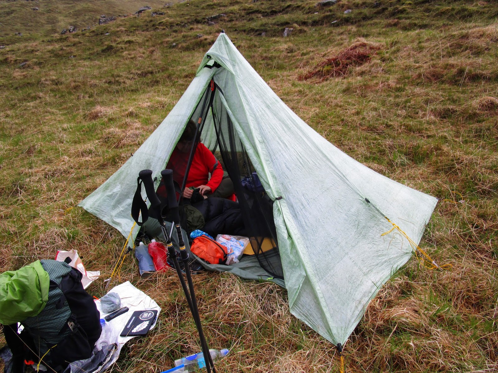
Ultimately I believe we made the right decision as I got the tent up and got water for us and we got inside the tent around 6:30 pm just as it started to pour down rain. It rained hard off and on all night. Had we continued up the hill we would have been at or near the top when the storm started, as it was we were nice and dry and comfy in the MLD Cuben Duomid.

The storms came and went and since it doesn't get dark until 10:30 pm or even later I was able to peek out of the tent from time to time and was rewarded with several great views.

Looking west (above) the low sun light lite up the valley to the east and when I turned to see the next rain shower approaching it was preceded by a fantastic rainbow that was grounded only a few hundred yards from our tent. Even though it had been a really tough day and nothing Vicky had ever been expecting or prepared for, this view made it seem like this was the place we should be and that we would continue.

Day 2
14 miles planned, only 9 miles in 9 hours achieved.
Animals scene:
Deer, Highland Cattle, Hawks, Slugs, Slugs, and more Slugs
Elevation profile for Day 2

Stopping was a sound strategy, Craig.
ReplyDeleteThe west of Scotland had had loads of heavy rainfall for the few weeks preceding the Challenge - which makes for dreadfully heavy going underfoot.
And you were rewarded with fabulous evening views as well.
Happiness!
:-)
Scotland does keep on giving doesn't it. Mainly water. Paths made of water, built on Peat & Moss. It must have been a unique culture shock. But then all that water creates all those colours. Tough old day that. We were doing the same slog further north.
ReplyDeleteBut.. Come September, you'll think about applying again :-)
It was a shock... nothing like it in the US that is for sure. I knew the FWA was an option so I was not as despondent as Vicky, but the rainbow convinced us to carry on and once Vicky knew I was not going to take her up that hill, everything was better.
Delete