This section of the trail was hit very hard by the flood in April-May 2017. The Ranger station/Visitors Nature Center (below) was completely flooded out and while there was some early talk of it being reopened in 2018 that has not happened and is likely not to happen in this location.
The campground is still accessible but facilities have not been restored so it is just primitive camping at this location.

There has been lots of discussion about if it is safe to park here and the Park Service/OT has provide advice on the message board in the parking area. The advice to travel down Highway 106 to FR 531 and then go on 533 to the point marked "I" on the map. This is exactly what you should do.

If you are continuing a south bound thru hike then you can see you go directly into the woods after crossing over the first big bridge on 106 across the Current River.

We wanted to not lose the 1.5 miles that going down to "J" would mean but that section is not worth it as it skirts some farmers fields and is in a rough corridor between the fields and river that is full of brambles and sticker bushes.

Nice maintenance building across from Trail Head "G"

Old Trail register at point "G" that had no register.


Current River view walking the first 1.5 miles from "G" to "J"

Current River at the gravel bar marked "H" on the Ozark Trail map.


Fungus growing on fallen log


This is the parking area marked "J" on the Ozark Trail Current River map. I do recommend parking here as it is a nice open area and this weekend was used by lots of hunters

The Current River section is a great combination of wood, open fields with lots of water crossings

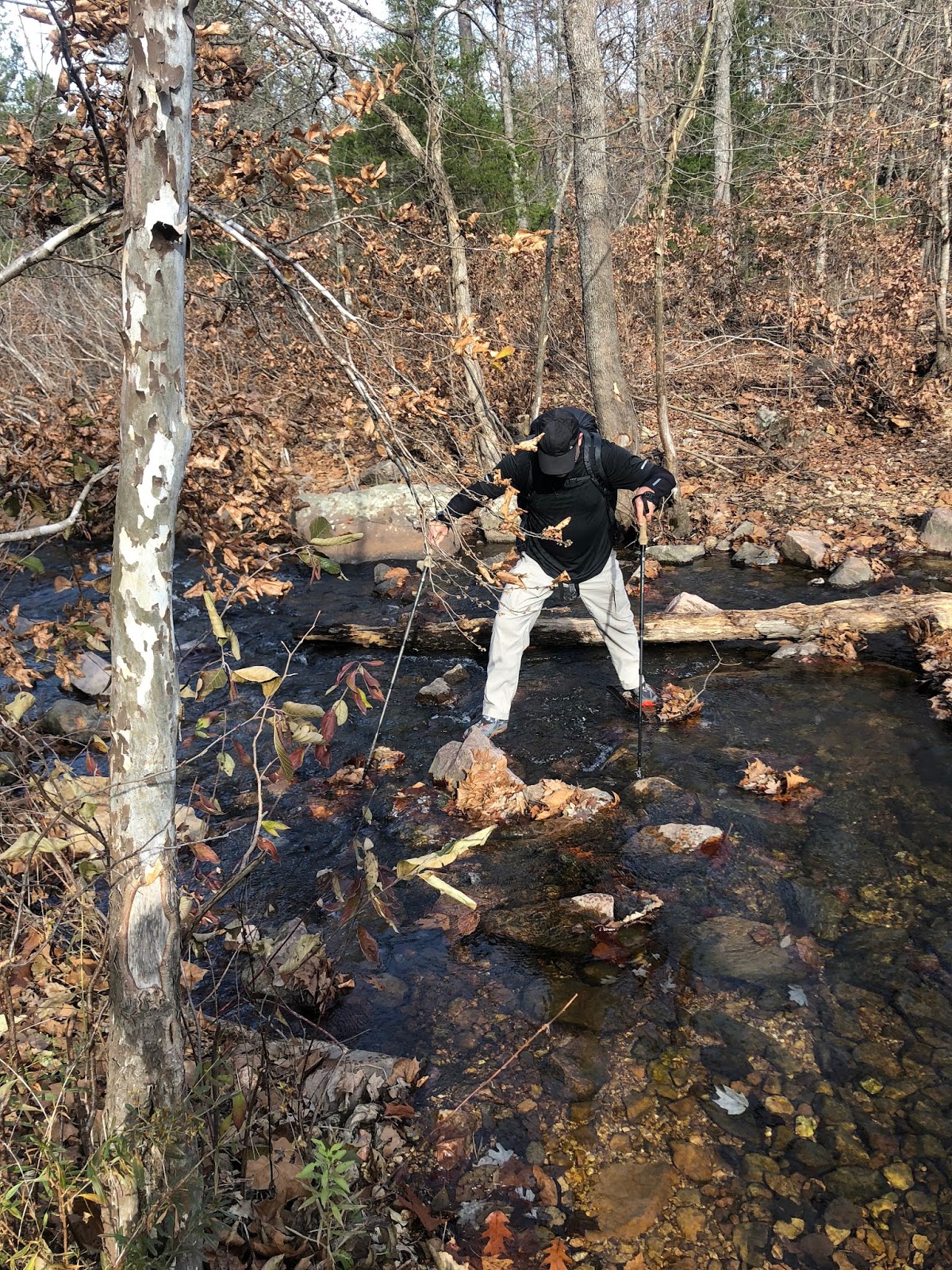
You cross Rocky Creek many times over the first 10 miles south on the trail

About 4 miles from parking area "J" is Kepzig Mill, a lovely part of this walk


More crossing between woods and field

Crossing Rocky Creek again and again
Marker for turn to Rocky Falls


Topping out on Stegall Mountain and walking the ridge

View from the firetower on top of Stegall Mountain

Joe going up the tower

Stegall Mountain Fire Tower

Beautiful evening hanging just below the firetower

Sunday morning a completely different view. Totally fogged in. What a difference a day makes as it was 55 degrees yesterday and today at sunrise 33 and it wouldn't get any higher than 37 the whole day.

Firetower barely visible

Taking the OT you reach the Stegall Mountain glade, which is as close as the official OT comes to the top of Stegall Mountain. Just before the glade (going south) you will see an abandoned Jeep road that goes straight up. (this is marked on the OT map). You then walk the flat jeep road the 1 miles up to the actual top (firetower). Just before you reach the top you will see another old jeep road (pictured below) and not marked on any map. I suspected that this old abandoned road would drop you straight off Stegall Mountain back to the OT in Kelly Hollow. This was exactly the case. We took it and ended right back on the OT saving about 2 miles of switch backs.

Even in November still lots of green on the trail

"winter" fern

On the way back we stopped at the overlook marked "J" on the OT trail map.
This has a nice fire ring and a couple of wood benches. However the fire ring had lots of trash which we cleaned before leaving after our coffee break.
(before)

(after) People- pack it in and pack it out- clean up your trash

We made it back to the parking area "I"

Instead of walking that marginal 1.5 miles back to the car we skirted the fields back to the car.

The field access ended about 1/4 mile from the car

Toasting another successful walk

Day 1. My GPS didn't start for the first 2 miles from the car, but you can see our track to the top of Stegall Mountain.

Day 2- notice coming straight off the mountain on the hidden jeep road and all the way back to parking area "F"

No comments:
Post a Comment
Because of spammers, I moderate all messages. Your comments should be posted shortly- Thank you