Our original itinerary for today was 17 miles, but since we had added 7 miles to our day yesterday we only had 10 miles to go today, so last night we had discussed going on ahead again and we decided we would try to go on to Portsoy.

The morning dawned grey and cold but we had a good nights sleep out of the wind in the caravan park. We got up and used the showers and got cleaned up for the day. Just about a quarter of a mile from where we camped there was a very nice city park that would have given us a great ocean view last night (but we wouldn't have just crossed the road for a meal!)
View from the Buckie Park (below)

The park overlooks my Island (Craigenroan) it is an important island for wildlife just off the coast (below)

We walked close to the sea on the rocks and a path (North Coast Trail) around to Findochty, a small coastal town.


The Harbor was very picturesque coming in from up high on the cliffs.


Leaving Findochty you have a nice path, along the golf course, of course. to Portknockie

Nice marker between the two towns


Approaching Portknockie

The town of Portknockie is larger but the harbor seemed smaller

Just Leaving Portknockie you come across Bowfiddle Rock. (Below)

We stopped here for something to eat and enjoy the view of the seabirds nesting all over the rock formation.

All along the shoreline we watched as small boats went about checking their nets for fish or crustaceans. they were very small boats in a very big sea!


There was a section of rock steps that had been constructed by just one person over the course of a couple of decades coming down the last section.

Once we were over the steep sections it was a nice beach walk into Cullen. We met several people on the beach in Cullen (people out walking their dogs or just playing on the beach)
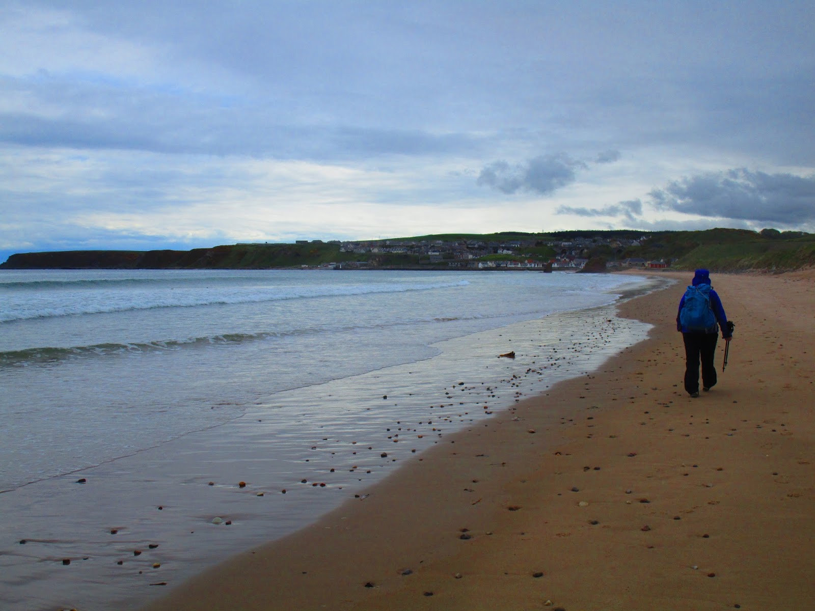

Cullen was a very pretty town. Below you can see the old railroad line that is now the bike path. We could have taken this from Portknockie to here to avoid the coast, but what fun would that have been!


Cullen Harbor.


Leaving Cullen you stay low along the rocky shore


After about 3.5 miles you leave the sea side and climb steeply up on the cliff tops again. Below our view as we are climbing up leaving another secluded and empty beach area.


there are benches and a kiosk telling the story of the castle and we stopped here to admire the view and have a snack.


We carried on the cliff tops toward Sandend.

We passed some lovely home gardens- the first real spring time color we had seen so far in Scotland.

We descended into Sandend which was suppose to be our original stopping point for today at only 10 miles, but as I mentioned we had decided to carry on. We did debate again on whether to stop here anyway as the miles had been strenuous today and we had seen a lot. The caravan park here was very nice and large but it had started to rain again and ultimately we decided that we didn't want to set up in rain and if we pushed on to Portsoy that we would treat ourselves to a hotel or B&B for the night.

So now a story of more helpful Scottish people, but with a lesson on how the rest of the world views directions. We left Sandend and since we are not really on any well developed path other than the vague North Coast Trail we have been sort of making this up as we go along, so leaving Sandend I knew we had to go behind the Glenglassaugh Distillery. The map was not clear as to exactly where so I missed the path that went steeply up from the beach to the cliff tops, instead we ended up directly behind the distillery. There were two maintenance guys cutting the grass in the creek bed. One stopped us to chat and we told him what we were doing and that we were going to Portsoy. He said no problem and the easiest way to get there was to walk through the distillery parking area go to the next road and turn left. We thanked him and off we went (at this point I didn't want to ignore his advice and turn around to go up to the path to the cliff tops)
So up through the distillery we went to the first road. Well the first road was the A98! The A98 has no shoulder for walkers as we have encountered already with the A98 in previous days.
The lesson here is that most people think in terms of driving directions and don't notice that there is no provisions for walkers or bicyclists.


Getting into Portsoy the first hotel we came across was the Boyne Hotel. It is an old hotel but has just opened again after being closed for a few years. It was purchased by a pair of brothers and their families and had just opened a few months ago, so they were not completely finished with everything.

They had room, the price was reasonable and the bed was comfortable - and it had lots of hot water!
we made our own food in our room, but did manage a few Kopperberg Ciders and some onion rings from the bar.

The sunset out the window and over the water in the evening was a lovely way to say goodnight to the day.
Today was not a long day in terms of mileage, 13 miles total, but it had been strenuous with lots of varied terrain and lots of different scenery. We didn't go fast as we stopped to rest, talk to people and just enjoy the day. It was certainly the day with the most going on so far.
Yes, now that was some beautiful scenic shots! I really like the lush, green look to just the seaside. Glad the day was a little shorter for you all, but with the hills, it must have been tough in spots. Good narrative, as usual!
ReplyDelete