A site to keep track of the adventures of Craig "Pisco"
Eagle Rock Loop, Arkansas- Nov 5-7 2022
Eagle Rock Loop in Arkansas has been on my list of trails to do for a long time. I had heard years ago that it was the prettiest hike in Arkansas but also the hardest hike in Arkansas. I have done portions of the Ozark Highland Trail and the Ouachita Trail and while I thought they were nice, they didn't overwhelm me as being better than the best sections of the Ozark Trail in Missouri and certainly not close to the very beautiful Fiery Gizzard Trail in Tennessee. When Eric mentioned that he was doing this trail with a friend the first week of November, I took the opportunity to ask if I could come along. When he said yes, I reached out to a mutual friend Jeremy, to invite him to make it a foursome.
I was going to combine the end of my work week in Southern Missouri to then drive the additional 4 hours south to the trail. The Eagle Rock Loop trail is not close to anything! Eric and his friend Dennis where driving together from Kansas City and Jeremy, while also living in the KC area, was driving himself. (this turned out to be a very wise decision)
When I mean this trail is in the middle of nowhere, it is at least in terms of accessible roads. Our trail head was 30 miles from the last paved road and this portion of the trip took me 2 hours to complete. A combination of gravel and ungraded dirt with steep ascents and descents over mountains and through hollows.
Below is the last 30 miles at its best. The rest of the time I had both hands on the wheel, in 4 wheel drive and 2nd gear.
You do top out briefly at Eagle Mountain Overlook
The guys driving two cars eventually did meet and caravan the majority of the way and it was a good thing as Dennis's car got a flat on this last section of road. Their spare was flat, but fortunately Jeremy had a can of a tire inflating foam, for the spare, that saved the day
As I mentioned I was driving myself so I arrived earlier in the afternoon having spent the night in Ft Smith Arkansas. Parking the truck in the FS 106 SW parking area, which was quite nice with space for about 12 cars and a pit toilet. It is one of the unofficial "starting" points of the trail, Perhaps not the best choice as I will discuss later.
Day 0
From the parking lot, you need to cross a small creek, Today I was able to do it without getting my feet wet.
Below you can see from the parking lot, labeled Car, it is just 0.4 miles to the camp spot (circled) Eric wanted to rendezvous at for the night.
I arrived about 2 pm, with the other guys not scheduled to arrive till about 4pm. With the flat it was closer to 5:30 pm.
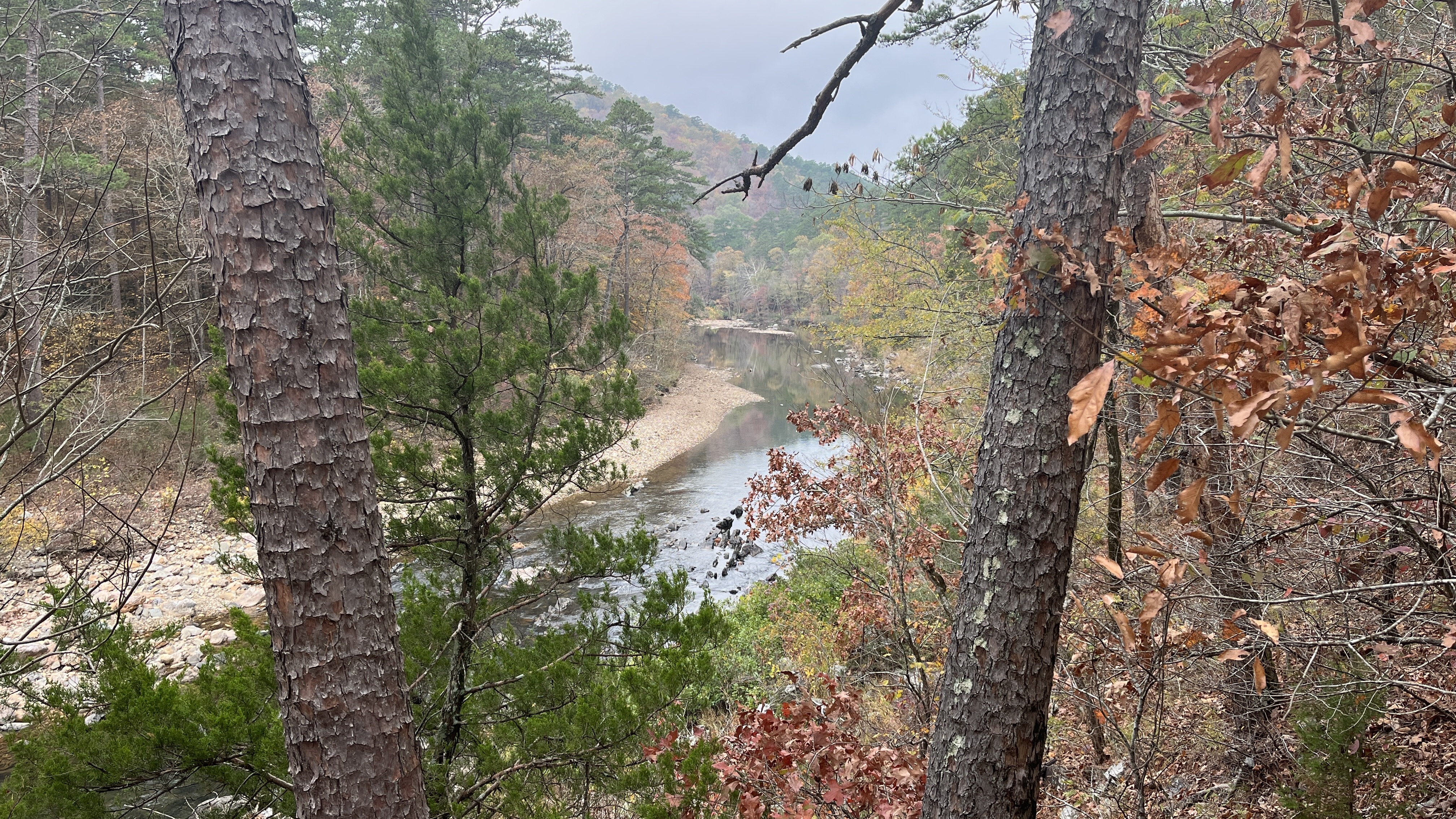
While waiting I took the time to wonder around a bit and down to the Little Missouri River, which would be our companion for this hike. (notice the water level here. It will change dramatically by the end of the weekend)
Absolutely beautiful scenery in the river bed. The colors were more muted being a week or so past prime, but still lovely.
The boys arrived. I had gathered some downed firewood in our camping spot. Everyone got set up. Jeremy was in a hammock as well. Eric and Dennis had brought their tents.
(left to right) Jeremy, Eric, Dennis
Very relaxing evening
Day 1
The day dawned overcast, but humid with very little wind. The temps were a bit unseasonable high but there was a threat of a really big storm Saturday night.
From this campsite, there is a brief uphill section of 150 feet but then it is a nice easy walk along the Little Missouri for about 5 miles.
Half way along this 5 mile walk you have to cross the Little Missouri for the first time. Today as yesterday the water level is no problem, just an ankle wade across.
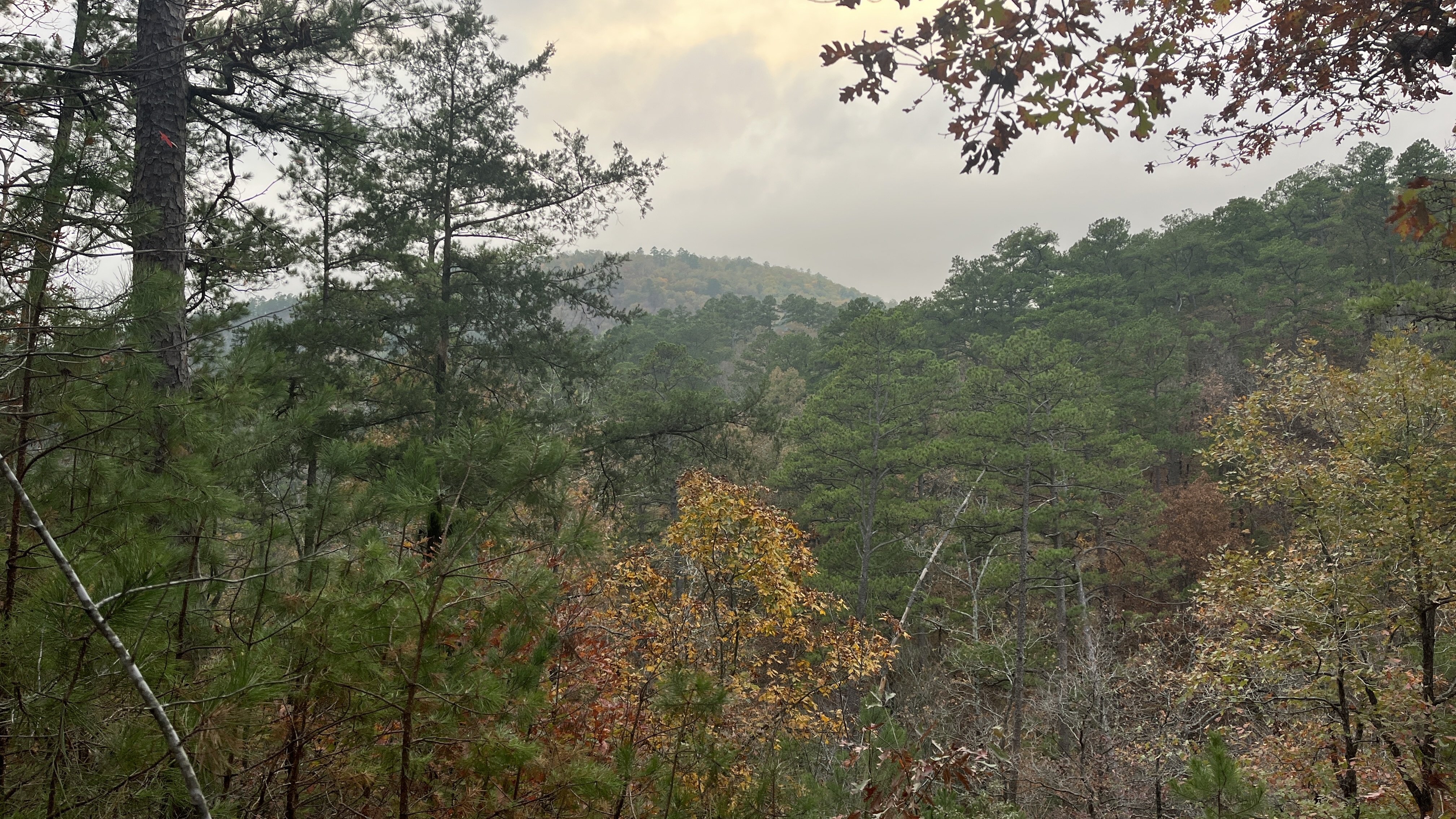
We carry on with just mostly flat walking among the beautiful Fall trees
After the initial 5 miles you reach the first "big" climb. It is 550 over 0.7 miles. It is a ~15% grade. This trail doesn't help you with many, if any switchbacks. It just picks a line and goes straight up the hill. There will be 6 of these with a small one thrown in at the end.
Up we go!
Reaching the top, it reminded me of my most recent trip to Scotland. A view of nothing 😅 Actually at this point the weather had changed. It was a colder wind and the clouds had moved in with a very damp feeling.
We have arrived above the top! GPS had not quite locked into us sitting at the top. We were able to get enough cell service to learn that the weather report had changed and the big storm was expected today, starting around 4 pm.
We had lunch here, at the top of Eagle Rock Vista, and waited on Dennis and Eric. They were about 30 minutes behind but soon joined us. We waited a while more and then I started to get a bit chilly in the mist so we started down the hill.
It is a steep but short decent to a creek bed before you climb even higher and steeper for the next hill. Eric and Dennis had joined us at the bottom before going up again to 1758' (Brushy Peak Mountain Pass).
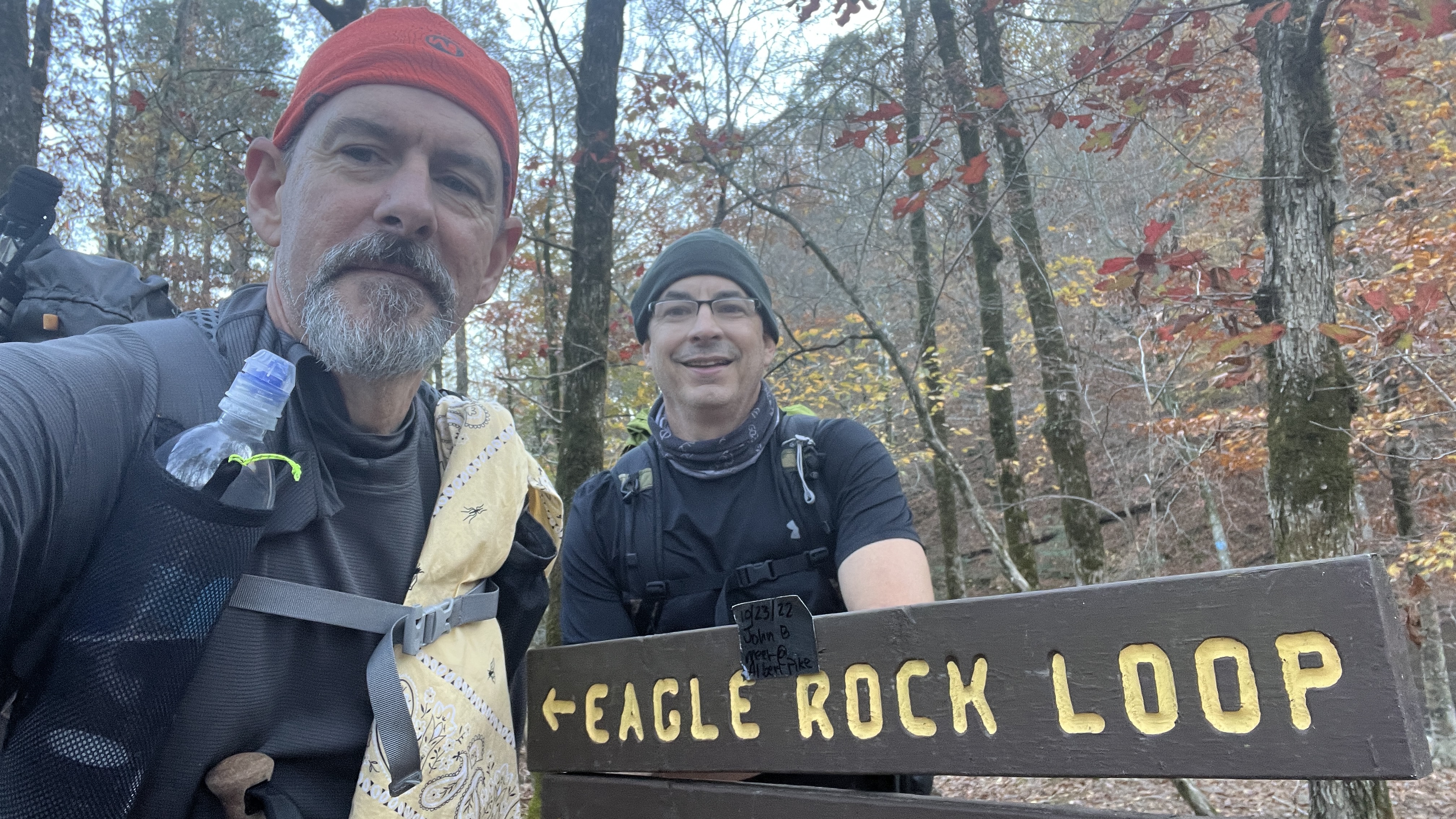
Before we knew it again we had separated and Jeremy and I were walking ahead again. We went right up and over the second mountain (Brushy Creek Mountain). The sign below marks the point that the trail crosses FS 106 (the same road we had come to the trail head on)
We continued on as we had all talked at the beginning of the day that we would camp between the third and fourth peak. While it might be a shorter day, we wanted to get set up before the storm arrived
Historical Trash
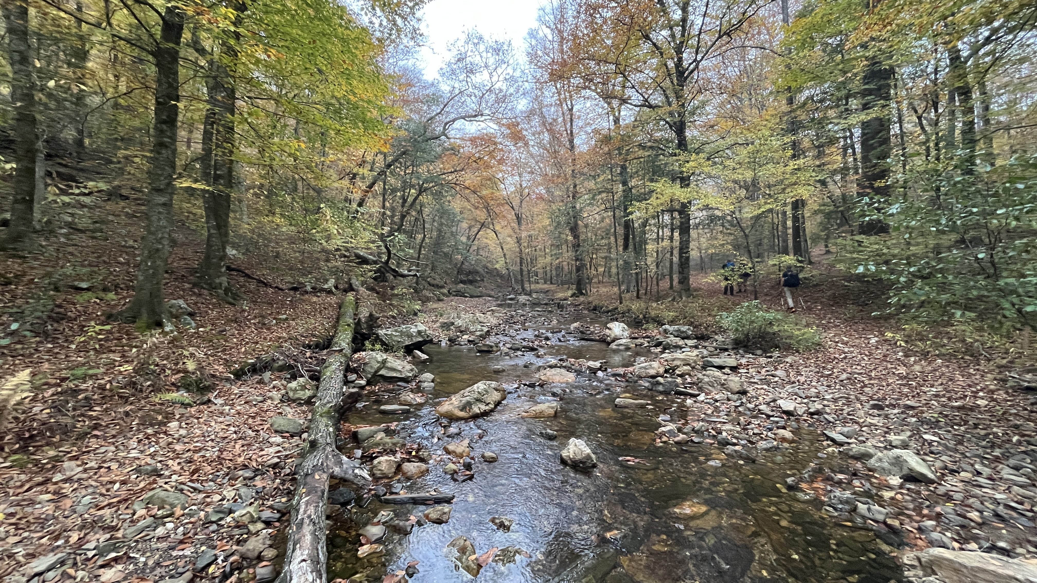
We arrived at the designated campsite only to discover the creek was dry. This was not really a problem as much as a surprise as water had been in every creek so far today, but a little walk back a half mile got us some water for the night (soon we would not have to worry about water any more!)
Eric and Dennis did not show up by the time the rain arrived. With no cell service and Eric not carrying his InReach, we assumed they just stopped short to set up before the rain and we would see them in the morning before going up peak four.
The walking stick is usually a pretty rare insect to see. Tonight in our campsite we saw dozens, in fact, they were crawling up my hammock and dropping on me! I had to remove 3 or 4 in the evening that were crawling on me. In the morning we discovered that it might be walking stick mating season and we had accidently camped on a "swinger's" club- que the Barry White music....
The rain started almost right on time around 4:30 and with it came very high winds (40-50 mph) the peak of the storm happened between 8-10 pm and we were sometimes holding the sides of the tarp as the strongest of the winds came in (you could hear it coming at you through the trees) We found out later that there was a tornado in the area.
Quick video with audio, just before 8 pm
The storm was over earlier than predicted for us, thankfully. It settled down around 10 pm and we were able to get some sleep after that. The day dawned much clearer but also much colder. The temperature had dropped a good 15 degrees overnight
Day 2
The day called for sunshine but we didn't see much of it till the afternoon. While the sun tried it stayed overcast, but a much better temperature for hiking only in the low 50's and not the high 70's of yesterday
Water was not a problem today. Ever small creek (even the one that had been dry yesterday afternoon, was no raging.
Peak four was immediate after we broke camp. you get a bit of a flat break of only about a half mile and then you face peaks five and six. These are steep having grades of 20% and 25% respectively. Peak six takes you to your highest point on the trail 1805' (550 meters)
The grade going up five
Top of peak five 1669'
Going up six, steep and rocky
Jeremy, top of six, the last hill
Top of the trail at peak six, 1805' (550 meters)
Your view point is next to Hurricane Knob (2133')
On top of the peak we get cell phone reception again and got texts from Eric saying they got off the trail after the second peak where the FS 106 road meets the trail. They walked that road back to their car and headed back up to Ft. Smith, Arkansas, to get the flat tire fixed before they headed back toward KC. This was a relief to know that they were ok and safe and didn't have any issues in the storm.
After peak six, you go back down steeply again all the way to the Little Missouri River bed.
You now have 10 miles of relatively flat walking, mostly along the Little Missouri River, before reaching the last little hill
If anyone can identify this flower, please let me know
from Dennis- Euonymus americanus. Known as bursting heart flower
Super campsite reaching the bottom of peak six
At about 5 miles into your flat walk you come to the first real parking area we have come too since the start of the trail, for the Little Missouri Falls. This might also be a better place to begin your hike as the roads leading into here are in better shape and closer to paved roads.
The Missouri Falls area is more developed, picnic tables, paved paths, toilet blocks and a nice bridge over the Little Missouri River.
View from the bridge (looking North)
Looking South
Little Missouri River Bridge
Little Missouri River Falls
After the Falls you walk another two miles (this is not flat as the profile suggests as you sometimes need to come up the banks steeply to avoid the river) You reach the first crossing of the Little Missouri River. We met people here that had crossed yesterday and said it was a rock hop. Today it was something to be careful with. There were hikers here that were hesitant and nervous to cross. We crossed with ease, hoping to give them some confidence, but remembering what it was like the first time I crossed a swift moving river.
Jeremy crossing
Another 2 miles downstream you need to cross again, this time a bit deeper and a bit quicker current. Craig crossing
After the last crossing it is a very pleasant 1.5 mile walk till just before you reach Albert Pile Recreation Area. The sun had come out, but you have a rather tricky river crossing that was longer but made higher by the rush of water from the storm last night
Looking back on that last little low bridge and water crossing of the day. More beautiful campsites in this area.
Walking into the Albert Pile Recreation area. This might also be a good place to start your hike as the roads leading into here are all paved
Here you only have 2 miles to go, but have to go up about 300 steep feet to reach the top of the hill before descending back into our starting point the Winding Stairs Trailhead
Top of the climb at Albert Pile Recreation Area.
Dropping down the other side, right near the end. The late afternoon light was spectacular
All done, reaching the end of the loop and the spur to the parking lot
Old man walking, or in this case leaning at the end. This was a long day at 17+ miles and lots of elevation gain.
I was very glad to have had Jeremy along
Jeremy and I had talked since peak six about how far we would go today. It was Saturday and we have another day on this trip. By the time we reached the Little Missouri Falls we had decided to try and make it to the end of the loop today. Why? I had beer in the truck!
We made it back in time to relax before dark and have our beers
We set our hammocks up just below the parking lot.
Made dinner on the tail gate
I had an excellent homemade Cajun pasta to eat.
We had a very wonderful time relaxing and enjoying the full Moon
The full Moon showing through my tarp
Surprisingly not a really good sleep last night, I didn't actually go to sleep till well after 1 am, but we to an extra hour with the time change so we were up around 7 am made coffee and said our goodbyes, Jeremy had to go out that same awful way he came in. I however was going east to get home and found a way that only had me on FS 106 for 1.5 miles before the pavement.
My way home took me East to Hot Springs, but to Little Rock then north to Popular Bluff and all the way to St Louis. The day was very misty and overcast for most of the way. By the time I reached the Northern Arkansas boarder the traffic was very light.
A few final thoughts:
The Eagle Rock Loop is marked at between 26 and 27 miles long. I think it is closer to 29 miles by the time you actually walk it.
The Farout (Guthook) guide does not show good resolution of the smaller ups and downs of the walk along the Little Missouri, All Trails is better for this.
You should go clockwise no matter where you decide to park. The mountain grades are less going up in the clockwise direction by a good margin and that is saying something since they are still up to 25% grade. The only exception is peak 6 (Hurricane Knob) this is actually steeper going up clockwise than counter-clockwise, but one in six is better than the reverse.
There is no cell service on this loop, except on the tops of two peaks.
It loop is very pretty and only tough for 30-40 minutes on the uphill sections, but you will need to pay attention to the water crossing points if there has been a good amount of rain over the previous few days before your hike.


.JPEG)


That flower: Euonymus americanus. Known as bursting heart flower.
ReplyDeleteCheck out the PlantNet app. It's great for that stuff... And how I found this one.
Not anymore ! LOL - thanks
ReplyDelete