One of the Three Musketeers- Joe- found a trail on line that has been very popular of late. The Fiery Gizzard Trail near Tracy City, TN. Now that is not that unusual, there are videos from Stick's Blog and even the Zpack's crew with Red Beard has hiked the trail. What is unusual is that it is only 13 miles long and for us take 13 hours of driving to get there! But we can certainly indulge a member of the group and who knows it might be fun. Besides I could use another bit of hiking before Vicky and I leave for Scotland.
Day 1 - Friday
I took a back seat for this adventure while Joe drove us to Tennessee
The time went by really fast. Our starting point was at South Cumberland State Park and its campgrounds. The campgrounds were very nice. Big spaces with nice clean facilities and while almost every campground site was taken it was really quiet.
This is the most relaxing start we have ever had to a hike. This is a one way hike so Joe had arranged a shuttle to take us to the other side and we would walk back here to our car we would park in the adjacent parking area tomorrow.
Once we got settled what are hikers to do, but walk. We ventured over to Foster Falls, the main scenic attraction for the park and did the 2.5 mile loop around the Falls area.
A steep decent from the board walk but some excellent trail building which would be a theme for this hike. The organization that built this trail, beside the CCC, has done a wonderful job.
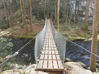
Crossing a nice suspension bridge just in front of the Falls
Glimpse of Foster Falls from the suspension bridge
Foster Falls from water level. I am sure this place is packed in the heat of the summer!
Panorama- Foster Falls
A big attraction for this park is climber access. There is about a mile of rock that is open to climbers. Several parties were on the rocks as we walked along the lower part of the trail next to the cliffs.
Another climbing pair
As you ascend back up to the rim you get a bit of help from some well placed steps
A view from the rim.
Walking back to the start on the rim the shadows are growing long
You get a great view of Foster Falls from above as you circle back on the loop. This is right above the location of the first set of photos of the Falls
Back across another bridge (over Fiery Gizzard Creek) to close the loop hike
The Falls starting their cascade
A perfect evening for a stretch of the legs
Back to our campsite in the campground in the woods
As I mentioned this was not our normal hiking trip. Being in a campground let us bring a grille and all the fixings for a great traditional campsite meal - Thanks Cory for cooking!
I of course had to bring dessert!
A nice fire to end the evening.
DAY 2- Saturday
The shuttle arrived for us a little before 9 am and by 9:15 we were around to the start point at Grundy State Forest and starting off on the trail. 13 miles back to our parking lot of last night.
Paired down to small packs for just an overnight now, we set off
Joe- left. Cory- right
You descend immediately into the gorge that we will be following all day. More excellent rock step work at the start of the trail
It appears we picked just the right time and day for this hike. The water if flowing in the creek and the gorge is greening up
Wildflowers are also abundant all along the trail
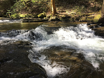
The creek is an endless cascade of fast moving water
The many smaller waterfalls will be a highlight of this walk that I didn't know anything about until now.
Close up panorama of a water fall and an narrow shoot emerging in the gorge
The uncommon selfie in front of the cascade
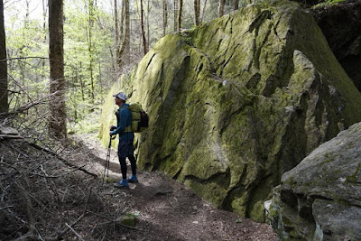
What would become a theme of this hike is the very rocky terrain. This is mild compared to what we would soon encounter and have for most of the day.
The trail is well marked with a white blaze that makes it easy to follow as sometimes the trail on the ground is just rock, but here at least the steps are easy to see
Trillium is a great flower that we don't have in Missouri and I only see when I come to the south.
It comes in several different colors and was beautiful along the trail
Can you spot the trail?
Here is a little help below. Look at the red line. This is how the next couple of hours would go.
The guys noticed my pack blended in with the color of the rocks perfectly.
A brief bit of open trail
More rocky trail
The trail hiding again in the boulders
And one more example of seek and find. (Actually the trail was well marked on the trees you just needed to watch your step.)
However the reward was a awesome display of wild flowers mixed into the rocks along all this section.
Just a beautiful display of color
more water cascaded over a huge variety of surfaces and each one had a charm of its own as you followed the creek
Several other kinds of life can be seen along the creek and this large centipede moved slowly up the tree
Leaving the creek bed finally and starting up to the rim again, more stone work
Steep going
but the reward was more fantastic color even if the trail stayed rocky in spots
can you see the trail?
Here is a hint.
I had to stop every few minutes just to take in the beauty of the color
So much purple!
Spring Azalea
but all the time going upward
and upward!
But once on top you are rewarded with a great scenic view of Raven Point.
A perfect place to have lunch and relax
After spending a good half hour or more it was time for more hiking and here that meant going down into another steep gorge.
This looked to be a brand new section. There was a dispute between the private land owner, that has 34 acres along the trail, and previously allowed access to this section, but now has withdrawn it. This section of trail looks to have been built to skirt around the private land.
More new steps down to the creek
a water slide down the rocks
A lovely new bridge
more fantastic water features
I believe this is called Monteagle Falls, but to be honest while the trail is in great shape and marked really well, there is really no detailed trail maps (that I could find) naming all the features.
Right next to the falls the private land owner had built stairs that come straight down the canyon side to the base of the falls
Stair master extreme
This waterfall you actually have to walk behind!
Very refreshing
A nice way to get up and over barbed wire fencing. You see this alot in the south and on the AT as well.
Historic garbage, in this case an old prohibition still and vats. I looked around for some glass bottles that might still contain some moonshine but no luck.
The still was located right next to this great source of water
would also make a great swimming hole in the hot summer months
A good section of flat smooth trail- quite a nice break from the boulders. We met a family of four here that had been on the trail all day not realizing how hard or long it w ould be. They were out of clean water with no filter, but Dad did have a flashlight and plenty of food. We gave them all our clean water and an estimate of how long to reach the parking lot at Foster Falls, but I also asked a pair younger girls that were passing us at the time and also going all the way to the end tonight to alert the ranger that there was a family with small children that may not make it out until after dark.
One more really big uphill to get out of the gorge and onto the final rim
The views were definitely worth it.
We were not going to the end tonight but had a campsite reserved at the Small Wilds Campground
this campground is only 2.3 miles from the end. It was 6:30 pm when we arrived at the campsite so that means it had taken us 9 hours to go 11 miles! This was not your ordinary day hike!
The good news is the family of 4 was making good time and I am sure they will get out safely either at dark or just before.
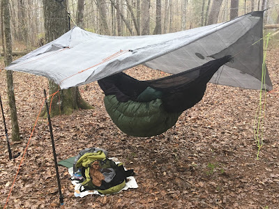
Set up in the hammock for the night
cooking a little dinner just as it was getting dark
DAY 3
Good look at the full hammock set up in the morning before packing up to go
One more fantastic over look in the morning. The morning was forecast for rain and it came right on time, raining on us pretty much the whole way back to the parking lot
The trail was well done the entire way through
Raining hard just as we finish. The last 2.3 miles done in less than an hour.
Getting to the parking lot in a down pour, Joe improvised and pulled into the pavilion so we could change into dry cloths and load up our gear!
It was great hike and the answer to if it was worth driving 13 hours to hike 13 miles is definitely YES.
Thanks Joe for suggesting and planning and thanks to both Joe and Cory for great food and even great company.


