We cached a car at the Hwy 21 ending and drove over to the start near the Shut-Ins.
The Hwy N parking lot is large and gives access to the Scour and Ozark Trail

Sping is trying but as we joked this would be the last winter hike of the season. The forecast was for a low of 21 tonight and even some snow possible.

more spring ?

A reminder for most folks that you are leaving the comforts of the parking lot!

The ruggedness of the area is immediately apparent as you climb up next to the Scour

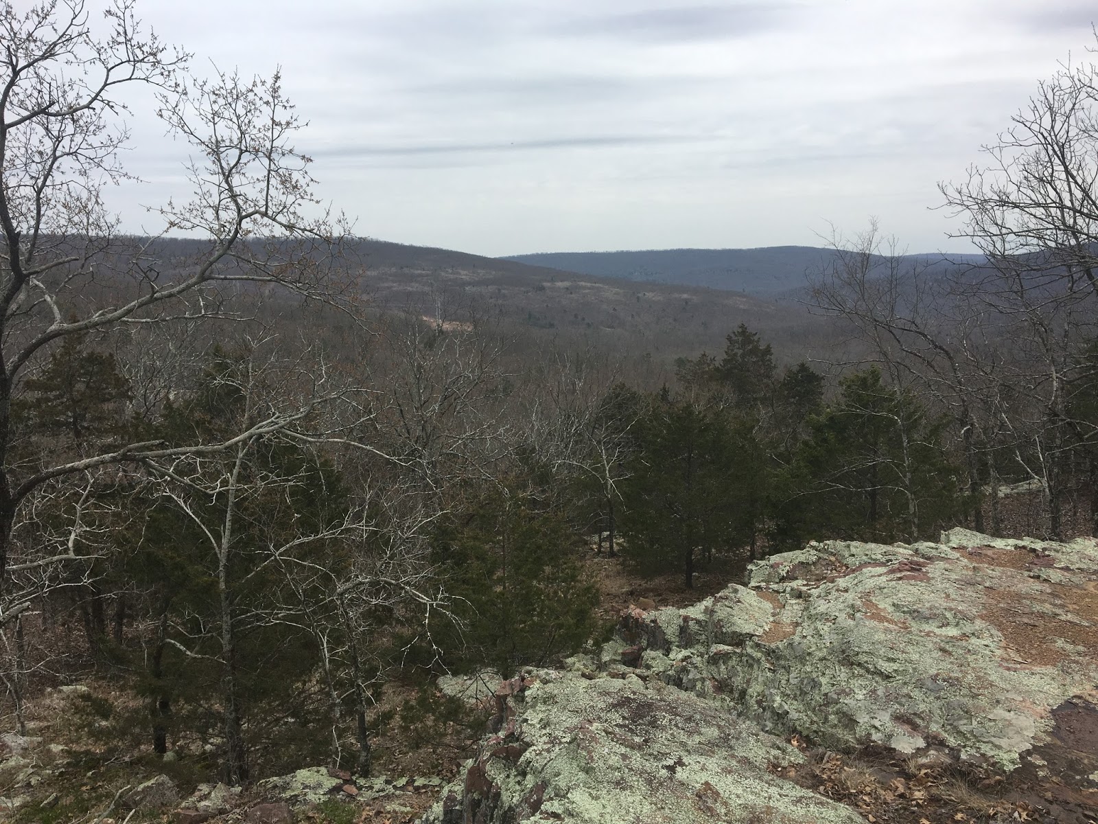
As you crest up Proffit Mountain you come to a lovely scenic overlook

Because this was a short section Hwy N (mm 17) to mm 35.5, so just 18.5 miles, we were going to go 5 miles today, 10 miles tomorrow and 3.5 miles Sunday morning.

A gorgeous setting for lunch and today turned out to be rather warm
pressing on up the trail a section that really didn't need this much signage. Maybe they only had three left in their bag and they could go home!

We got close to our 5 mile point and found some interesting signage. There was a corner marker for the state park and then this sign in a couple of trees (Witness Tree) I am not sure what these are for?

We left the trail at mm22 and climbed up the hill to what is part of the Proffit Mountain summit at 1640 feet.

We had lovely view but the wind was gusting at 30-40 mph and the temperature was dropping rapidly toward the low of 21

A view from the tent. I am using the bridge hammock called the RidgeRunner from Warbonnet Hammocks on this trip. you will notice that because the RidgeRunner has "spreader bars" to make the top and bottom the hammock wider for a very flat lay, it also means that the tarp is very spread open letting a lot of the high wind come in.

A shot of Gideon's set up. one of the benefits of having the tarp in "porch mode" is the great views you get while laying down.

Night falls and so does the temperature.

Epic gear fail last night. Because of the high winds I needed to drop my tarp down to try and block some of the cold wind, but I got the tarp too close to the spreader bars on the hammock and when I needed to get out of the hammock it ripped wholes in the side of the tarp. In addition the wind was strong enough to get under the tarp and into my underquilt on the bridge hammock so I was very cold and couldn't sleep all night. I should have brought my normal gathered end hammock and then I would have been warm and snug like Gideon, who was snoring away in his hammock all night. I might have managed 20-30 minutes of sleep all night!

The next morning was cold to get up! A check of the weather and it was 21 degrees in the near by town, certainly colder where we were on top of a mountain in the wind. I packed up early and Gideon was game to get started once I told him about my night. We hit the trail before 8 am.
We agreed to go ahead and hike all the way to the end today as I didn't want to spend another night being cold and my tarp needed repair anyway. So we needed to walk the 13.5 miles to the car.

The day did manage to brighten but not warm up. Even with the sun out you could see your breath all day. Temps might have made it to 38-40 by the afternoon.

photo above by Gideon
A typical Taum Sauk section of trail a few hundred yards of decent trail and then right back to the boulder fields again.

A very old forestry service marker embedded in a pine

There was ice in my water bottle last night and all of the day as well as many icicles along the creek beds

A beautiful shot by Gideon of the overhanging ice from underneath

panorama of the winter woods before the view is completely obscured by the leaves in a few weeks time

Lots of water crossings around the Mina Sauk falls area

more water crossing of Taum Sauk Creek. We did manage to stay dry the whole trip

A popular feature, on this section of the trail is "The Devil's Tollgate"

Mina Sauk falls from the bottom. It did have a good flow this weekend.

Climbing up the side of the falls the trail is very steep

Looking up where we need to go. Can you see a trail?

Trail marker says it must be here somewhere!

At the top is signage for where we need to go 5.4 miles


A view from the top of the Falls

and again. This will actually dry up in hot summer months

A great view from the top of the Falls and a good place to have lunch.

This tree was bent by Native Americans as a marker. The tree is tied over and allowed to grow in this shape. There were several of these along the trail route in this area.

As we got to the Taum Sauk fire tower we found an excellent cabin protect by this quonset hut roof

It had a picnic table with umbrella and an outhouse. We wondered who might live here? If anyone knows and wants to comment please feel free to let me know.

Missouri has one of the best conservation departments and it shows in the trails and management they supervise


This is the section of trail that neither of us had been on before and it is fantastic. Almost 5 miles of nothing but ridge walking with flat level ground.

Lot of the trail miles are covered in a green spongy moss that is great to walk on and made for a great way to finish the hike contouring around Ketcherside Mountain

A sign welcoming you to the end (or the beginning) of this section

Ketcherside Mountain we like you.

Car shuttling back to our starting point and the celebratory beer finish.
Thanks Gideon for a great couple of days. Let's do this again in the Spring!

Stay tuned for one more practice hike before Scotland. The three amigos are off to Tennessee for the Fiery Gizzard Trail on April 20-22
No comments:
Post a Comment
Because of spammers, I moderate all messages. Your comments should be posted shortly- Thank you