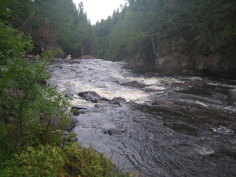
Superior Hiking Trail - August 2011

The Superior Hiking Trail starts off just south of the Canadian border at a place called Otter Lake Rd. It took 4 hours for the Superior Hiking Shuttle service to bring me from where I parked my car, and hoped to walk back too, Gooseberry Falls State Park. This is just a road distance of 101 miles.

I got dropped off at Otter Lake Rd at 12:30 pm and the goal was to go the 11 miles to Woodland Caribou Campsite.

DAY 1
Otter Lake Rd., to Woodland Caribou Pond Campsite ( 11 miles)
The wildflowers were out in abundance around the beginning of the trail.
 

 After about 2.5 miles you reach the highest point on the SHT trail 1829 ft.

You have to look through the trees as it is not a great vista, but you can look far back into Canada


Long parts of this section are done in boardwalks as the ground is very wet and soggy underfoot.

No more than a couple hour old bear scat, directly on the trail ( their here!)
The day remained very nice with just a hint of clouds. High temps were in the low 70's.

Woodland Caribou Pond campsite is 3/4 of the way up a ridge and the water source is just a small beaver pond.

 It took exactly 5 hours to make the 11 miles to Woodland Caribou pond campsite and I got my hammock set up for the first time in the real wilderness. This site was the 4th of this trail section, but really the only one that could be used by a hammock and only then did I just have a couple of trees to choice from.
After I was done with setting up camp and getting water from the beaver pond ( this was some nasty standing water!) I made dinner in the Bushbuddy Ultra wood stove.
DAY 2
Woodland Caribou Pond campsite to C.R. Magney State Park ( estimated 16 miles)

I had a long way to go today ( estimated at 16 miles) so I was up early and made some creme of wheat and a chocolate bar and I was packed up and on the trail by 7:30 am.

The first push up the hill and you are at the hellacious overlook. Sweeping views of Lake Superior and surrounding countryside


7 miles into the second day you come across maybe the most lovely campsite on the trail, South Carlson Pond campsite


 A slice of mushroom is missing

A considerable amount of today was spent on road walking, both some forest service roads and Camp 20 road, which is paved but not very wide
 There are not any campsites on the North side of the Brule River in C.R. Magney State Park, so I planned to just hike until the trail met the river and after 17 miles total this day it did. One of the biggest benefits of the hammock is that it makes it easy to "stealth" camp anywhere you can find 2 trees. Bellow is the view from my hammock with the tarp open
 This was a beautiful spot along the river and since I haven't seen anybody for now 2 days, I wasn't worried about having anyone find me.

Day 3
C.R. Magney State Park to Kimble Creek campsite (15 miles estimate)
Right after I broke camp at C.R. Magney I walked up the hill to the jewel of the Park, The Devil's Kettle Falls. I had not realized I was so close to the falls as I then started to run into people just coming up from the parking lot to visit the falls. The first people I had really seen for 2 full days

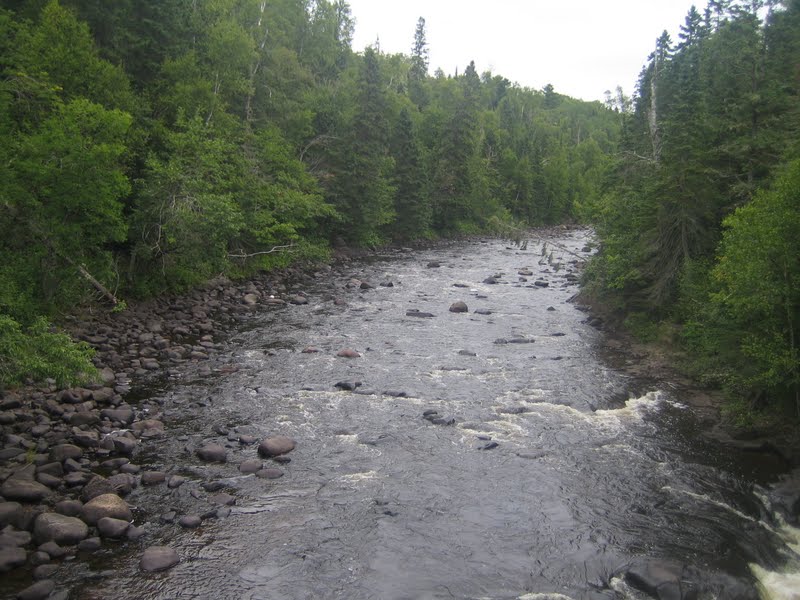
 Leaving the falls and river level you have to walk up several hundred flights of steps to reach the road level again. it is very painful!


Beach Walk. After 8 miles you actually cross Hwy 61 and arrive at the beach along Lake Superior. You have a 1.5 mile walk along the beach. while it is pretty, walking on sand and loose rock is very hard, so after just a brief walk on the beach I went back out and walked along the highway for the rest of the distance until the trail leaves the beach and goes back in the woods and uphill again.

About 4 miles after getting off the beach you reach the Kadunce River. A lovely place to stop and rest and only about 2 miles from my final destination

 resting

Bridge across the Kadunce River

 more bridges across the Little Kadunce river

Leaving the last of the campsites in the Kadunce River area, called Crow Creek, you head up hill and you encounter what looks like a left  turn in the SHT., it is marked with an SHT sign. Don't take it! it is a spur trail that leads you about .7 miles down to a cheap looking motel on Hwy 61 and then you have to turn around and come all the way back up hill.
 My campsite at Kimble Creek was a lovely set up right next to Kimble Creek. By now I have completely lost my appetite, but the The Hawk's Vittles Lasagna was great tonight.

DAY 4
Kimble Creek campsite to Pinchusion B&B ( estimated to be 18 miles)

Day 4 starts out going up and finishes going up. Actually this was the hardest day on the trail so far, with the trail going up and down all day. Every time you would gain elevation, you would lose it again, just to have to gain it all back once more. You pass several multi-use campsites ( Cliff Creek, Durfee Creek)
 The highest section of the trail today was an overlook called Windham Hill (above). it was a much warmer day today, so Lake Superior had a layer of fog on it from the higher air temperature right above the 42 degree lake water temperature.
 This section had a large number of raspberries and gooseberries (thimble berries)


It also had a good number of woodland walking sections

After going uphill yet again, you finally reach the Woodland Creek area
and after the woodland Creek area you enter the Devil Track River area


The area is a very large gorge with step walls and several falls.
 A 50' A frame bridge takes you across the Devil's Track River


To leave the Devil's track area going North to South you have to ascend 150 steps or 300 vertical feet of rise to reach the Pincushion Mountain Recreational Area.

Finally reaching the level walking of the Pincushion X-country skiing area I am about 2 miles from the B&B
none of the trails in the area are marked so once you get off the SHT you need to navigate to the B&B. I spent a few extra miles finding it. ending the day at around 18 miles total.


View from my room at the B&B

Recommendations:

Superior Hiking Shuttle Service-
218-834-5511
superiorshuttle.com
Wynn and Bill

Pincushion Mountain Bed & Breakfast
Grand Marais, MN
Lynn Parish- owner
218-387-2969
pincushionbb.com

Our Place- Restaurant
Finland, MN
locally owned- great fish sandwich


Superior Hiking Trail- Prehike plans August 2011


Well I am committed now. I have just sealed up and mailed off the re-supply boxes for the Superior Hiking Trail thru hike. August 19- Sept 2. 202.5 miles from the Canadian border hiking south to Gooseberry State Park.  I will start off with 4 days of food. I will have 2 spots I will re-supply, A B&B I will stay after the 4th day and the Finland MN post office, which is 2 miles off the trail. I will pick up 6 days worth of food at the B&B along with more soap, bug spray, and some other items- then I will pick up 4 days supplies again in Finland, MN along with a change of hiking shoes if I need them

( click on map to make it larger) 
I have previously done 62 miles of this trail before so the last couple of days ( the hardest, by all accounts, will be familiar territory) Taken together I will have hiked the entire traditional length of the trail.

Here is half the food all laid out for inspection and packaging. I have about 12 ounces of food a day, keeping the weight down as much as possible. I will run about a 3000 calorie per day deficit, so when I stop at the B&B on the 5th night, I will get a Pizza!  ;-)


I should average about 13.8 miles per day. A very easy pace to keep up, with so much daylight. Of course I will be using my hammock this time.
This is by far the most involved hike I have planned. It requires re-supply, shuttles, campground and B&B reservation and parking permits.

You will be able to follow my progress on SPOT as I go. see the link on the left side of the blog or here


The Hammock Lives 7.23.11

Well everything has arrived for the hammock for the SHT thru hike. I set it up in the hammock forest and tried it out. I have to sort out lines and lengths and such, but I will do that today and tomorrow.


Coming next- backing up the resupply boxes for the 2 drop shipments I need along the 201.5 miles.

Hanging a hammock forest 7.17.11

Well since our backyard doesn't have enough mature trees to hang a hammock and I have to practice (I have the Hammock Gear Cuben Tarp and Phoenix 3/4 underquilt coming) and get ready for my SHT thru hike.
I decided to "plant" my own. Can't wait for the goodies to arrive.

First "tree" in and hardening 6x6x12 rough cedar
both "trees" in and my view
This will be my actual view as I lay in the hammock
My 9 ft Cedar "trees" 15 feet apart
I will put some wind chimes and such (maybe a place to put an extra set of prayer flags on them as well. Maybe a lantern would be nice.
It is actually quite hidden from the house.
100 degrees by 10 am, but I started early and got done by 10 am


Thanks Shug and Stormcrow- just when I thought I was done buying more outdoor gear!  LOL :-)
http://www.hammockgear.com/

First Hammock Hang- July 2, 2011

Finally a day off to get the hammock out and put it between to real trees. I have had it up in the basement for a couple of weeks as I have removed the heavy commercial parts from it and installed a real light weight suspension using whoopie slings and tree huggers with toggles. Indian Camp Creek is very close to my house and has several areas to practice a hang. It was a nice day, but hot. 92 at 8:30 am with about 90% humidity.


 Summer flowers were everywhere in the park. I was surpised not to see any snakes, sunning themselves, today


Pitched the hammock in a groove of Cedar trees about 50 feet off the trail. 3 bikers and 2 trail runners passed by and never noticed I was resting just off the trail


Plenty of room for me to lay perfectly flat

 The view through the bug netting, keeping the flying, biting insects off me.
The hammock should be perfect for hikes in Missouri, Minnesota, and the Smoky Mountain Area.

Video of today's hike and closeup of the new hammock

Trail- 4 miles in 1:30 minutes-
Grand Trunk Hammock- skeeter beater
Hammock Suspension- whoopieslings.com
Support Our National Parks - Preserve - Protect - Enjoy