This hike could not have come at a better time. I have not had much exercise, other than yard work and to be honest I have been mentally run down over the last couple months. Work, life, just a bit much, so the cure for that is to be outside and go hiking. I also really like to hike with Jeremy. Our paces are very similar and we just seem to have good adventures. We recently did the Eagle Rock Loop in Arkansas and that was a very fun hike.
We don't mess about either, we get after the walk and cover some good miles. I knew this and also knew that while it is exactly what I need, it might be a bit of a challenge coming off the couch to hike this section of the 26.5 mile section of Ozark Trail.
First though, we up on Thursday at Jeremy's property. A few years ago he purchased five acres down near the town of Cabool, Missouri. We met to spend the night before the hike on his property as Cabool is very near the North Fork section of the Ozark Trail.
The property is great. Lots of possibilities for a pond, some trails, and it is on the top of a hill in a very remote area.


He has created a little deck area for hanging out, while he clears and thins out the land for a future house.

I never mentioned we were going to rough it, the night before the hike.
Jeremy was kind enough to provide ribeye's for the grill and mac and cheese and green bean.
My contribution was a bourbon barrel aged Saison.


He also has built a little shed that houses a portable shower that can provide hot water with a bit of planning and serves as a great coffee station out of the wind.

And attached, a potty room. Perfect for his kids and nice for adults too.

The weather for this trip, being early Spring, as been all over the place. The final pre-trip report was rain tonight, possible thunderstorms, and then rain tomorrow starting around 1 pm but the next two days forecast also included some very high winds, here and also across the whole mid-west of the US.
In order to start with my tarp and other gear dry, it was decided that tonight's accommodations will be in the back seat of my truck.
(edit)- over the next two days severe weather and wind caused many tornados in neighboring states with lots of property damage and a rather high number of deaths. We were certainly spared this weather for our trip.

Well it did storm, but only till about twelve midnight. The temperature actually went up during the night and it was a humid low sixties in the morning, but very stormy skies overhead.

The southern end if at Collins Ridge Trailhead, which is really not by anything! It is on the southern edge of the Devils Backbone Wilderness, about 20 miles west of West Plains, MO. We left Jeremy's car at the Pomona trailhead and drove my truck down to the Collins Ridge trailhead, not knowing what the more privative roads would be like. As it turned out, with the exception of one low water crossing, the dirt roads were brief and easy. Jeremy did call the local sheriff's office on the way down to let them know were we parked and when we would return. They were super nice and said they would send cars both from the and the highway patrol to check on them.

This section of the Ozark Trail is isolated from the rest of the continuous section. The southern terminus currently lies 46 driving miles to the east on the Eleven Point section. There still needs to be approximately 60+ miles of trail developed to connect the sections together. However this section of trail has been here, in one form or another, for a long time.


Off we went at 9 am on Friday morning. North Fork mile marker 26.5. I really had no idea what to expect, other than the usual Ozark Trail experience, which is a lot of up and down and really rocky trail tread.


Whoever laid out these sections of the Devils Backbone Wilderness is a genius.
The official Ozark Trail section is made up of the Collins Ridge Trail and the McGarr Ridge Trail. Believe it or not, it is a walk on the ridge! You do very little climbing and then you walk on the Devil's Backbone ridge for almost five miles. You might think you are walking the PCT in Oregon. Well not quite, but this is the flattest smoothest walking I have done in Missouri

Almost the only wildlife we would see the entire hike.

After only half a mile you come to the fork in the trail coming from the trailhead. The arrow takes you on the Devils Backbone loop, counterclockwise. We were going clockwise to stay on the trails actually being used by the official Ozark Trail

We did not dismantle this one!


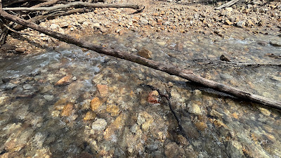
Crossing Crooked Creek, just near the North Fork River, no problem rock hopping.

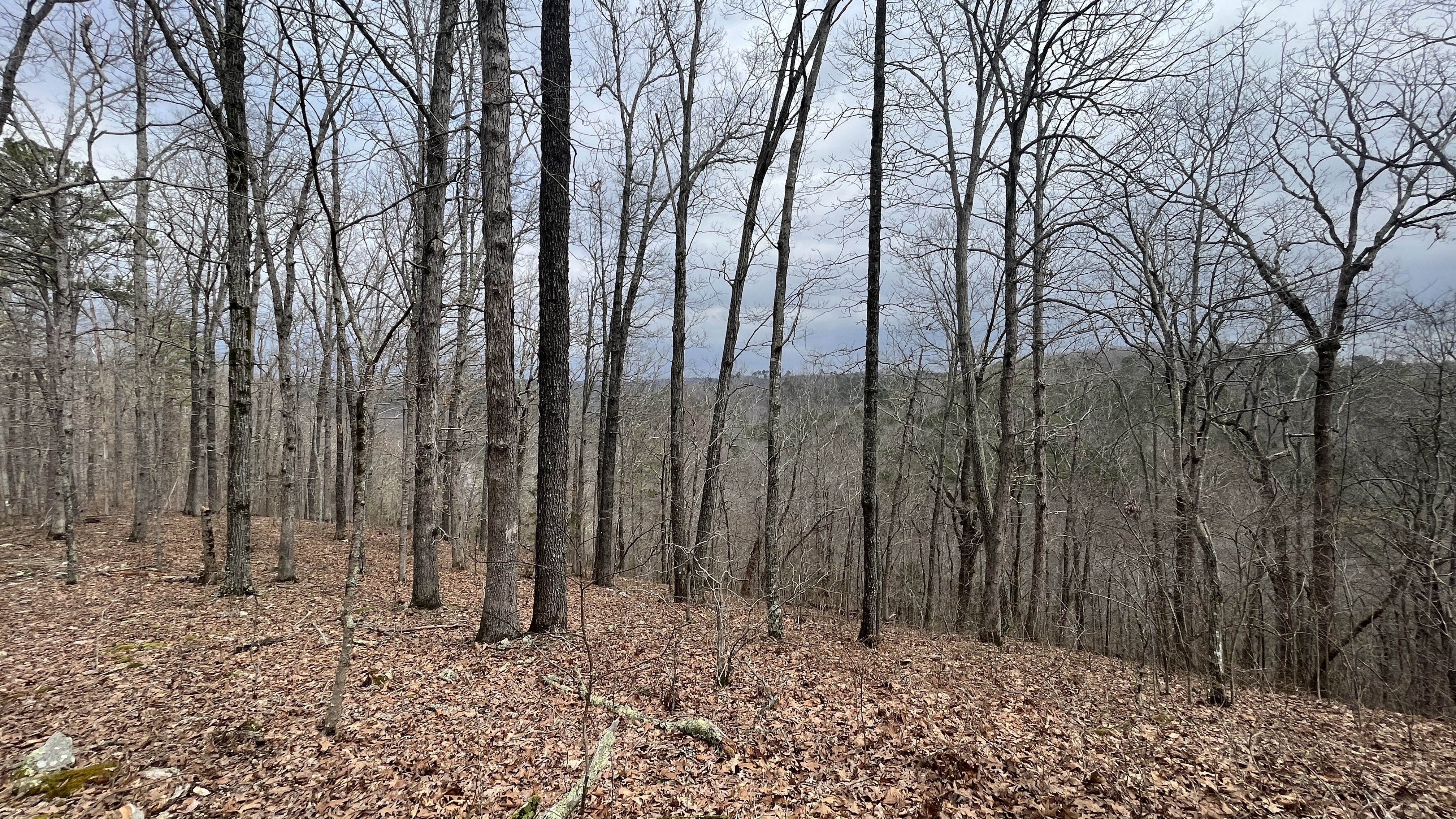
Long ridge walk and plenty of views. The perfect time of year to see out both sides. In a few weeks this will be totally covered in leaves and you won't get any of this view.


More pretty spring flowers


A tree that looks like it was recently hit by lighting. The tree had "shattered" and large sections were strewn about including a couple that had been driven into near by trees or the ground yards away


I will leave it to your imagination to decide whether we left them standing!


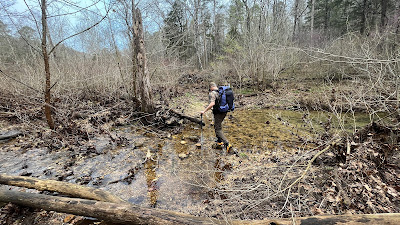
This is Tabor Creek (17.5mm). It was not seasonal today. It was multi-branched and shin deep, running with some force. No problem to get across, but definitely a wet crossing.

Just after Tabor Creek, there is a water source locator sign posted (north bound hikers) on a tree just as you hit the forest road 14-361. There is also an old Spa and Spring House just down the road, but we filled up water at Tabor Creek, so we didn't venture down the road, but continued on the trail uphill.

 Can you see the trail ? This is all still the Ridge Runner Trail, but I have to admit it didn't quite stay on the ridge the whole time, but reverted back to normal Missouri hiking; skirting around the ridges, dropping into hollows and then back up and around all over again, for about three and half miles


More old trail sign just North of Hwy 14.


We had to press on. We walked on another 2 miles until we met the Ridge Runner Trail going toward Norbett Lake. There is a spring .25 miles off the OT trail (red arrow, spring icon), so we took it and the spring was flowing clear and cold into a stream. We filled up with 3 liters and headed back to the OT. We only regained the OT and looked for the first sign of some good trees to hang from. (Green triangle). End of Day 1 - 14.25 miles.

Just flat nice walking on Collin's Ridge


Up a hill to McGarr Ridge


Turkey Tail

Spruce blossom

A little friendly garter snake. He was not moving very fast today.

After about five miles (21.5 mm) of fantastic walking you emerge from the Wilderness at the Hwy CC trailhead

There is a big horse staging area just across the road with picnic tables. I think it is around 11:30 am now.


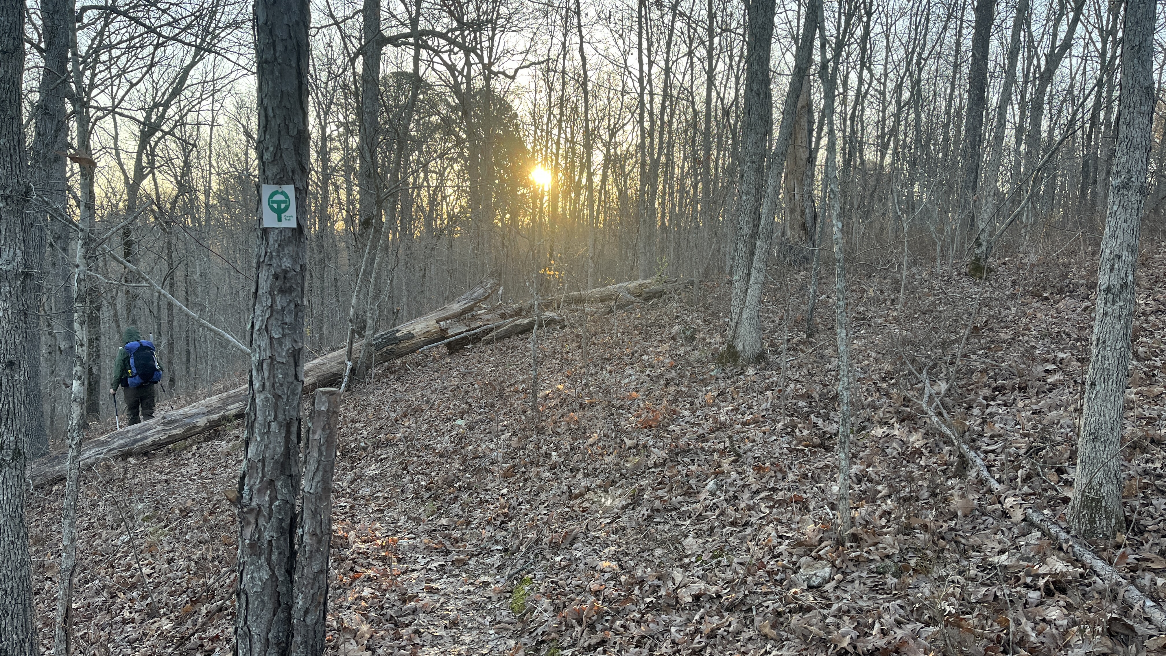
I mentioned that this section is old. You can see old style trail markers, mixed with new OT markers, along the entire 26.5 miles of this section

More pretty Spring flowers

Several animal ponds along this next section. Even for the amount of rain we have had over the last few weeks the previous Wilderness Area was pretty dry. Water just at the major creek crossings but any smaller ones were dry.


A few very large rock cairns along this section of the trail (19-17mm)


Very new OT trail markers above very old trail signs


This section is called the Ridge Runner Trail and with good reason, more super ridge walking for miles

Very old grey diamond trail marker. I remember these as the original trail markers when I started backpacking


The trail in this section was easy for us to follow, but we both know what Missouri trails look like in the winter and spring. You won't find much of a tread, but if you look closely you can see a subtle indentation in the leaves covering the path. I didn't it much thought as we churned up several miles on this type of trail, but if you are not used to trail walking it might be a bit confusing, of course you can always count on the OT trail markers on the trees. The OT has done a fantastic job of signing the trail making it really hard to get off the trail. (or so we thought. Wait until tomorrow.)


Crossing Hwy 14 at the 13.5mm we had thought this would be the end of our day. I had been told that there as a campsite with fire ring just off this road.


This was the only thing resembling a fire ring in the area and it was WAY to close to a major road to camp here. Also, we had only gotten a liter of water at Tabor Creek, so neither of us had the amount of water we wanted for the night.


It was around 5 pm. when we go the hammocks up and finally sat for a good rest.

That was a bit longer than I wanted for my first trail day after coming off the couch, but all went well.
I have not talked about the weather. The rain around 1 pm, never materialized, nether did the wind, instead, the skies cleared and it got hot. 75 degrees (23.8 C).

WARNING - GROSS picture alert!
Walking about 5 miles with wet feet, over mixed terrain, from Tabor Creek, with the hotter day, my feet were in bad shape. Too many callouses to count and the skin macerated by the water.


Made an excellent home made Pesto Pasta with Chicken


After a bit of a rest about 90 minutes! I got up and finished setting up and hanging up everything.


Got the Snow Peak purple pot out for its inaugural boil


The forecast was for very high winds and wind gust starting early Saturday morning, but for now the evening was lovely. Going to bed with clear skies and 65 degrees.
Saturday morning dawned but only after it blew a hooley! the wind started up about 4:30 in the morning and you could hear each wave start over the far off ridge, to the North, like a freight train and then it would move closer through the tops of the trees until it hit my tarp. I dozed mostly through it all, but a deep roar started about 5 am, and I could tell it was different from the rest as it was a very low rumble like a freight train and it got louder as it approached. It hit my tarp almost with an explosion and immediately blew 4 of the 6 tarp stakes out of the ground. Fortunately, it passed just as quick as it came and I was able to get out of the hammock, get all the stakes back in the ground and get back in the hammock, warm and snug before the next one. I did sleep through the rest and woke just before 7 am. It was still windy but much calmer with the temperatures around 38 degrees (quite the change overnight!)
 |
| Saturday Morning |

I put on all the warm cloths I have and get out of the hammock. Smartly, I had packed my 20 degree under quilt and 10 degree top quilt, so I had slept warm all night.

All packed up and no sign I was ever here


Who put this river here? The big surprise and not even 8 am. This is Dry Creek. Yes, that is the name. Listed as normally dry and seasonal, this morning shin deep and flowing cold and strong!

Jeremy man's up and goes first.


 |
| yours truly, photo by Jeremy Korn |
Remember when I said you couldn't get lost. (technically, not lost, just misplaced). Just after crossing Dry Creek (in blue, below) you can see the old forest road above that is our exit point. We stopped to clean out our shoes and when we continued we missed the trail to the right off the forest road that would have kept us low along Dry Creek. We stayed on the jeep road as it was graded really well and continued up to the top of the hill.
You can see below the red line of the trail and we took the old road marked in yellow. About half way up I realized that we had not seen any OT markers and they had been VERY consistent the entire trail. Pro Tip- If the trail markers have been very consistent and suddenly you don't see them, you are in the wrong spot.

Time for some old fashioned bushwhacking. A quick check of the map and the GPS, down the hill we went, about 500 feet decent to find the trail right where it should be. However, had I studied the map in a bit more detail (which means spending the time to get my glasses out!) I would have seen that the old road winds around, on the ridge, and meets the OT further on. There might have been a question of private property on some of these old forest roads, but that was a thought after the fact. You can see the ridge we descended in the photo below
 |
| Looking back up the way we came down. |
Next on the trail was an overlook named Lover's Leap. Great views and if you are going North bound as we were, you could get water from Dry Creek and bring it up here to camp.


Don't fall!

 |
| Photo by Jeremy Korn |
Marker and Witness Tree just North of Lover's Leap.


More lovely walking through a prescribed burn area around MM9.

Farmer's field from the burn area mm9.

The forest road that would have brought us to the OT (oh what might have been) but we stayed true to the OT on this trip.


Crossing FR-5490 at mm7.75

After another mile or so, the trail crosses FR-5470 at mm6.25. It was just 10:30 am but not having any breakfast or coffee as we were packing up in the cold morning and the wind, it was time for some lunch. I hadn't gotten a picture yesterday and almost didn't today of my BBQ brats on a bun. A total trail lunch success!😄

Lunch time with Jeremy


Unfortunately just passed mm3.75 as you cross FR-780 some "moron" had started marking trees with a hatchet. I am not sure why someone feels the need to needlessly scare trees when there is a trail marker every 500 feet. This person did a number on trees for the next 3.5 miles. Another example of why we can't have nice things and perhaps a reason to "pack"
"I am sorry officer, I met a crazed person with a hatchet on the trial"


Hard to miss the perfectly groomed white trail!

Ok, rant over.


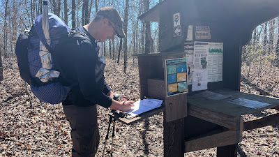
Jeremy signing the log at Pomona Trailhead.

Jeremy's car, no problems at the trail head


We made it! It is an easy walk from FR-780 to the end. Gradual grades both up and down, with one or two exceptions). This has been the most flat walking I have done on a Missouri trail.


Finished at 1:10 pm 12.5 miles

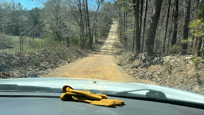
That one low water bridge going back to get my truck

Leaving Collins Ridge trail head and heading home.


Thanks Jeremy for a great time. Let's pick another trail soon.
Thanks to the Ozark Trail Association for a really well done trail.
Trail Stats:
Day 1


Day 2


No comments:
Post a Comment
Because of spammers, I moderate all messages. Your comments should be posted shortly- Thank you