Day 2 started as another fantastic weather day. Today I am headed over to Glensulaig Bothy a relatively short day of just 13 miles. There is another road walk on the A830 of about 2 1/2 miles due to a bridge being out on the walking/biking trail. I have time this morning to have a full breakfast in the train car as I figure my day will be a short one with only one big climb over a bealach from Glenn Fionnlighe into Glen Sulaig. Part of my plan this year is to be more mindful of my day and not rush. When I hike alone I tend to power through the day, walking fast and stopping very little. There is really no point, as the end of the day is fixed (in most cases) and walking and looking around is much better than getting to camp and sitting. Last night at dinner, while talking with Sue and John, they were also going to Glensulaig bothy as well. We decided to have breakfast together this morning. While having breakfast I asked if I could walk with them today and they were kind enough to agree. John is from the US and Sue from the UK. They met on the Challenge in 2017 and have been walking together each year since then. It is one of the great things about this event, how lasting friendships form. I think that has a lot to do with the more "mature" average age of TGO Challengers, which I think this year is somewhere in mid 50's.

Today's route and elevation profile
Walking out of Glenfinnan was lovely. the views were great.But so was the traffic. The Viaduct car parks had already begun to fill up with vans and cars to walk to the bridge
After a few miles you turn off the road and head up Glenn Fionnlighe. The track here is very nice and gradual and gives you time to look around John and Sue, stop every couple of hours, which is a quite sensible thing to do and I was happy to sit as well.

The track carries on and follows the river Fionn Lighe, where we stopped for lunch
It eventually leaves the trees behind and you break out into the moors. On an OS map, you know you are entering a "wetter" area because you see a symbol everywhere, on the map, that looks like an eyelash
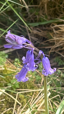
Bluebells everywhere along the river
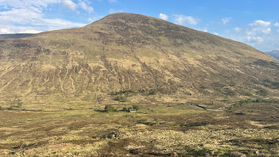
This path eventually leads to the Munro called Gulvain (986m) 3234'
This is where the day got a bit harder. There is clearly a rover track (jeep trail) to this point and you can see a switchback trail up to the summit of Gulvain (see map below) however our path completely stops at this point. (red arrow). Now on some OS maps you still see a single dashed line on the map, indicating a path. In these wetter areas you can't count on that still being a path you can follow on the ground. This became a very rough walk over ground that was very contoured and in some places had been washed completely into the river.
The next few miles became very slow and tiresome. Looking up the pathless glenn
Because I had studied almost every foot of this route on google earth over the winter I had noticed some tracks on the opposite side of the river on much flatter ground that seemed to be a "shortcut" to getting us up the bealach (pass between mountains) that we had to ascend.
When we got to that point I crossed over the river and walked a bit up the hill to see if I could verify what I saw on Google Earth. It was not pretty, but I could make out a rover track that was here and that did head to the path we wanted. I signaled for Sue and John to follow and after a bit, we were all on this side.
You may not see it in the photo, but the yellow line is the path going up the hill and believe me it was better than what we had been walking for the last couple of hours and would have had to walk for another couple.
Gaining the track that goes over the bealach was a welcome site for all of us.
We were rewarded with exceptional views from the top.After a short walk on top, you do have a very steep decent into Glen Sulaig. you can see our objective for the day below as the Glensulaig Bothy.
Looking North up Glen Sulaig as we descend toward the bothyarriving at the bothy
We decided to camp out on a grass circle. I thought to myself, this looks like where cows would come to bed down?
and sure enough as soon as the sun was going down, here came the cows
John has a fear of cows and stayed tucked in his tent, Sue, however, has experience with wrangling cattle and shooed them all away for the night... twice!
A super big thank you to Sue and John for letting me walk with them. Despite some rough ground, it turned out to be a great day. I was pleased again today that I did not get fatigued during the day, although we really only had one substantial climb late in the day.


No comments:
Post a Comment
Because of spammers, I moderate all messages. Your comments should be posted shortly- Thank you