A Big Day
Today I will be covering over 5000 feet of elevation gain, over just 8 miles.
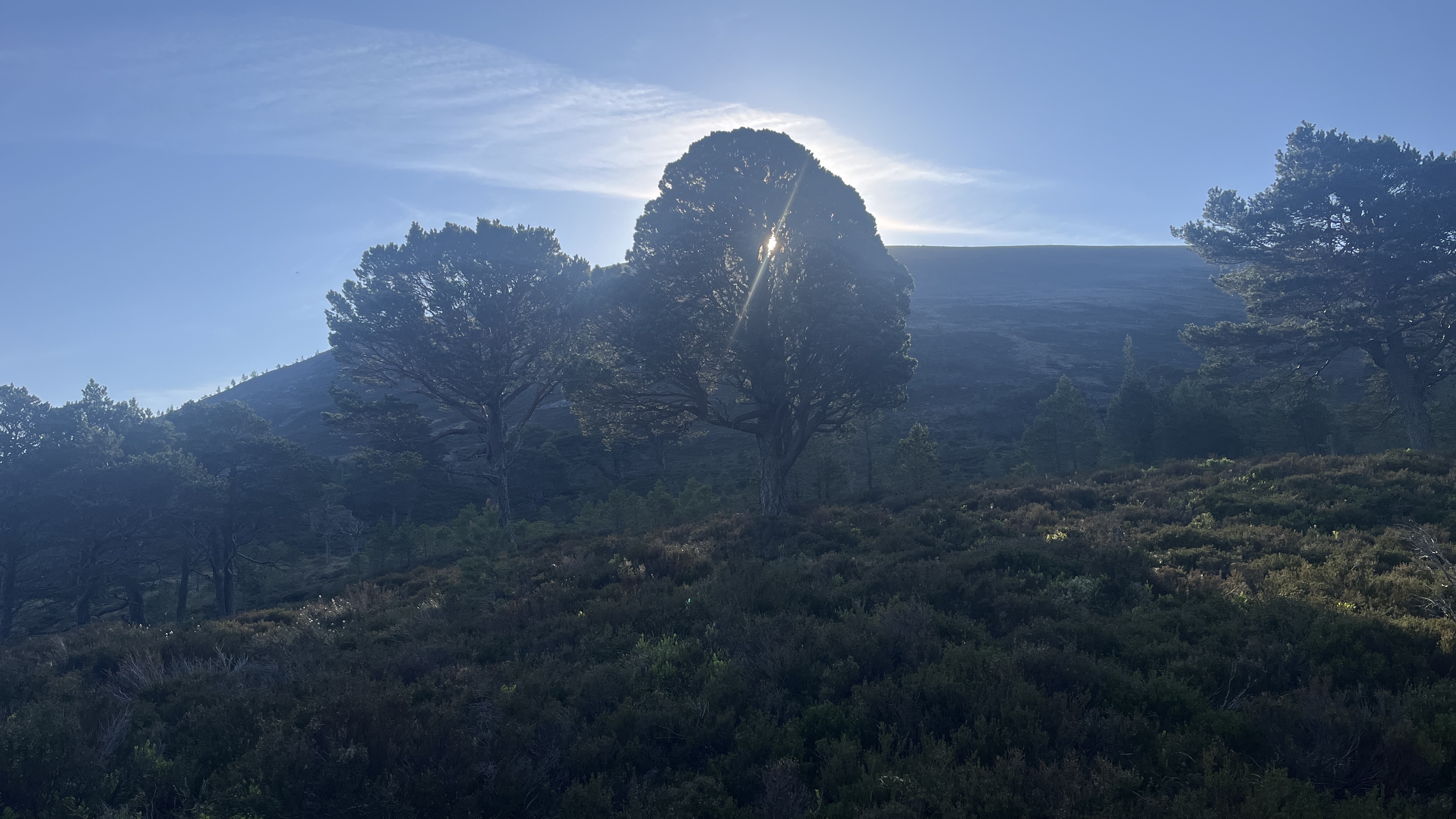
One last look at the fantastic camping spot from the night before next to the Aultdrue (Allt Druidh- lots of different spellings for features, depending on the map you choose) The day has dawned with blue skies and it finally seems like my curse of 2022 (no views above 550 meters) will be lifted this year.

I start off with an extensive walk through more of the excellent Rothiemurchus Forest

It is a wonderful walk and I am alone in the woods


I am on the westside of the Lairig Ghru (a prominent path south, running at the bottom of two ridges). I will need to cross over to the eastside, but now I can see some of the other hills to my West and even see a few hikers walking on the Chalamain Gap.

Unfortunately, I have to lose all the elevation I have gained breaking over the treeline, to come down to the river Dee again to ford over and start up the eastside as the Lairig Ghru narrows into the canyon. Below you can see the start of the steep climb up my first hill. I will gain about 1500' here.

looking down the ravine that is the Lairig Ghru

Continuing to climb up toward Sron na Lairige


I leap frogged with a family that was being lead on a day hike up the ridge. No switchbacks here, just straight up.

Looking down at the Lairig Ghru path

Making to the top of Sron na Lairige 3884'

Here again you have to lose a bunch of elevation before starting up again toward the Braeriach Ridge
This photo definitely doesn't do justice to the steepness of this ascent.


After lunch and a sit, I wondered off, but I was drawn to the edge where the views where some of the best I have ever experienced in Scotland. You can see from the map below, my actual route is in solid red and the dashed line was the established route. I walked directly along the rim for a bit. (purple circle area)


More views from the edge


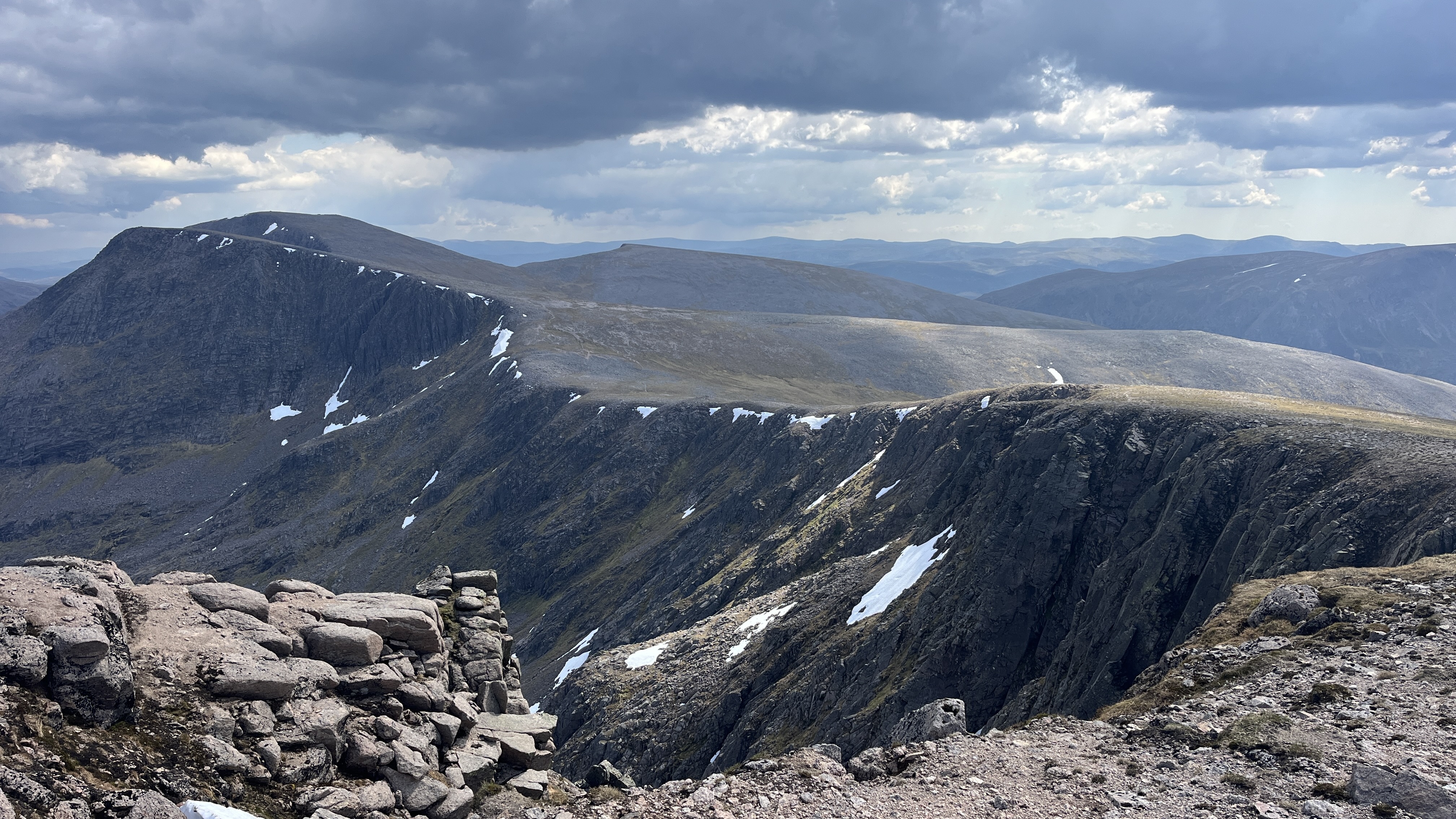
The next major section was the ridge around Carn na Criche 4150'

It is just a steady climb straight up to the ridge and the summit cairn

What a spectacular view you get from standing at the edge, just in front of the Cairn, at 4252'

I was out of water and hungry as it was about lunch time. I have only covered about 7 miles in 5 hours.

There were a few large patches of snow around the summit cairn, so I melted some snow for about a liter of water and had lunch out of the wind, sheltering up against the back of the summit cairn.

After lunch and a sit, I wondered off, but I was drawn to the edge where the views where some of the best I have ever experienced in Scotland. You can see from the map below, my actual route is in solid red and the dashed line was the established route. I walked directly along the rim for a bit. (purple circle area)

This was the bit directly along the edge. spectacular!

More views from the edge

It was a pretty zig-zag course for a bit, as I picked my way through the rocky top, until I got water coming from the Springs of Dee. (you can see that on the map as well). You can see that as the last bit of red line that veers away at the bottom left of the map above
more cornice snow along the ridge


Here is the ridge in person starting with Pinnacles Buttress and continuing on from the map above. the peak you see at the top left is Angel's Peak

I am past the ridge and at the base of the climb to Angel's Peak. Looking back at the my start on the ridge. Here I also started to run into people that were running this section as part of a Challenge. They were running a circular route around both sides of the Lairig Ghru, starting and finishing at the ski center atop Cairn Gorm, one runner was doing it with his dog! - craziness!😲


Fortunately, it was not the physicality that was the problem. Nine days into the challenge I was not tired due to exertion, but the mental effort not to twist an ankle or fall made it fairly slow going.

Made it to the top of Angel's Peak, (Sgor an Lochain Uaine). It was a view well worth the effort


Same view but on the map below. The arrow indicates the direction I am facing on the picture above

What you can't see in the photo from Angel's Peak or from the map, is the boulder field for the entire approach to Cairn Toul (below)

Persistence pays off and in a bit I am on top of Cairn Toul, the highest point of the day at 4235'


At this point, I probably don't have to mention that it was a complete boulder field all the way down the backside of the hill as well


Looking back up to Cairn Toul. (below) You can also notice the weather has been threatening all afternoon, but thankfully it just looked dramatic and never amounted to anything. I was thankful that I didn't have to do these boulder fields in the rain or when the rocks were wet.


On top of Stob Coire, looking back at Cairn Toul


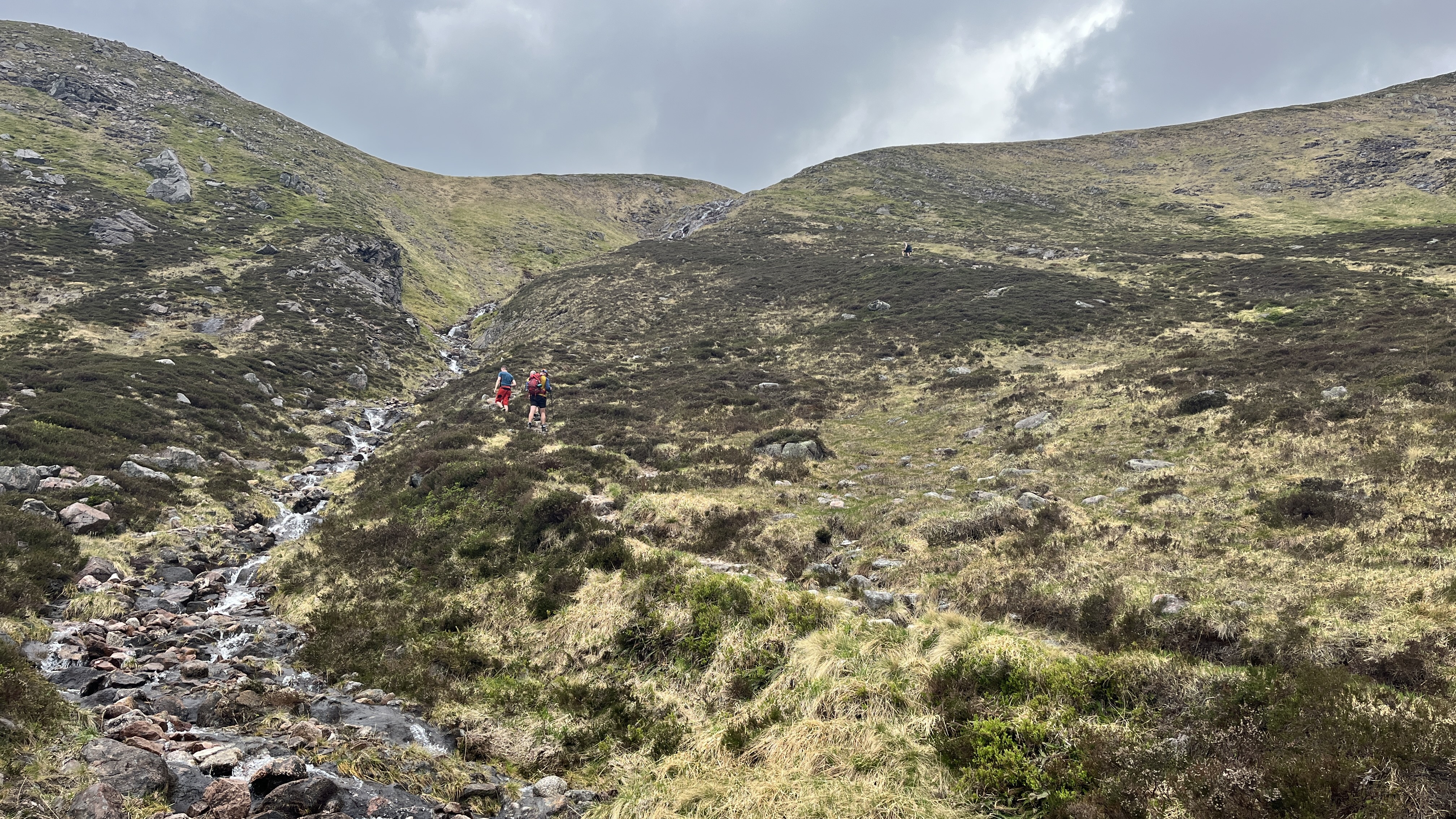
Down to the Bealach, looking back at Stob Coire, finally out of the boulders.


Looking back up the bealach. You can see how steep it is. Notice the other hikers going up? Why are they going up so late in the afternoon...
 |
| corrour bothy |
The bothy is already full and there are lots of tents all around this bothy, so all the good spots are taken for my tent. It is nothing but pride and stubbornness that makes me decide to push on to finish at my proposed destination of Bob Scott's Bothy.

Just as I press on and descend to the River Dee, it starts to rain, making me rethink my decision but it is short lived and I am going anyway at this point.

The end in sight, crossing the bridge to Derry Lodge


John and Sue pitched up.


and with a few more steps, Bob Scott Memorial Hut


Today's route. 18-ish miles and 12 full hours of walking


Postscript to today- while melting snow, back on the Braeriach, I set the top to my stove down and that is where it remains. I again needed the kindness of John to boil some of my water for me or I would have been without dinner- Thanks again John and Sue
No comments:
Post a Comment
Because of spammers, I moderate all messages. Your comments should be posted shortly- Thank you