We are properly in it now. Been on trail long enough to do laundry and get my first resupply done, so it feels like a proper hike. I had a great night at the Ben Nevis Campground. A slight downside, I found a tick on my hip, (bastard) not sure how he managed to get past all the permethrin but when I pulled him off he just didn't want to leave and his head stayed behind! So I needed to perform a little self surgery in a contorted angle, but managed to clear him out and put on some antibiotic ointment, so I am good to go.
Today promised something new, a bit of "unusual" geography from the usual Scottish glens and rolling heather hills. This morning was going to have a real canyon gorge. I was looking forward to it. It was also going to be another good sized distance day, around 22 miles (35km)
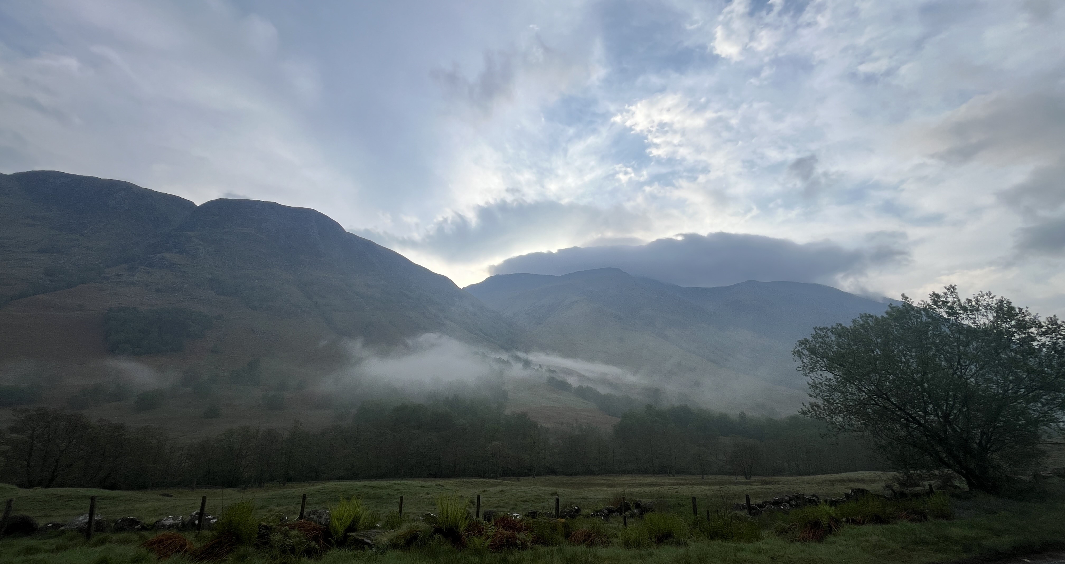
Today is a day of many parts, the first after leaving Ben Nevis Campground was along the road for a good amount of distance about 4 miles, but while it was road walking and hard on the feet, it was still very beautiful. It had rained last night and the misty clouds held close to the ground this morning. Leaving the campground I couldn't see any views, but shortly after starting out the clouds lifted and the views got really good!
This is looking ahead to the Glen Nevis, which I will soon get too.
Lots to look at along the way.I think this one is Carn Dearg 1020m (3346')
At Achriabhach, there is a parking area and toilets, a very nice addition. Unfortunately, there was no toilet paper (never fear, I had my own) but no trash cans anywhere. Entering Glen Nevis proper, you get a fantastic waterfall from the bridge
There is short nature walk along the River Nevis that takes you off the road and it is lined with wildflowers, mostly bluebells now, It is gorgeous and climbs high on a hillside, with some terrific views.The weather was a bit "iffy" here, it tried to rain a few times, but never really started.
You cross back over to the road for just a short bit, about 1.5 miles, until you reach the Water of Nevis parking area Suddenly you are in this world of granite walls and a ravine of raging rivers cascading through these giant boulders and sheer gorges. A place called Eas an Tuill
(photo from the internet)
It reminded me more of hiking back home than Scotland, this was completely new to me here and I had never seen anything like it in my previous crossings.

Clearly people had taken a lot of time to create this trail going up the gorge. I didn't take a lot of photos in the gorge, as the rocks where slippery from the mist and spray of the cascading water and you needed to watch your step on the uneven rocks.
When emerging from the gorge you are treated the fabulous site of An Steall (the white spout) waterfall. The water falls close to 400'
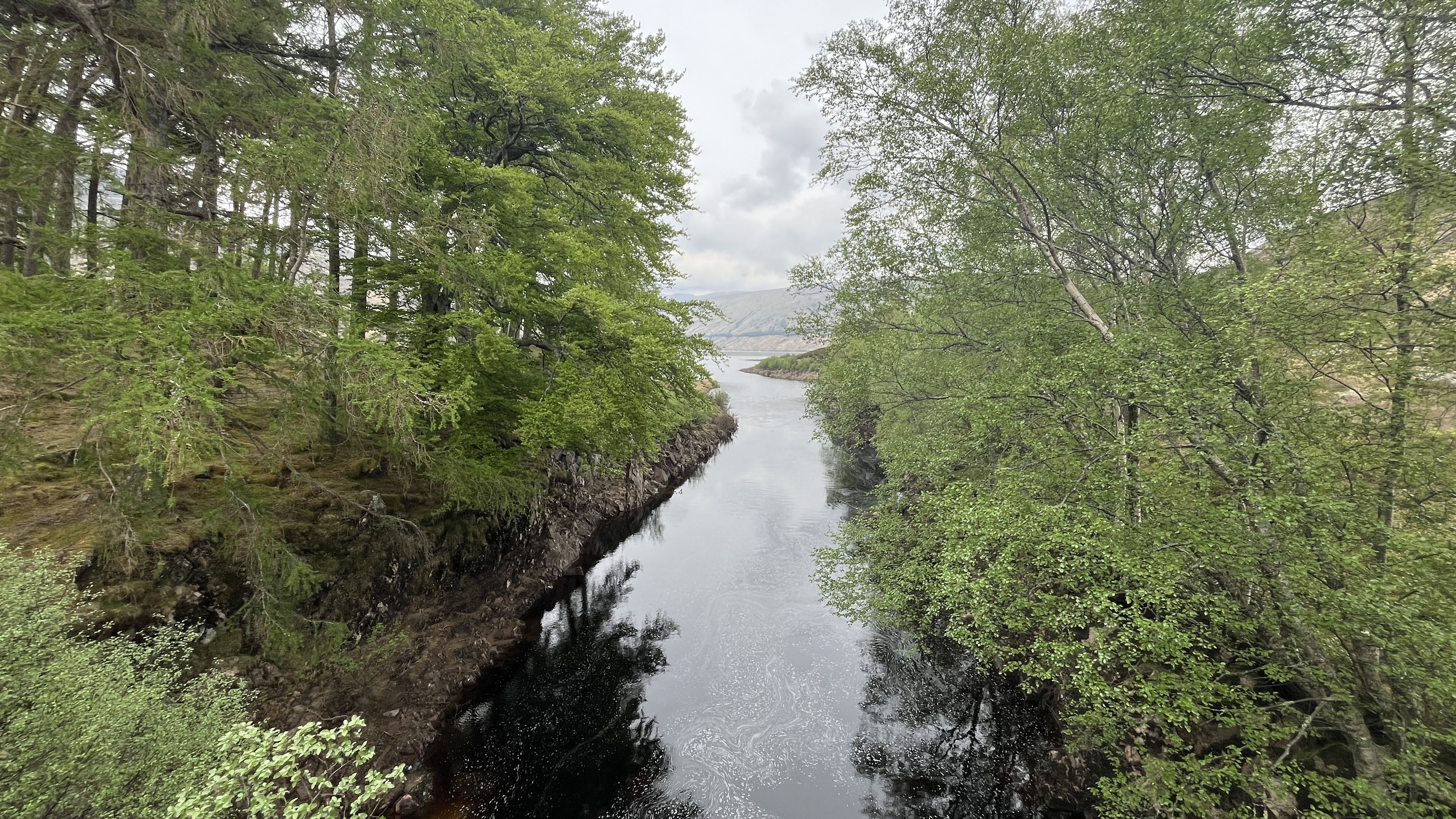
As you head up Glen Nevis the scenery changes yet again back to the more traditional heather and bog, but the views don't diminish here. This whole area is owned by the John Muir Trust.
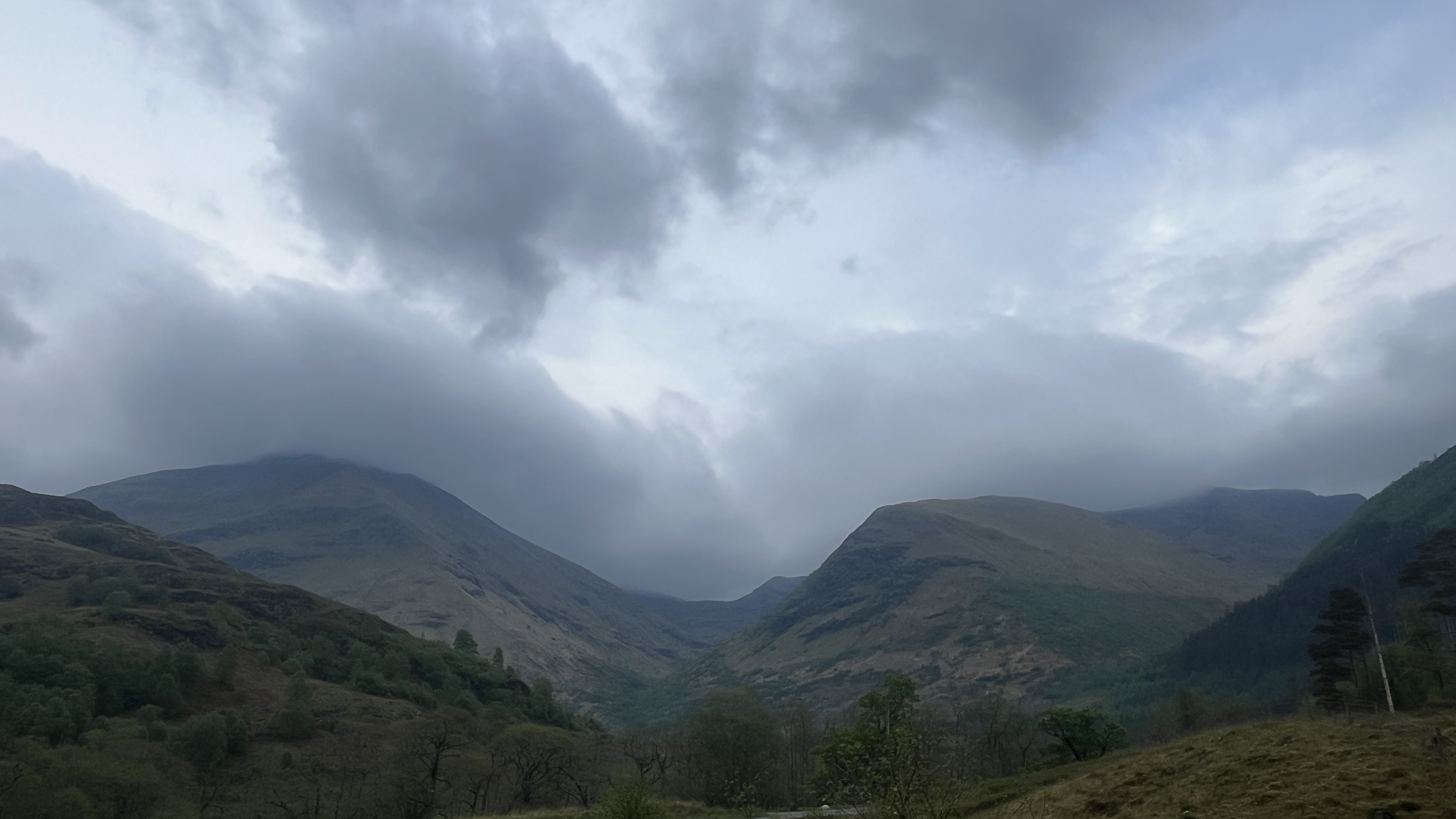
One last look behind, back to the end of the gorge and the waterfall. I think that is Sgurr a' Mha'im (1099 meters) 3605' in the background on the middle left.
Looking ahead now to the third (and longest) portion of my day.
This will be a recurring theme on this crossing and also a running joke. You must always close the gate behind you, when you pass through 😆
For the next 5.5 miles the scenery was not remarkable. (above).
The weather came down and it was dreary and it was incredibly wet underfoot. Very little in the way of path and a few times I found myself following the wrong track. I have already had difficulty following the OS map track on the first few days and today was also no exception. I found myself about 300' to high up the side of the hill, when I should have been closer to the river.
About half way through this section you have to cross at the confluence of the Waters of Nevis and Abhainn Rath (river). This is a wet crossing, no way to avoid it. (above) This is where I crossed about 100 yards up from this "official" spot at the actual confluence, which was very wide and a bit deeper. I was only in to my ankles.
After crossing it was lunch time. I stopped and got out of my wet shoes and socks for a bit. Lovely lunch view
It was a good place for water and my favorite lunches on my Crossings, meat and cheese sandwiches. I had stocked up at the Co-Op in Ft William the day before. After lunch I pressed on, more boggy ground where the "path" was hard to find, intermixed with just a faint tractor path going through the wet ground, toward Luibeilt (a derelict mason house). Luibeilt is a crossroads for going to Kinlochleven to the south or Spean Bridge to the North.
Luibeilt
After Luibeilt there is another wet crossing After an initial marshy bit, the track does get a bit better
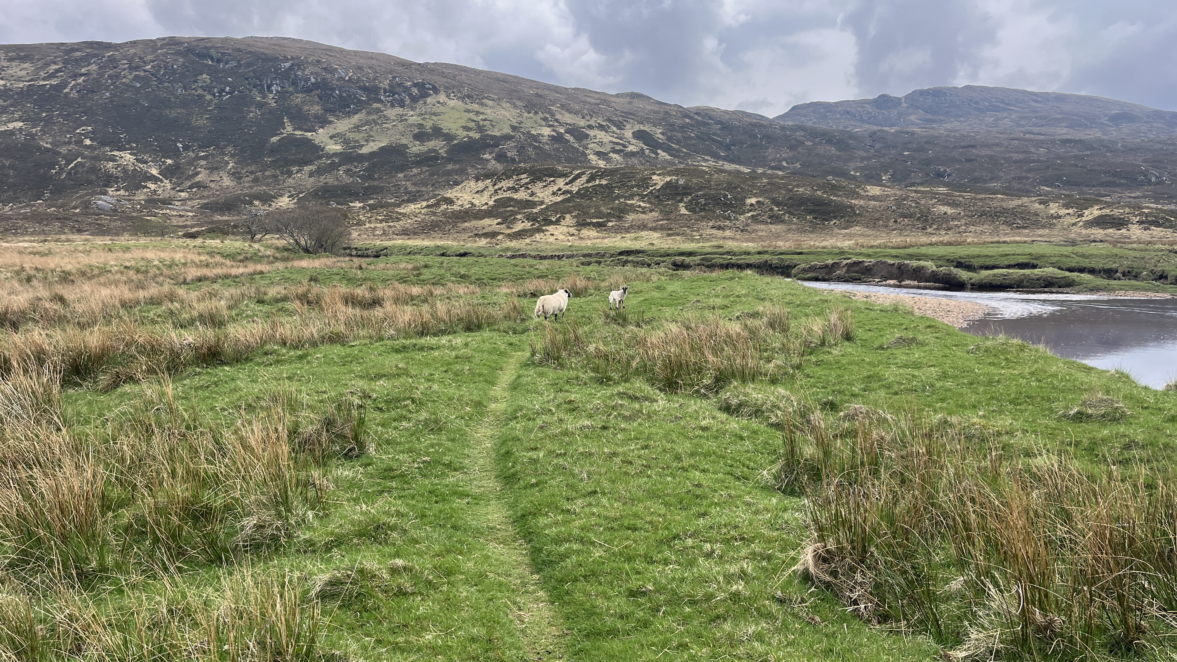
We are following the Abhainn Rath now and it is very wild and beautiful, flowing through the many rocks in the river.Sheep along the river
May is lambing season and there are plenty of new arrivals Mom is never far away
I pass another bothy Staoineag. It sits on a hill and the only way to reach it is by hopping across the river on a series of big stones. I think Staoineag means stepping stones.
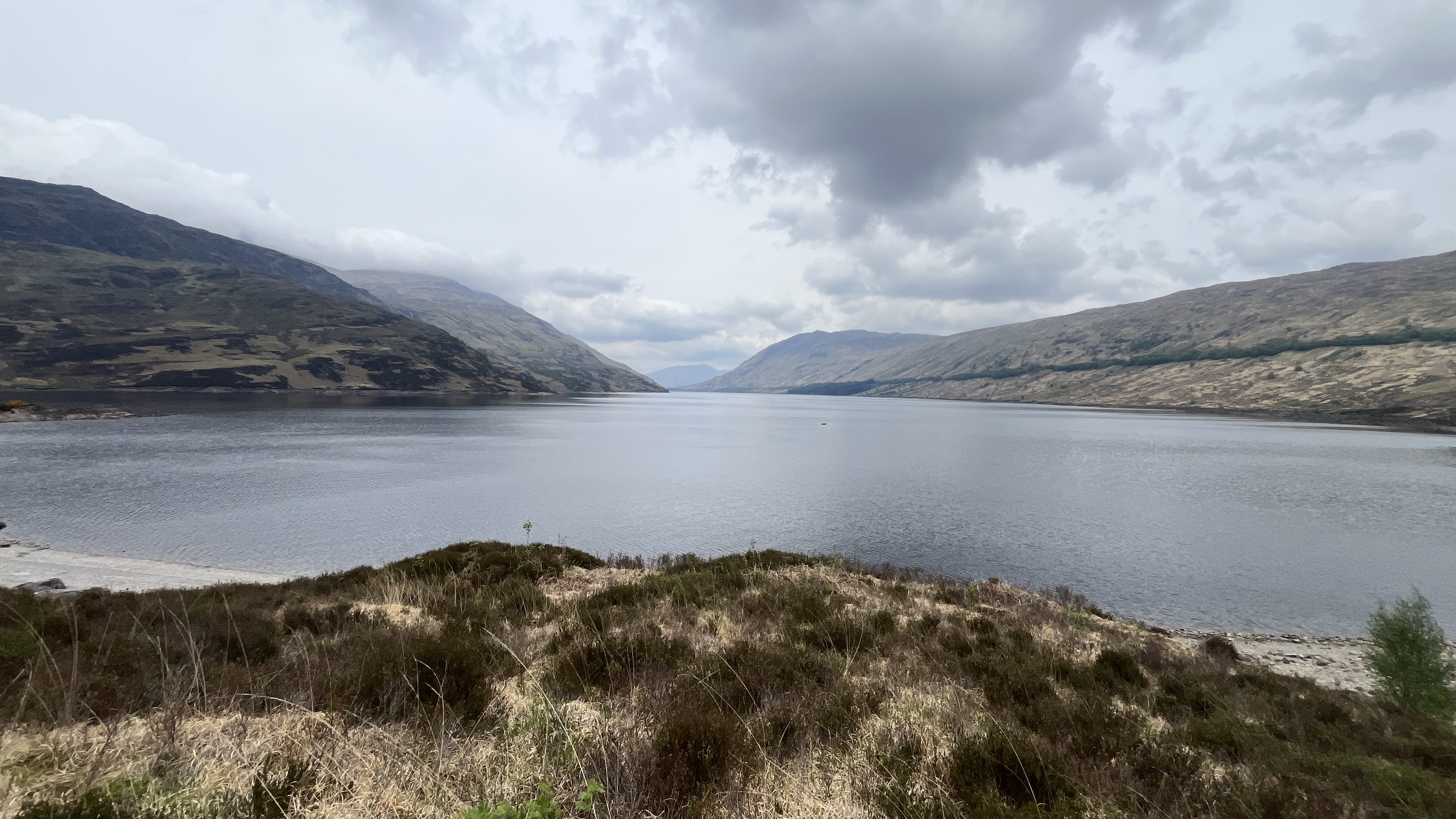
I thought the path was getting better, as I approached Loch Treig
You can just make it out the loch in the background
but I was wrong! In the distance you can see the grove of trees around Creaguaineach Lodge. This is a sporadically used Corrour Estate Lodge. I would imagine mostly around hunting season.
Getting closer The bridge across the loch at the Lodge
A couple of fellow Challengers resting at the end of the bridge After crossing over, the path becomes an actually gravel road. This is looking back at Creaguaineach Lodge and Loch Treig
Looking down Loch Treig. Loch Treig is the lonely loch as it has no electricity or cell service. Part four of today is the shortest but the nastiest. After leaving the loch, you climb a rather steep section of road as you approach the railroad tracks that run along Corrour Station. You think you might get this gravel road all the way but it stops just before passing under the railroad bridge and you are sent off into the wettest boggiest bit of track I have been on in any Challenge.
I had dry feet and clean shoes until I arrived at this section and when I arrived in about 2 miles at Corrour Station, my shoes were covered in boggy mud. This can be avoided with a slightly longer walk, by just taking the gravel road under the railroad bridge and climbing up and coming in behind Corrour Station (you can thank me later for telling you this!)
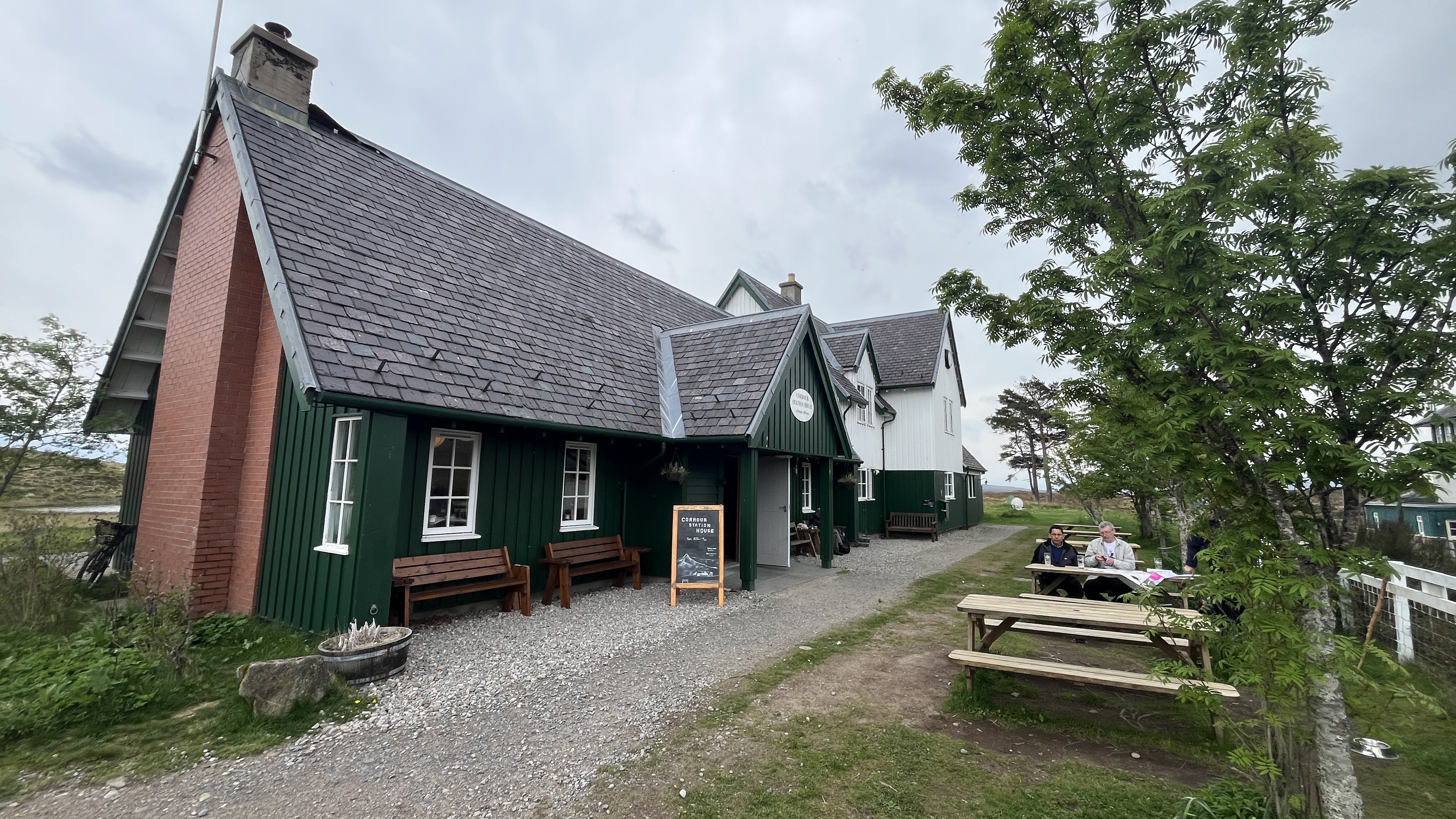
Luem Uilleim (909 m) 2982' (on the left below) and Beinn a' Bhric (876 m) 2876', people come by train to walk up this area. Corrour Station is one of the most remote train stations in all of Scotland.
However it has a surprise inside, it is fantastic restaurant and coffee shop. They even have 3 rooms you can rent out, including one that has a 360 degree view atop the station.The venison burger was wonderful and hit the spot after such a long and tiring day. It also helped that I had three of the local beers.
Mr. Walker had shown up from a different direction just in time for dinner and afterward we walked together toward the Loch Ossian Youth Hostel, on the shores of Loch Ossian. Unfortunately, this is the evening that Andy decided that he couldn't continue the Challenge with his ongoing back issues.
Looking back at Corrour StationThe Youth Hostel at Loch Ossian.
This was a vcry friendly place. It was full and everyone one was very nice, but there was no hot water in the showers and non of the inside toilets worked. They had provided porta potties for use outside, and of course it was raining on and off all night. David Albon was here as well. David was feeling fine tonight, but in just a couple of days he would also drop out due to a bout of COVID. 😱 Don't worry I never got any symptoms despite David being in the bunk below me... 😆
Below is the route for today as well as the elevation profile. It was long with lots of varied terrain and conditions. Click to make it larger.


I’m glad I didn’t infect you Craig!!! Am enjoying your write up!
ReplyDeleteLOL, no worries David. It was one of the highlights of this year's Challenge, for me, to spend so much time with you.
Delete