As I mentioned in my last blog entry, I consider this the half way point and the second half of my Challenge starts with a couple really long days and the toughest day coming up tomorrow, but for today, it is an early start on these 21 miles with a quiet walk out of Newtonmore on a lovely morning.
There is about 3 miles between Newtonmore and Kingussie and I am listening to a podcast (Backpacker Radio) with guest Ryan Silva (Dirtmonger), who is, in my opinion, the best long walking adventurer today. I am laughing a bit out loud as one of the hosts (Chauncy) is so young, she doesn't get most of the references that Ryan is using (Ryan is only in his mid-forties), I suddenly feel quite old!
Kingusse Town Square
Crossing the River Spey coming out of Kingusse
Ruthven Barracks are just on the other side of the River and an impressive site as you walk up the hill from the river.
Along with another impressive sight, the highland cattle
Hairy Cooz
Built in 1719 after the Jacobite Uprising in 1715
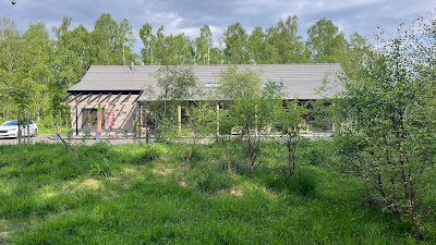
After the Barracks it is just a short little walk along the road to a park where you get on the Badenoch Way. This is really pretty path through some varied woodland to reach Tomie Bridge.
Tomie Bridge is a bridge and just a short road bridge connector over the River Tromie, between the forest I was in and the much larger Inshriach Forest across the B970
Inshriach Forest walk
The view you get from the lending library bench
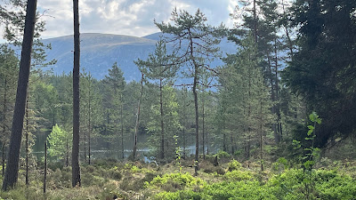
Continuing on deeper into the forest there is also clearly more timber harvesting here as well. Something I have seen all across Scotland this year. In the distance you can start to see the Cairngorm plateau start to rise up.
It was more forest walking on the Badenoch Way to a parking area around series of smaller lochans containing Uath Lochan.
After that my proposed route was to continue in the forest turning near a gate house for an estate called Torbreck. However it was only about 200 yards on this path that I realized it would be a huge effort to get through this way due to all the downed trees. It was hard to tell why these trees had fallen and so purposely across the path, but it was clear this was not the way I wanted to spend my afternoon.
So it was back out and down the cycle path that ran next to the road way. Hard surface walking but without needing to look out for any traffic.
It would have been better to retreat just a bit and cut over to Ballintean and along to the Lagganlia Outdoor Center, to Feshiebridge
The route I did take is in purple, the route I should have taken is in orange, eventually I made it to Feshiebridge.
I spoke with a couple of ladies, that walked by, that knew about the Challenge and wanted to do it this year, however, already had plans during this time, but will be on the Challenge next year. They have already done plenty of strenuous adventures like the Cape Wrath Trail (CWT). After lunch while walking toward the Moor of Feshie, I met a group of 6 young hikers, as I approached they were looking at their map quite a bit, I asked if they needed some assistance. Turns out they had missed their turn off to the bothy just back a short ways and couldn't figure out where they were. It was easy to understand why, as they had walked off the portion of the map they were holding. A minute or so looking at my map and turning them around, they were on their way. I ran into their chaperones, on bikes, just as I was reaching their (and my) turn off. They asked if I had seen them and I confirmed they were just behind me, headed in this direction. The OS 1:25K maps I was using on OMN, did not show the bothy building, so it was good to speak to them and verify that I did direct the kids in the correct direction based on comparing our maps and the reference point they had circled. 😂
After leaving them and walking by the bothy and the youth group lounging in the grass, along with the two women I had met at lunch time, it was another 6 miles through the Rothiemurchus Forest, with ever increasing views of my destination for tomorrow. The path went around Loch an Eilein, which I had walked on the opposite side in 2022.
I was going to camp right at the bridge (you can see the area on the right of the photo above) in my original planned route, but I was given very specific recommendations for tonight's camping spot from my Vetter, "about 1km from the bridge you will find a giant tree at a bend in the river. Camp there."
Walking up to the tree, I encountered an older couple sitting in the grass, I apologized for intruding on their solitude. They explained that they had been walking to this spot together for more than 50 years!
Doesn't get much better than this.
Despite a bit more hard surface walking, a beautiful day.
Hold on to your hats for tomorrow!


No comments:
Post a Comment
Because of spammers, I moderate all messages. Your comments should be posted shortly- Thank you