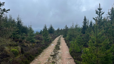
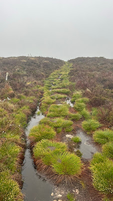
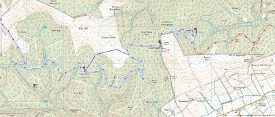
First a word of follow up. Why didn't I just finish yesterday? There was only 22 miles from my camp spot in the Fetteresso to the Sea. I could have easily covered that distance. The answer is my scheduled finish is today and my hotel reservations in Montrose don't start until tonight. Without cell service I couldn't see about booking any accommodations paid or free if I had finished yesterday. Besides, why finish your vacation early! Given a choice, I would gladly turn around and start back to the West coast.
The last day always brings with it all kinds of emotions. Even as I write this up, weeks after, I feel it. Yesterday, even given the mileage, I had finished early, because I had started early. With the afternoon to catch up on eating and drinking (I had eaten nothing all day, until I got to my camping spot and I had drank less than a liter of water all day) I ate everything left in my food bag and had about 4 liters of water. I also went to bed early and on this last day woke up ridiculously early. It gets light around 4:30 am. I was up and ready to walk by 5:30 am!
Sometimes you just get rewarded, perhaps it was for my irritation at myself from yesterday or just the karma of appreciating the great crossing this year, but as I got up and ready to go, I was greeted with the perfect day.
After packing up, I made sure no one could tell I was ever here.
As I made my way back to the minor road, I turned around and I could only stop and watch as magic unfolds.
Fantastic
This early, my only companions were the animals. The deer in the field, the grouse, the sheep and these horses enjoying the early morning.
Just about 40 minutes of walking and I was cresting the last hill to get my first view of the sea.
The only break in these quiet minor roads was the A90/A92 cloverleaf, but even that had just a few cars, this early in the morning.
On your way to the Castle you pass the abandon 6 Degrees North Radio Station. It has quite a history, but I can't believe it has stayed abandoned for so long. I would snatch it up and renovate it, as a house, what a view!
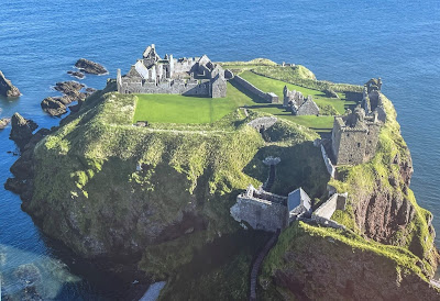
The poster when arriving at Dunnottar Castle shows a nice aerial view of the layout. You can tour the castle and inner castle grounds, but it doesn't open till 10 am. I arrived at 7:10 am! 😂
I am glad that there was no lock on the path that lets you go down to the castle. I had the entire area to myself
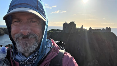
Proof I have arrived at the end. The Sun is really shining for the first time in two weeks, preventing very good photos of the Castle, but I don't care, it is a fabulous day. I couldn't be happier.
Panorama of the Castle and the adjacent cliffs
This video captures the scenery much better
My crossing not yet done, I need to walk down the MANY steps to the sea.
The North Sea.
Feet in the water. Now job done.
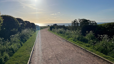
Huge bonus finishing at the Castle. You get to walk a fantastic path along the sea side into Stonehaven. It is a little over 2 miles into town and the train station
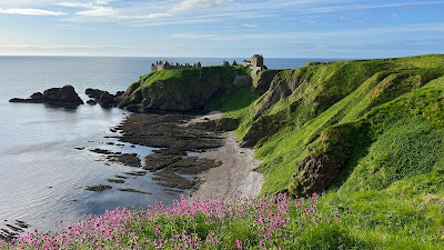
A couple gorgeous views of the castle from the sea side walk
Fields of cattle with the War Memorial on the hill
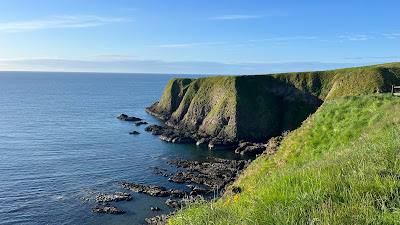
Looking out to sea.
Coming into Stonehaven

Flowers along the path, in the sunshine 

Stonehaven Harbor
Looking over the town
Stopping at the same bakery, Vicky and I did, on our first challenge in 2014, to get a sausage roll for breakfast.
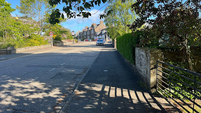
Walking the lovely streets up to the train station
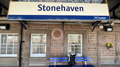
Arrived at the Train Station at 8:20 to find the next train to Montrose was 8:37. NiceLooking South
Nessie and I made it together20 minutes by train and arriving in Montrose
In order to officially finish, you have to go to the Park Hotel (Challenge Control) and sign out.
This completes your Challenge and you get your completion certificate, T-shirt, and any other souvenirs you might have pre-ordered. I got a coffee mug and a pin. I also snagged a T-shirt for Vicky.
I was, not surprisingly, the first finisher today. I think it was a little before 10 am! The Challenge volunteers, at Control, welcome you, make you some tea or coffee. They did another fantastic job with year organizing the Challenge and looking after everyone. I was also fortunate to have a lengthy conversation with the wonderful John Donohoe.
My Certificate
The Park Hotel is frequently sold out, well before we make our reservations, so from the beginning of our Challenges, Vicky and I have made the Link Hotel (owned by the same people and just right next door) our hotel for finishing. I just kept up the tradition.
Also tradition is the evening celebration dinner. There is one for each night. After I checked in to my room and got cleaned up, remember I had mailed my duffle bag, from Glasgow, with clean clothes right before I started. I got some laundry done and relaxed.
When it was dinner time, I made my way downstairs to head over to the Park Hotel. However in the bar of the Link, I found some of our favorite people.
Alan Sloman- his completed crossing this year is a feat of sheer will and stubbornness! You can find Alan's blog Here:
| Ester (new friend). Long time friends, Emma, Kevin E, and Louise |
at dinner, Mr. Willem Fox, of course!
Also tonight I saw Ken and Nina Stimson. They were getting their award for 10 Crossings. Vicky and I had met them a few times during our very first challenge in 2014 and they were so delightfully kind to us. - Well done you two Special thanks this year to Mad n' Bad, Andy Walker, for helping with logistics and always a fun guy to be around.
Dinner was delicious
Final Day's Stats:
Officially: 227.38 miles, 26,014 feet of elevation gain. Just for grins, here is a look at my step count, just prior to the Challenge, and then the 14 days of the Challenge.
May 13-26 2022
Thanks for coming along on this year's Challenge. It would be impossible to thank all the people that made this year's walk splendid, but just a few more; Charles and Duncan Bain Smith, Jim Davidson, Lyndsay (Feshie Bothy), Gordon Green, Bill & Craig (Loch Callater Lodge), Carl Mynott and Martin Rye, Even though my walk this year was a more solo affair, seeing you briefly or just knowing you were out there, made it special.
Not everything always goes to plan, but that is part of the 'challenge.' Scotland doesn't have any bad scenery, so whether you end up going high or low, rain or shine, you will find both sites and people that delight you.


.JPEG)








.JPEG)


.JPEG)


.PNG)


