The penultimate day dawned along the track in the Fetteresso. It was wet and foggy. Very foggy. The tent was soaking wet from the rain last night and no chance of any sun this morning, for it to dry. I had managed quite the stable of slugs overnight and tried my best not to take any with me when I packed everything away. I did not feel like lingering in the misty morning, so no breakfast, just pack and go. Today and tomorrow where meant to be short days, each just 11 miles, to take me to the Sea.

I might have felt like a Ghostbuster, as they did manage to slime my tent.

Started walking, with more of the same scenery as the end of yesterday, wide track with no room on either side.


The forest track ends just shy of the wind farm proper and you find a Scottish Rite of Way post. Odd place to find one. Perhaps a remnant from the past.

There was actually an old path, a bit of a stream today, long forgotten or neglected running into the southern edge of the wind farm.

Giants in the mist. This always gives me a 'War of the Worlds' vibe.

The Monsters at work
A wider view of walking just the southern edge of 'The Farm'

Ok, so, having made it through the entire wind farm, I potentially made a navigation error. First, let's look at the maps I am using. Below is the way my navigation app looks on my phone and on my printed maps. Notice that these maps show no evidence of the wind farm. I believe that my software is 2017 so this explains why it might not appear on my map set.
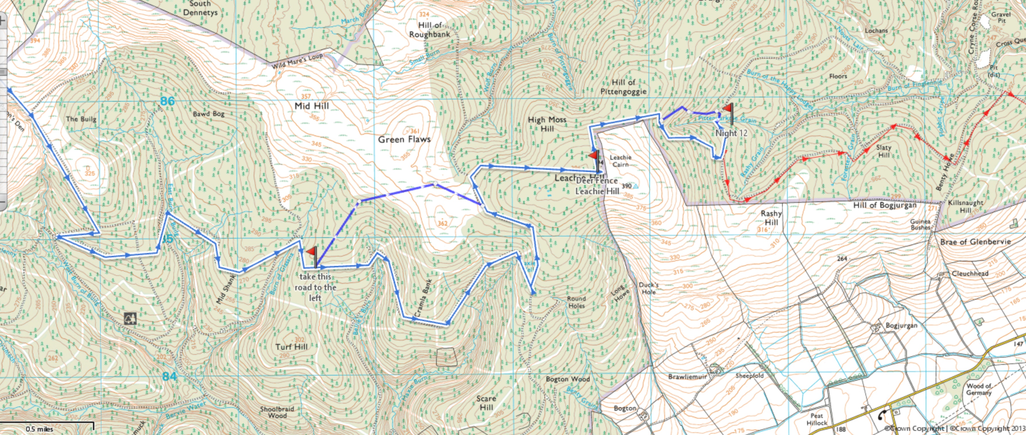
Now let's look at the same area on Google Earth. Big difference! The windfarm is clearly visible on the ground.

I did plan my route using both my mapping software and Google Earth, which is why I planned to go on the south side of the Wind Farm and not walk directly through it, although it is hard to avoid all of it.
*I was walking the road out of the wind farm when a Forestry Warden in his truck passed me, stopped, and we chatted for about 20 minutes. He asked what I was doing and I told him about the Challenge. He said he had run into a few other Challengers this past week on his forest patrols.*
So, back to the maps. I confused the break in the forest rows, at the point of the dashed yellow line, for the point I expected to find a path up the hill, which is clearly shown on the Google Earth view. My maps don't show individual breaks in the forest sections.
All I found was a gap in the forest with some waist high grass. I was not going to go bash through that to the top! I think I missed the actual track I needed by just a few hundred feet further down the road. Since, on my maps, I had no evidence of multiple gaps in the forest rows, I didn't go searching any further down the road.... I am a moron!
No cell service, no Google Earth. uggh

I just stood there for a few minutes and contemplated my next move. In the end, I think I was disgusted with myself, this forest, and decided to bail. I turned south to exit the Fetteresso as fast as I could via the red line on the map above.
The wide forest track was pretty, lined with gorse, and led quickly out of the Fetteresso at Chapelton Croft. - did you follow all that? Well don't worry if you didn't, the only person that was irritated was me! 😵😬
Today's little misadventure meant I had 4.5 miles of additional road walking, and instead of it being an 11 mile day, it became 18. I also might not find a permissible place to camp tonight.

More cute cottages


It was raining up in the Fetteresso, but when I hit the minor road, the weather broke and the sun came out for a bit.


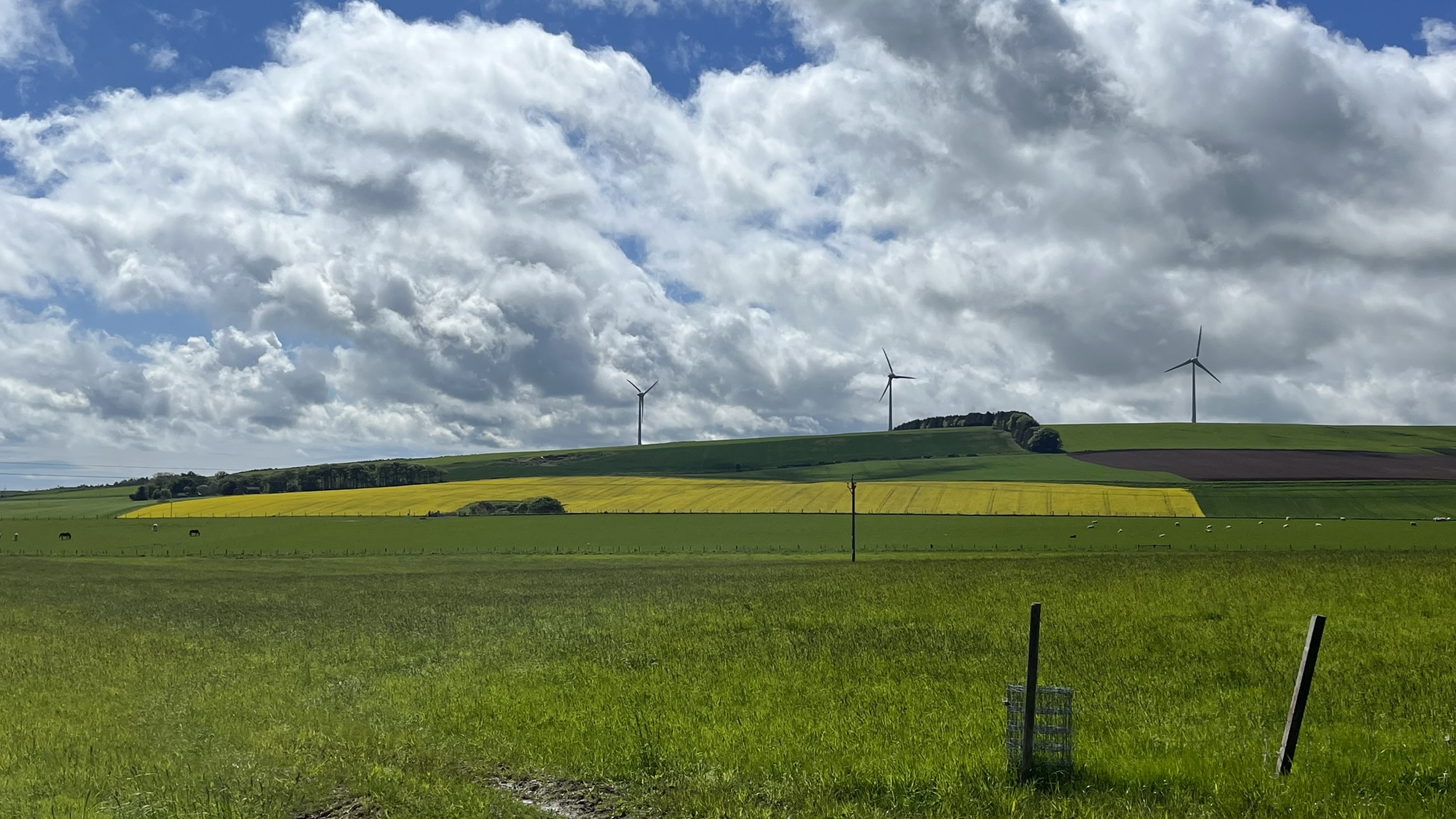
You can tell you are near the East Coast when you start to see fields of rape seed oil plants (yellow field)

A brief, but strong, shower while walking the road.

After the rain, sun again. I stopped to dry my tent in the sun and wind, as it was still dripping wet, from the night before. Along with my first rest stop of the day. Good time to get my shoes off and air out my feet.
Without a 'legal' place to camp tonight, I thought about walking all the way to the coast today, but a few more miles down the road, with only 5 miles to the end, my feet were not having anymore road walking today and I had already made this day 60% longer than I had planned.
Somewhere around Carron Water, and I won't say exactly where, I found a beautiful stealth spot for the night. I set up my tent and ate almost everything in my food bag!

Today's Stats:


No comments:
Post a Comment
Because of spammers, I moderate all messages. Your comments should be posted shortly- Thank you