Having had a great night in Glen Mazeran with Jim. We both were ready to go about the same time and so off we went together.
The view this morning, looking back from where we came yesterday was fantastic
.JPEG)
Yesterday afternoon I had noticed Charles, Duncan and then Ester pass by above us, on the path. This morning we found them, just after starting, all lingering, having just broken camp themselves.

Duncan and Charles would linger longer, undoubtedly to make good coffee and Ester joined us for our walk toward Glen Mazeran Lodge.


Crossing over the River Findhorn, Ester decided it was time for second breakfast and would stop for a bit, so Jim and I continued on.


After a few miles we arrived at the turn off to climb our hill for the day. If I have not mentioned before, we are in the Monadhliath Mountains, essentially big rounded hills of peat and heather.


These are not really hard climbs just long and steady. You can see our goal in the middle of the picture below.


There is a new shooting hut at around 550 meters (1800 feet) that would have been great to sit in for lunch, but it was locked. Jim and I went around back and sat out of some of the wind for a while and had lunch and rested for the final push up to the summit. Below Jim getting up to the plateau just before the summit proper. The wind had really started to blow much harder!

The plateau well above the other surrounding hills


These next four photos are just me panning the camera around the summit. I am the tallest thing up here, so nothing to get in the way of the view for 360 degrees.


Jim getting out of the wind, which was strong enough to make it hard to stand up straight and it was also much colder now.


You can see the track in the distance, photo below, that we need to connect with. I had created a route off the top that gradually dropped us to the track following the ridge line, but Jim said "let's just go straight for it!" Who am I to argue with experience.

This lighter heather was short and firm and presented no problems in walking straight down the hill toward the track. We did encounter a fence (fortunately not electric) that was easily cleared and a few boggy bits but we soon gained the track


Jim on the track down toward the Red Bothy

The Red Bothy sitting on the River Dulnain

Legends hardly ever live up to expectations! 😄


Looking North


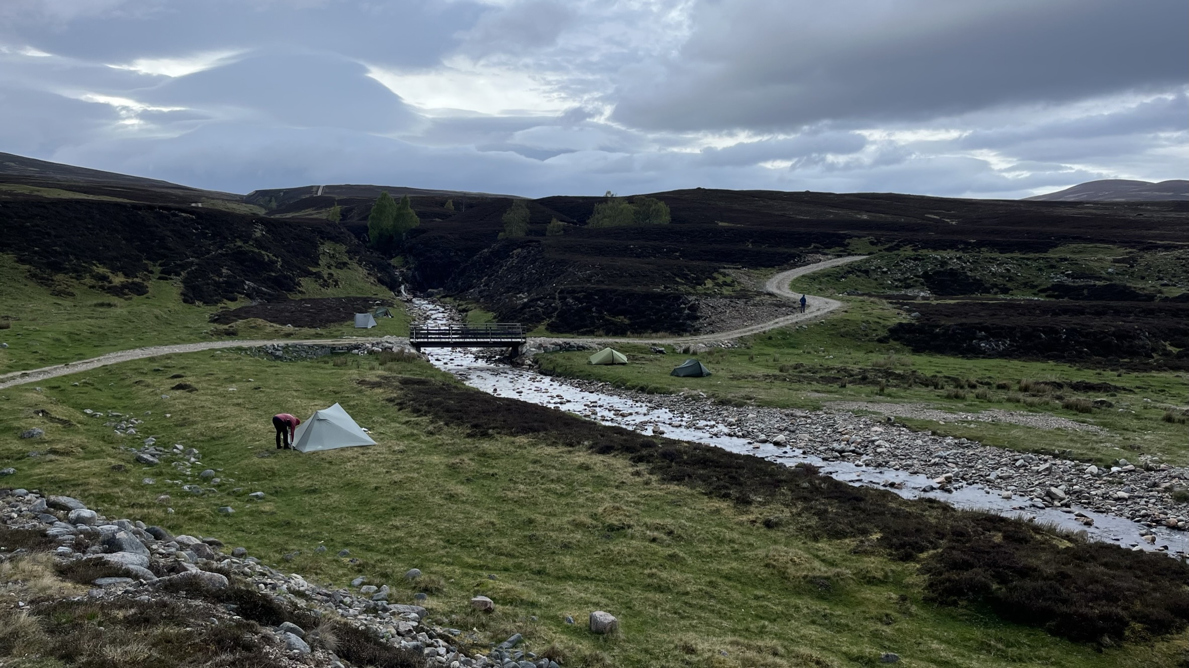
Later many Challengers showed up. Everyone pitched near the bridge needing to get out of the wind tonight


Looking South from the bothy

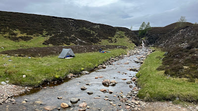
The bothy being not big enough to sleep in and too much in the wind for the tents, We found great pitches just down the hill by the bridge with a fantastic waterfall coming right off the hill

The view right out my tent

Then a lovely evening spent in the bothy for dinner and conversation

Today's Stats: a shorter day after yesterday's longer one.


A cracking walk, in good weather too. Nicely done.
ReplyDelete